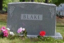
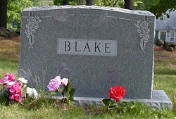
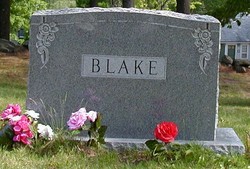
Clifton Millard “Sam” Blake
| Birth | : | 21 Sep 1923 Meredith, Belknap County, New Hampshire, USA |
| Death | : | 5 Sep 2004 Laconia, Belknap County, New Hampshire, USA |
| Burial | : | St. Paul's Anglican Church Cemetery, Canterbury, Canterbury-Bankstown Council, Australia |
| Coordinate | : | -33.9081600, 151.1236000 |
| Plot | : | Lot 89 |
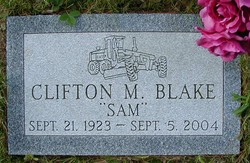
| Inscription | : | Clifton M. Blake | "Sam" | Sept. 21. 1923 - Sept 5, 2004 |
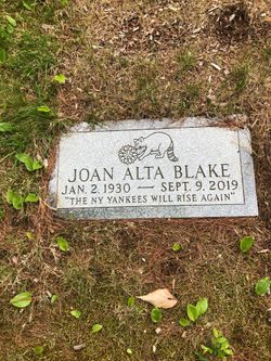
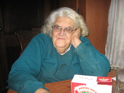
| Description | : | Married June 4, 1955 in Ashland, Clifton M. Blake, 31, farmer, born in Meredith and Joan A. Smith, 25, beautician, born in New Hampton. Married by Stanley M. Sprague, clergyman of Plymouth. 1st marriage for each. His parents: Millard I. Blake and Nellie M. Drake. Her parents: Ziba A.Smith and Minnie E. Torsey. New Hampton Town Report. Clifton "Sam" Blake Long Time Employee of Town of New Hampton New Hampton — Clifton "Sam" Blake, 80, of New Hampton died Sunday, September 5, 2004 at Lake Region General Hospital following a short illness. ... Read More |
frequently asked questions (FAQ):
-
Where is Clifton Millard “Sam” Blake's memorial?
Clifton Millard “Sam” Blake's memorial is located at: St. Paul's Anglican Church Cemetery, Canterbury, Canterbury-Bankstown Council, Australia.
-
When did Clifton Millard “Sam” Blake death?
Clifton Millard “Sam” Blake death on 5 Sep 2004 in Laconia, Belknap County, New Hampshire, USA
-
Where are the coordinates of the Clifton Millard “Sam” Blake's memorial?
Latitude: -33.9081600
Longitude: 151.1236000
Family Members:
Parent
Spouse
Siblings
Flowers:
Nearby Cemetories:
1. St. Paul's Anglican Church Cemetery
Canterbury, Canterbury-Bankstown Council, Australia
Coordinate: -33.9081600, 151.1236000
2. St Thomas Becket Churchyard
Lewisham, Inner West Council, Australia
Coordinate: -33.8928760, 151.1480490
3. St. John's Anglican Church Cemetery
Ashfield, Inner West Council, Australia
Coordinate: -33.8817160, 151.1278730
4. St David’s Presbyterian Cemetery
Haberfield, Inner West Council, Australia
Coordinate: -33.8823220, 151.1378500
5. St. Thomas Anglican Cemetery
Enfield, Burwood Municipality, Australia
Coordinate: -33.8912070, 151.0916610
6. St Paul's Anglican Church
Burwood, Burwood Municipality, Australia
Coordinate: -33.8816114, 151.1027492
7. Balmain Catholic Cemetery (Defunct)
Leichhardt, Inner West Council, Australia
Coordinate: -33.8797270, 151.1523730
8. Moorefields Methodist Cemetery
Kingsgrove, Canterbury-Bankstown Council, Australia
Coordinate: -33.9343560, 151.0904450
9. St Luke's Anglican Church
Enmore, Inner West Council, Australia
Coordinate: -33.8989218, 151.1700724
10. Pioneers Memorial Park
Leichhardt, Inner West Council, Australia
Coordinate: -33.8780800, 151.1575000
11. St. Luke's Anglican Church Columbarium
Concord, Canada Bay City, Australia
Coordinate: -33.8678417, 151.1068448
12. St. Mary's Roman Catholic Church Cemetery
Concord, Canada Bay City, Australia
Coordinate: -33.8677100, 151.1024300
13. St. Peters Cooks River Cemetery
Saint Peters, Inner West Council, Australia
Coordinate: -33.9139390, 151.1775670
14. Rockdale Uniting Church Cemetery
Rockdale, Bayside Council, Australia
Coordinate: -33.9533350, 151.1381840
15. Camperdown Cemetery
Newtown, City of Sydney, Australia
Coordinate: -33.8942220, 151.1804900
16. Longbottom Cemetery
Concord, Canada Bay City, Australia
Coordinate: -33.8596140, 151.0986280
17. Sydney Memorial
Rookwood, Cumberland Council, Australia
Coordinate: -33.8773100, 151.0642800
18. Sydney War Cemetery
Rookwood, Cumberland Council, Australia
Coordinate: -33.8769700, 151.0636100
19. New South Wales Cremation Memorial
Rookwood, Cumberland Council, Australia
Coordinate: -33.8776400, 151.0627700
20. New South Wales Garden of Remembrance
Rookwood, Cumberland Council, Australia
Coordinate: -33.8776400, 151.0627700
21. St George’s Anglican Church Cemetery (Defunct)
Hurstville, Georges River Council, Australia
Coordinate: -33.9668590, 151.1079150
22. St. Saviour's Church of England Cemetery
Punchbowl, Canterbury-Bankstown Council, Australia
Coordinate: -33.9311480, 151.0552250
23. Rookwood Memorial Gardens and Crematorium
Rookwood, Cumberland Council, Australia
Coordinate: -33.8768500, 151.0598900
24. Rookwood General Cemetery
Rookwood, Cumberland Council, Australia
Coordinate: -33.8740500, 151.0591100

