
| Birth | : | 16 Aug 1923 Swain County, North Carolina, USA |
| Death | : | 19 Jul 1987 High Point, Guilford County, North Carolina, USA |
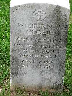
| Burial | : | Forest Hill Memorial Park, Lexington, Davidson County, USA |
| Coordinate | : | 35.8275986, -80.2800980 |
| Description | : | On 23 Apr 1943, nineteen year old Clyde Curtis Cloer would leave his native Swain County, enlisting in the US Army at Camp Croft Infantry Replacement Training Center (IRTC) in Spartanburg County, SC. He was single, without dependents. All existing military facilities were swamped by various units trying to mobilize and bring their readiness up to Army standards. Without a major new building program, there would be no place to teach the draftees how to be soldiers and get them ready to join their units. On 08 Nov 1940, the War Department announced that one of these new... Read More |
frequently asked questions (FAQ):
-
Where is Clyde Curtis Cloer's memorial?
Clyde Curtis Cloer's memorial is located at: Forest Hill Memorial Park, Lexington, Davidson County, USA.
-
When did Clyde Curtis Cloer death?
Clyde Curtis Cloer death on 19 Jul 1987 in High Point, Guilford County, North Carolina, USA
-
Where are the coordinates of the Clyde Curtis Cloer's memorial?
Latitude: 35.8275986
Longitude: -80.2800980
Family Members:
Parent

Spouse
Siblings
Flowers:


Nearby Cemetories:
1. Forest Hill Memorial Park
Lexington, Davidson County, USA
Coordinate: 35.8275986, -80.2800980
2. Grace Episcopal Church Columbarium
Lexington, Davidson County, USA
Coordinate: 35.8202780, -80.2572220
3. Meadowview Presbyterian Church Cemetery
Davidson County, USA
Coordinate: 35.8064003, -80.2810974
4. Lexington City Cemetery
Lexington, Davidson County, USA
Coordinate: 35.8280983, -80.2525024
5. First Reformed UCC Columbarium
Lexington, Davidson County, USA
Coordinate: 35.8235059, -80.2517930
6. Churchland Baptist Church Cemetery
Churchland, Davidson County, USA
Coordinate: 35.8469009, -80.2632980
7. North Lexington Baptist Church Cemetery
Lexington, Davidson County, USA
Coordinate: 35.8487778, -80.2664108
8. Raleigh Road Cemetery
Lexington, Davidson County, USA
Coordinate: 35.8253288, -80.2440567
9. Mabry Cemetery
Davidson County, USA
Coordinate: 35.8178825, -80.2448196
10. Arrington Heights Free Will BC Cemetery
Lexington, Davidson County, USA
Coordinate: 35.8474998, -80.2493973
11. South Lexington City Cemetery
Lexington, Davidson County, USA
Coordinate: 35.7972450, -80.2652969
12. Pauls Chapel Memorial Cemetery
Davidson County, USA
Coordinate: 35.8649830, -80.2922940
13. Finch-Gilchrist Cemetery
Davidson County, USA
Coordinate: 35.8037376, -80.2325745
14. Ebenezer Memorial Cemetery
Lexington, Davidson County, USA
Coordinate: 35.8677800, -80.2522000
15. Shiloh UMC Cemetery
Lexington, Davidson County, USA
Coordinate: 35.8651153, -80.3222114
16. Promiseland Baptist Church House Cemetery
Currytown, Davidson County, USA
Coordinate: 35.8756981, -80.3169708
17. Pilgrim Reformed Church Cemetery
Lexington, Davidson County, USA
Coordinate: 35.8530630, -80.2162610
18. Old Pilgrim Reformed Cemetery
Davidson County, USA
Coordinate: 35.8536740, -80.2136790
19. Maple Grove Church of the Brethren Cemetery
Davidson County, USA
Coordinate: 35.8793488, -80.3198013
20. Mount Tabor United Church of Christ Cemetery
Davidson County, USA
Coordinate: 35.8196411, -80.2053223
21. Owens Cemetery
Davidson County, USA
Coordinate: 35.7633018, -80.2735977
22. Becks Lutheran Church Cemetery
Lexington, Davidson County, USA
Coordinate: 35.7894300, -80.2154500
23. County Home Cemetery
Davidson County, USA
Coordinate: 35.8184200, -80.1985600
24. Center Hill Baptist Church Cemetery
Davidson County, USA
Coordinate: 35.7619100, -80.2630350