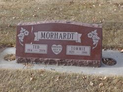
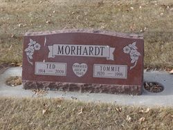
Clysta May “Tommie” Stott Morhardt
| Birth | : | 23 Feb 1920 Mountain Home, Duchesne County, Utah, USA |
| Death | : | 1 Dec 1996 Choteau, Teton County, Montana, USA |
| Burial | : | Choteau Cemetery, Choteau, Teton County, USA |
| Coordinate | : | 47.8121986, -112.1631012 |
| Description | : | CHOTEAU—Clysta M. (Stott) Morhardt, 76, of 519 N. Main, Choteau, died Sunday of congestive heart failure. Funeral services are 2 p.m. Wednesday at The Church of Jesus Christ of Latter-day Saints in Choteau, with burial in the Choteau Cemetery. Croxford & Sons Funeral Home is handling arrangements. She was born Feb. 23, 1920, at Mountain Home, Utah and attended Bynum school. She graduated from Teton County High School in 1939, and attended college in Missoula. She worked at Teton County High School as librarian after college. On July 4, 1940, she married Ted Morhardt at Great Falls. They farmed near Choteau until retiring... Read More |
frequently asked questions (FAQ):
-
Where is Clysta May “Tommie” Stott Morhardt's memorial?
Clysta May “Tommie” Stott Morhardt's memorial is located at: Choteau Cemetery, Choteau, Teton County, USA.
-
When did Clysta May “Tommie” Stott Morhardt death?
Clysta May “Tommie” Stott Morhardt death on 1 Dec 1996 in Choteau, Teton County, Montana, USA
-
Where are the coordinates of the Clysta May “Tommie” Stott Morhardt's memorial?
Latitude: 47.8121986
Longitude: -112.1631012
Family Members:
Parent
Spouse
Flowers:
Nearby Cemetories:
1. Choteau Cemetery
Choteau, Teton County, USA
Coordinate: 47.8121986, -112.1631012
2. Trinity Lutheran Cemetery
Farmington, Teton County, USA
Coordinate: 47.8843994, -112.0764008
3. New Rockport Colony Cemetery
New Rockport Colony, Teton County, USA
Coordinate: 47.8648000, -112.0199000
4. Miller Colony Cemetery
Miller Colony, Teton County, USA
Coordinate: 47.9258000, -112.2943000
5. Bynum Cemetery
Bynum, Teton County, USA
Coordinate: 47.9710007, -112.3059998
6. Saint Paul Cemetery
Fairfield, Teton County, USA
Coordinate: 47.6758000, -111.9014000
7. United Church of Christ Columbarium
Fairfield, Teton County, USA
Coordinate: 47.6158400, -111.9784300
8. Fairfield Mennonite Cemetery
Fairfield, Teton County, USA
Coordinate: 47.6149840, -111.9804050
9. Beck Cemetery
Teton County, USA
Coordinate: 47.7844009, -111.8163986
10. Sunset Hills Cemetery
Fairfield, Teton County, USA
Coordinate: 47.5946400, -111.9870900
11. Midway Hutterite Colony Cemetery
Conrad, Pondera County, USA
Coordinate: 48.0669000, -111.9959000
12. Pondera Valley Lutheran Cemetery
Conrad, Pondera County, USA
Coordinate: 48.1085000, -112.1126000
13. Dutton Cemetery
Dutton, Teton County, USA
Coordinate: 47.8504000, -111.7100000
14. Power Community Cemetery
Teton County, USA
Coordinate: 47.7421989, -111.6913986
15. Rockport Colony Cemetery
Rockport Colony, Teton County, USA
Coordinate: 48.0677000, -112.4783000
16. Teton Canyon Metis Cemetery
Choteau, Teton County, USA
Coordinate: 47.8695750, -112.6675680
17. Augusta Cemetery
Augusta, Lewis and Clark County, USA
Coordinate: 47.4961014, -112.4039001
18. Indian Burial Ground
Teton County, USA
Coordinate: 47.9719009, -112.6539001
19. Elk Creek Colony Cemetery
Augusta, Lewis and Clark County, USA
Coordinate: 47.4620000, -112.3218000
20. Fort Shaw Military Cemetery
Fort Shaw, Cascade County, USA
Coordinate: 47.5065700, -111.8358500
21. Hillside Cemetery
Conrad, Pondera County, USA
Coordinate: 48.1768990, -111.9835968
22. New Miami Colony Cemetery
New Miami Colony, Pondera County, USA
Coordinate: 48.1911000, -112.2832000
23. Sun River Cemetery
Sun River, Cascade County, USA
Coordinate: 47.5242004, -111.7166977
24. Dupuyer Cemetery
Pondera County, USA
Coordinate: 48.1857986, -112.5083008


