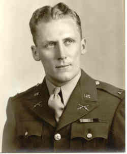
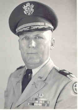
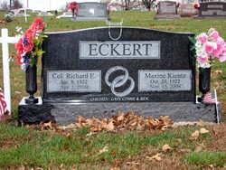
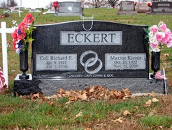
Col Richard Earl “Dick” Eckert
| Birth | : | 9 Jun 1922 Arrington, Atchison County, Kansas, USA |
| Death | : | 2 Apr 2009 Minneapolis, Ottawa County, Kansas, USA |
| Burial | : | Sanger Cemetery, Sanger, Fresno County, USA |
| Coordinate | : | 36.7266998, -119.5092010 |
| Description | : | WETMORE – Richard E. "Dick" Eckert, 86, of Holton formerly of Wetmore, KS passed away April 2, 2009 at Ottawa County Health Center in Minneapolis, KS. He was born June 9, 1922 in Arrington, KS, the son of Jacob Richard and Helen Littleton Eckert. He graduated from Denison High School in 1940. He was mobilized as a Private with the Kansas National Guard in Holton on December 23, 1940. He served with the 11th Airborne Division in the Philippines, Okinawa, and Japan. He remained in active duty until February 1946. He remained active in the National Guard until he went... Read More |
frequently asked questions (FAQ):
-
Where is Col Richard Earl “Dick” Eckert's memorial?
Col Richard Earl “Dick” Eckert's memorial is located at: Sanger Cemetery, Sanger, Fresno County, USA.
-
When did Col Richard Earl “Dick” Eckert death?
Col Richard Earl “Dick” Eckert death on 2 Apr 2009 in Minneapolis, Ottawa County, Kansas, USA
-
Where are the coordinates of the Col Richard Earl “Dick” Eckert's memorial?
Latitude: 36.7266998
Longitude: -119.5092010
Family Members:
Parent
Spouse
Siblings
Children
Flowers:
Nearby Cemetories:
1. Sanger Cemetery
Sanger, Fresno County, USA
Coordinate: 36.7266998, -119.5092010
2. Akers Cemetery
Centerville, Fresno County, USA
Coordinate: 36.7474100, -119.4729700
3. Fairview Cemetery
Sanger, Fresno County, USA
Coordinate: 36.7648800, -119.5699200
4. Bethel Cemetery
Sanger, Fresno County, USA
Coordinate: 36.6777510, -119.5812420
5. Hazelton Cemetery
Fresno County, USA
Coordinate: 36.7860100, -119.4298000
6. Salem Cemetery
Sanger, Fresno County, USA
Coordinate: 36.6849700, -119.6152000
7. Phillips Family Cemetery
Fresno County, USA
Coordinate: 36.6690420, -119.4127810
8. Redbank Cemetery
Clovis, Fresno County, USA
Coordinate: 36.8088989, -119.5761032
9. Del Rey Cemetery
Fresno County, USA
Coordinate: 36.6615000, -119.6106400
10. Mendocino Cemetery
Parlier, Fresno County, USA
Coordinate: 36.6204400, -119.5475400
11. Reedley Cemetery
Reedley, Fresno County, USA
Coordinate: 36.5819016, -119.4569016
12. Choinumni Sacred Burial Grounds
Piedra, Fresno County, USA
Coordinate: 36.8258890, -119.3434360
13. Academy Cemetery
Clovis, Fresno County, USA
Coordinate: 36.8939018, -119.5464020
14. Floral Memorial Park
Selma, Fresno County, USA
Coordinate: 36.5769005, -119.6164017
15. North Selma Cemetery
Selma, Fresno County, USA
Coordinate: 36.5752110, -119.6206860
16. Fowler Cemetery
Fowler, Fresno County, USA
Coordinate: 36.6116982, -119.6836014
17. Hughes Creek Cemetery
Fresno County, USA
Coordinate: 36.8731003, -119.3739014
18. Old IOOF Cemetery
Selma, Fresno County, USA
Coordinate: 36.5577050, -119.6165660
19. West Selma Cemetery
Selma, Fresno County, USA
Coordinate: 36.5589100, -119.6200820
20. Clovis Cemetery
Clovis, Fresno County, USA
Coordinate: 36.8363991, -119.7118988
21. Seventh Day Adventist Cemetery
Dinuba, Tulare County, USA
Coordinate: 36.5313988, -119.4293976
22. Smith Mountain Cemetery
Dinuba, Tulare County, USA
Coordinate: 36.5546989, -119.3458023
23. Squaw Valley Cemetery
Squaw Valley, Fresno County, USA
Coordinate: 36.7268982, -119.2367020
24. Zion Krimmer Mennonite Brethren Church Cemetery
Dinuba, Tulare County, USA
Coordinate: 36.5168440, -119.4328000

