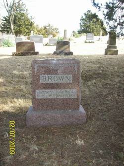
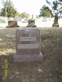
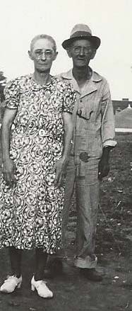
Cora Jane Hutchings Brown
| Birth | : | 22 May 1882 Ray County, Missouri, USA |
| Death | : | 19 Nov 1938 Excelsior Springs, Clay County, Missouri, USA |
| Burial | : | Shiloh Cemetery, Bowman, Orangeburg County, USA |
| Coordinate | : | 33.3982560, -80.7088270 |
frequently asked questions (FAQ):
-
Where is Cora Jane Hutchings Brown's memorial?
Cora Jane Hutchings Brown's memorial is located at: Shiloh Cemetery, Bowman, Orangeburg County, USA.
-
When did Cora Jane Hutchings Brown death?
Cora Jane Hutchings Brown death on 19 Nov 1938 in Excelsior Springs, Clay County, Missouri, USA
-
Where are the coordinates of the Cora Jane Hutchings Brown's memorial?
Latitude: 33.3982560
Longitude: -80.7088270
Family Members:
Parent
Spouse
Siblings
Flowers:
Left by Anonymous on 24 Jan 2010
Left by Anonymous on 24 May 2010

Perhaps they are not stars in the sky, but rather openings where our loved ones shine down to let us know they are happy. ~Unknown Author~.....You are not forgotten, Cora Jane Brown; May you rest in peace.
Left by Anonymous on 27 Dec 2011
2nd cousin 4x removed
Left by Anonymous on 16 Jan 2016
Nearby Cemetories:
1. Shiloh Cemetery
Bowman, Orangeburg County, USA
Coordinate: 33.3982560, -80.7088270
2. Pineville Cemetery
Orangeburg County, USA
Coordinate: 33.4028015, -80.7110977
3. Shuler-Frederick Cemetery
Bowman, Orangeburg County, USA
Coordinate: 33.3839630, -80.7270120
4. Fair-Moorer Family Cemetery
Bowman, Orangeburg County, USA
Coordinate: 33.4026670, -80.6724670
5. Bowman Memorial Cemetery
Bowman, Orangeburg County, USA
Coordinate: 33.3631480, -80.6905160
6. Ruple Family Cemetery
Orangeburg, Orangeburg County, USA
Coordinate: 33.4221490, -80.7506650
7. Bethel United Methodist Church Cemetery
Bowman, Orangeburg County, USA
Coordinate: 33.4222920, -80.7576440
8. Forest Chapel United Methodist Church Cemetery
Orangeburg, Orangeburg County, USA
Coordinate: 33.4211770, -80.7585440
9. Shuler Cemetery
Four Holes, Orangeburg County, USA
Coordinate: 33.3832390, -80.6495220
10. New Mount Zion Cemetery
Bowman, Orangeburg County, USA
Coordinate: 33.3824997, -80.6493988
11. Mount Zion Baptist Churchyard
Bowman, Orangeburg County, USA
Coordinate: 33.3842590, -80.6389510
12. White House Methodist Church Cemetery
Orangeburg, Orangeburg County, USA
Coordinate: 33.4596000, -80.7178690
13. Pearson-Cain Family
Orangeburg, Orangeburg County, USA
Coordinate: 33.4579040, -80.7366370
14. Prospect United Methodist Church Cemetery
Rowesville, Orangeburg County, USA
Coordinate: 33.3437030, -80.7564130
15. Stroman Cemetery
Orangeburg, Orangeburg County, USA
Coordinate: 33.4605130, -80.7426100
16. Andrew Chapel Baptist Church Cemetery
Orangeburg, Orangeburg County, USA
Coordinate: 33.4671490, -80.7128550
17. Walnut Grove Baptist Church Cemetery
Orangeburg, Orangeburg County, USA
Coordinate: 33.4086720, -80.6266580
18. Hurger Family Cemetery
Bowman, Orangeburg County, USA
Coordinate: 33.3416340, -80.6596960
19. Sandel Cemetery
Orangeburg, Orangeburg County, USA
Coordinate: 33.4312750, -80.7828070
20. Pitthan V Cemetery
Bowman, Orangeburg County, USA
Coordinate: 33.4428690, -80.6426190
21. Myers Cemetery
Bowman, Orangeburg County, USA
Coordinate: 33.3829580, -80.6245540
22. Easterling Cemetery
Bowman, Orangeburg County, USA
Coordinate: 33.3537830, -80.6383910
23. Bowman Family Cemetery
Bowman, Orangeburg County, USA
Coordinate: 33.3265540, -80.6767090
24. Antioch Baptist Church Cemetery #1
Bowman, Orangeburg County, USA
Coordinate: 33.3308260, -80.6649660


