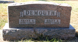
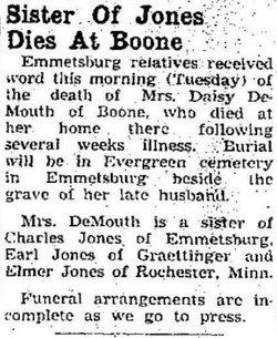
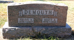
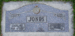
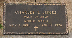
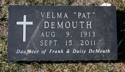
Daisy Edith Jones DeMouth
| Birth | : | 23 Jan 1876 Canton, Barron County, Wisconsin, USA |
| Death | : | 13 Aug 1956 Boone, Boone County, Iowa, USA |
| Burial | : | Evergreen Cemetery, Emmetsburg, Palo Alto County, USA |
| Coordinate | : | 43.0940018, -94.6791992 |
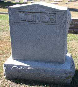
| Description | : | Daughter of Franklin "Frank" Jones and Mary Wells; wife of Frank Arthur DeMouth whom she married 14 Oct 1896 in Emnmetsburg, Palo Alto Co., IA; mother of Lester Elvin, Ruth M. Melvin R. and Velma Irene DeMouth. ___________ Iowa Marriages, 1809-1992, LDS Film No. 1436131, Palo Alto County, no. 1329, p. 106 [via LDS FamilySearch]: Groom's Name: Frank A. Demouth Groom's Age: 21; Est. Birth Date: 1875 Groom's Birthplace: Rockford, Ill. Bride's Name: Daisy E. Jones Bride's Age: 20; Est. Birth Date: 1876 Bride's Birthplace: Canton, Wis. Marriage Date: 14 Oct 1896 Marriage Place: Emnmetsburg, Palo Alto Co., IA Groom's Father's Name: Theodore Demouth Groom's Mother's Name: Lucinda Foster Bride's Father's Name: Franklin... Read More |
frequently asked questions (FAQ):
-
Where is Daisy Edith Jones DeMouth's memorial?
Daisy Edith Jones DeMouth's memorial is located at: Evergreen Cemetery, Emmetsburg, Palo Alto County, USA.
-
When did Daisy Edith Jones DeMouth death?
Daisy Edith Jones DeMouth death on 13 Aug 1956 in Boone, Boone County, Iowa, USA
-
Where are the coordinates of the Daisy Edith Jones DeMouth's memorial?
Latitude: 43.0940018
Longitude: -94.6791992
Family Members:
Parent
Spouse
Siblings
Children
Flowers:
Nearby Cemetories:
1. Evergreen Cemetery
Emmetsburg, Palo Alto County, USA
Coordinate: 43.0940018, -94.6791992
2. Saint Johns Catholic Cemetery
Emmetsburg, Palo Alto County, USA
Coordinate: 43.0913200, -94.6790000
3. Vernon Township Cemetery
Vernon Township, Palo Alto County, USA
Coordinate: 43.1840000, -94.6185000
4. Saint Paul Lutheran Cemetery
Walnut Township, Palo Alto County, USA
Coordinate: 43.1866740, -94.7872050
5. Saint John's Lutheran Cemetery
Fairfield Township, Palo Alto County, USA
Coordinate: 43.1265000, -94.5017000
6. Riverside Cemetery
Fern Valley Township, Palo Alto County, USA
Coordinate: 43.0200000, -94.5220000
7. Saint Mary's Cemetery
Rush Lake Township, Palo Alto County, USA
Coordinate: 42.9560000, -94.6980000
8. Highland Cemetery
Highland Township, Palo Alto County, USA
Coordinate: 43.1497002, -94.8578033
9. Silver Lake Cemetery
Silver Lake Township, Palo Alto County, USA
Coordinate: 43.0386009, -94.8597031
10. Calvary Cemetery
Silver Lake Township, Palo Alto County, USA
Coordinate: 43.0386009, -94.8613968
11. North Saint John's Lutheran Cemetery
Independence Township, Palo Alto County, USA
Coordinate: 43.1696281, -94.5077438
12. Rush Lake Cemetery
Rush Lake Township, Palo Alto County, USA
Coordinate: 42.9497185, -94.7383270
13. Valley View Cemetery
Walnut Township, Palo Alto County, USA
Coordinate: 43.2428000, -94.7212000
14. Lost Island Lutheran Cemetery
Lost Island Township, Palo Alto County, USA
Coordinate: 43.1980000, -94.8375000
15. Calvary Cemetery
Ruthven, Palo Alto County, USA
Coordinate: 43.1314011, -94.8869019
16. Crown Hill Cemetery
Ruthven, Palo Alto County, USA
Coordinate: 43.1328011, -94.8878021
17. Lincoln Cemetery
West Bend, Palo Alto County, USA
Coordinate: 42.9596842, -94.5602466
18. Ellington Cemetery
Ellington Township, Palo Alto County, USA
Coordinate: 42.9377000, -94.6240400
19. Saint Luke's Lutheran Cemetery
Fairfield Township, Palo Alto County, USA
Coordinate: 43.1545000, -94.4723000
20. Saint Jacobs Cemetery
Graettinger, Palo Alto County, USA
Coordinate: 43.2546997, -94.7705994
21. Graettinger City Cemetery
Graettinger, Palo Alto County, USA
Coordinate: 43.2550011, -94.7722015
22. Saint Michaels Catholic Cemetery
Whittemore, Kossuth County, USA
Coordinate: 43.0827000, -94.4322500
23. Riverside Cemetery
West Bend, Palo Alto County, USA
Coordinate: 42.9512000, -94.5120000
24. Saint Pauls Lutheran Cemetery
Whittemore, Kossuth County, USA
Coordinate: 43.0530014, -94.4135971

