
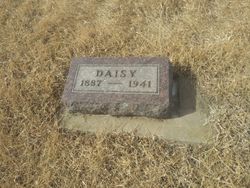
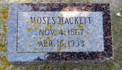
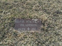
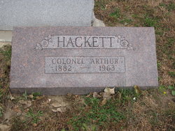
Daisy Mabel Hackett Rearick
| Birth | : | 29 Jun 1887 South Dakota, USA |
| Death | : | 21 Jul 1941 Yankton County, South Dakota, USA |
| Burial | : | Union Cemetery, Wakonda, Clay County, USA |
| Coordinate | : | 42.9827995, -97.1222000 |
frequently asked questions (FAQ):
-
Where is Daisy Mabel Hackett Rearick's memorial?
Daisy Mabel Hackett Rearick's memorial is located at: Union Cemetery, Wakonda, Clay County, USA.
-
When did Daisy Mabel Hackett Rearick death?
Daisy Mabel Hackett Rearick death on 21 Jul 1941 in Yankton County, South Dakota, USA
-
Where are the coordinates of the Daisy Mabel Hackett Rearick's memorial?
Latitude: 42.9827995
Longitude: -97.1222000
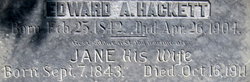
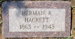
Family Members:
Parent

Siblings

Flowers:


Nearby Cemetories:
1. Union Cemetery
Wakonda, Clay County, USA
Coordinate: 42.9827995, -97.1222000
2. Volin Cemetery
Volin, Yankton County, USA
Coordinate: 42.9672012, -97.1707993
3. Saint Patricks Catholic Cemetery
Wakonda, Clay County, USA
Coordinate: 42.9672012, -97.0516968
4. New Lodi Cemetery
Lodi, Clay County, USA
Coordinate: 42.9530983, -97.0417023
5. Bethel Baptist Cemetery
Wakonda, Clay County, USA
Coordinate: 42.9393570, -97.0433520
6. Zion Cemetery
Volin, Yankton County, USA
Coordinate: 42.9963300, -97.2234600
7. Saint Columbkill Cemetery
Wakonda, Clay County, USA
Coordinate: 43.0642014, -97.0828018
8. Trondhjem Cemetery
Volin, Yankton County, USA
Coordinate: 43.0325400, -97.2346200
9. Old Lodi Cemetery
Lodi, Clay County, USA
Coordinate: 42.9757996, -96.9907990
10. Gayville Community Cemetery
Gayville, Yankton County, USA
Coordinate: 42.8950005, -97.1800003
11. Pleasant Valley Cemetery
Westerville, Clay County, USA
Coordinate: 42.9247017, -97.0124969
12. Rosenberg Cemetery
Mission Hill, Yankton County, USA
Coordinate: 42.9501090, -97.2596880
13. Hillcrest Cemetery
Yankton County, USA
Coordinate: 43.0835991, -97.1680984
14. Mortvedt Cemetery
Clay County, USA
Coordinate: 42.9169006, -97.0028000
15. Pioneer Cemetery
Yankton County, USA
Coordinate: 43.0758018, -97.2118988
16. Salem Cemetery
Yankton County, USA
Coordinate: 43.0830180, -97.2090590
17. Vangen Church Cemetery
Mission Hill, Yankton County, USA
Coordinate: 42.9260120, -97.2650100
18. CJ Anderson Homestead
Riverside Township, Clay County, USA
Coordinate: 43.0214180, -96.9675540
19. Riverside-Barton Cemetery
Clay County, USA
Coordinate: 43.0402985, -96.9725037
20. Mission Hill Congregational Cemetery
Mission Hill, Yankton County, USA
Coordinate: 42.9247900, -97.2795370
21. Holland Cemetery
Centerville, Turner County, USA
Coordinate: 43.1114006, -97.0314026
22. Hansen Cemetery
Turner County, USA
Coordinate: 43.1260986, -97.1511002
23. Walshtown Catholic Cemetery
Mission Hill, Yankton County, USA
Coordinate: 43.0105500, -97.3208300
24. Walshtown Cemetery
Yankton County, USA
Coordinate: 43.0393982, -97.3094025