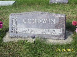
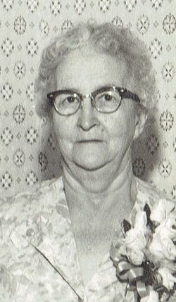
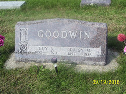
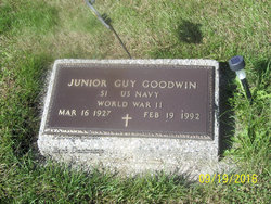
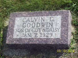
Daisy Mae Rhoads Goodwin
| Birth | : | 22 Oct 1897 Newton Township, Carroll County, Iowa, USA |
| Death | : | 19 Jul 1983 Carroll, Carroll County, Iowa, USA |
| Burial | : | Woodlawn Memorial Park, Bluewell, Mercer County, USA |
| Coordinate | : | 37.3042110, -81.2557730 |
| Description | : | Daisy Mae (Rhoads or Rhoades) Goodwin was born October 22, 1897, in a log cabin built by her father along the Middle Raccoon River between Dedham and Coon Rapids in Newton Township, Carroll County. She was the daughter of James M. and Rachel (Sigler) Rhoads, and the granddaughter to Cyrus & Elizabeth (Vance) Rhoads pioneers of Carroll County, Iowa. Daisy attended the Carrollton schools as a young girl. She was baptized and a member of the Methodist church. On May 19, 1914, she was united in marriage with Guy B. Goodwin in a country church near Scranton, Iowa. They farmed... Read More |
frequently asked questions (FAQ):
-
Where is Daisy Mae Rhoads Goodwin's memorial?
Daisy Mae Rhoads Goodwin's memorial is located at: Woodlawn Memorial Park, Bluewell, Mercer County, USA.
-
When did Daisy Mae Rhoads Goodwin death?
Daisy Mae Rhoads Goodwin death on 19 Jul 1983 in Carroll, Carroll County, Iowa, USA
-
Where are the coordinates of the Daisy Mae Rhoads Goodwin's memorial?
Latitude: 37.3042110
Longitude: -81.2557730
Family Members:
Parent
Spouse
Siblings
Children
Flowers:
Nearby Cemetories:
1. Woodlawn Memorial Park
Bluewell, Mercer County, USA
Coordinate: 37.3042110, -81.2557730
2. Hale Cemetery
Mercer County, USA
Coordinate: 37.3074989, -81.2611008
3. Davidson Cemetery
Brush Fork, Mercer County, USA
Coordinate: 37.2949400, -81.2471100
4. Oak Grove Cemetery
Bluewell, Mercer County, USA
Coordinate: 37.3168983, -81.2639008
5. Taylor Cemetery
Bluewell, Mercer County, USA
Coordinate: 37.3127610, -81.2287090
6. Perdue Cemetery
Brush Fork, Mercer County, USA
Coordinate: 37.2807999, -81.2542038
7. Butt Cemetery
Mercer County, USA
Coordinate: 37.3125000, -81.2835999
8. Brown Cemetery
Brush Fork, Mercer County, USA
Coordinate: 37.2854303, -81.2749329
9. Wild Meadow Cemetery
Bluewell, Mercer County, USA
Coordinate: 37.3100014, -81.2872009
10. Doyle Cemetery
Mercer County, USA
Coordinate: 37.3044014, -81.2228012
11. Butt Cemetery
Mercer County, USA
Coordinate: 37.3189011, -81.2853012
12. McQuire Cemetery
Bluefield, Mercer County, USA
Coordinate: 37.2778015, -81.2322006
13. Hutchinson Cemetery
Bluefield, Mercer County, USA
Coordinate: 37.2902985, -81.2185974
14. Harry Cemetery
Mercer County, USA
Coordinate: 37.2719002, -81.2686005
15. Johnson-Cooper Cemetery
Brush Fork, Mercer County, USA
Coordinate: 37.2811220, -81.2915630
16. Delp Cemetery
Mercer County, USA
Coordinate: 37.3064003, -81.3041992
17. Thomason Cemetery
Bluewell, Mercer County, USA
Coordinate: 37.3130989, -81.2080994
18. Bailey Cemetery
Flipping, Mercer County, USA
Coordinate: 37.3443000, -81.2620070
19. Christ Episcopal Church Columbarium
Bluefield, Mercer County, USA
Coordinate: 37.2680940, -81.2248990
20. Akers Cemetery
Edison, Mercer County, USA
Coordinate: 37.2901160, -81.2008520
21. Oak Hill Cemetery
Freeman, Mercer County, USA
Coordinate: 37.3314018, -81.3035965
22. Dillon Family Cemetery
Mercer County, USA
Coordinate: 37.3445810, -81.2869960
23. Restlawn Memorial Gardens
Bluefield, Mercer County, USA
Coordinate: 37.3275390, -81.2026220
24. Moran Cemetery
Bluestone, Mercer County, USA
Coordinate: 37.3186200, -81.3144100

