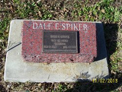
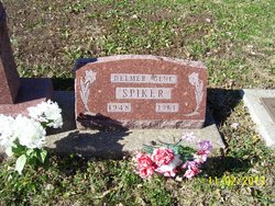
Dale E. Spiker
| Birth | : | 24 Dec 1940 Holton, Jackson County, Kansas, USA |
| Death | : | 30 Jul 2001 Holton, Jackson County, Kansas, USA |
| Burial | : | Beverly Hills Memorial Park, Morgantown, Monongalia County, USA |
| Coordinate | : | 39.6206017, -79.9982986 |
| Plot | : | Section E |
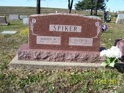
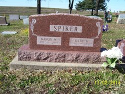
| Description | : | HOYT --- Dale E. Spiker, 60, Hoyt, died Monday, July 30, 2001, at a Holton nursing home. Mr. Spiker worked for Josten's in Topeka for 25 years. He was a U.S. Army veteran of the Vietnam war, earning Vietnam and National Defense service medals. He was born Dec. 24, 1940, to Marvin W. and Ellen Bohnenkemper Spiker. He graduated from Hoyt High School in 1958 and lived most of his life in the Hoyt community. Mr. Spiker was a member of the Hoyt United Methodist Church. Survivors include his mother, Ellen Bohnenkemper Spiker, Holton; and two sisters, Diane Williams, Wichita, and Darlene Puro, Astoria,... Read More |
frequently asked questions (FAQ):
-
Where is Dale E. Spiker's memorial?
Dale E. Spiker's memorial is located at: Beverly Hills Memorial Park, Morgantown, Monongalia County, USA.
-
When did Dale E. Spiker death?
Dale E. Spiker death on 30 Jul 2001 in Holton, Jackson County, Kansas, USA
-
Where are the coordinates of the Dale E. Spiker's memorial?
Latitude: 39.6206017
Longitude: -79.9982986
Family Members:
Parent
Siblings
Flowers:
Nearby Cemetories:
1. Beverly Hills Memorial Park
Morgantown, Monongalia County, USA
Coordinate: 39.6206017, -79.9982986
2. Burnt Meeting House Cemetery
Harmony Grove, Monongalia County, USA
Coordinate: 39.6093920, -80.0036160
3. Old Granville Cemetery
Granville, Monongalia County, USA
Coordinate: 39.6412700, -79.9883760
4. Laurel Point United Methodist Church Cemetery
Laurel Point, Monongalia County, USA
Coordinate: 39.6187900, -80.0296080
5. Lawnwood Cemetery
Morgantown, Monongalia County, USA
Coordinate: 39.6206017, -79.9649963
6. Oak Grove Cemetery
Morgantown, Monongalia County, USA
Coordinate: 39.6213989, -79.9638977
7. Dents Run Cemetery
Monongalia County, USA
Coordinate: 39.6311111, -80.0411072
8. East Oak Grove Cemetery
Morgantown, Monongalia County, USA
Coordinate: 39.6133003, -79.9467010
9. Brand Cemetery
Monongalia County, USA
Coordinate: 39.6272011, -80.0503006
10. Suncrest United Methodist Church Columbarium
Morgantown, Monongalia County, USA
Coordinate: 39.6526280, -79.9642920
11. Burrows Cemetery
Monongalia County, USA
Coordinate: 39.6615200, -79.9750600
12. Old Frum Cemetery
Monongalia County, USA
Coordinate: 39.6052246, -79.9417572
13. Thorn Cemetery
Georgetown, Monongalia County, USA
Coordinate: 39.6039886, -80.0579681
14. Fox Cemetery
Monongalia County, USA
Coordinate: 39.6269989, -80.0635986
15. Baker Cemetery
Morgantown, Monongalia County, USA
Coordinate: 39.6600029, -79.9561276
16. Snider Cemetery
Laurel Point, Monongalia County, USA
Coordinate: 39.6274986, -80.0661011
17. Fairview Cemetery
Morgantown, Monongalia County, USA
Coordinate: 39.5788994, -79.9507980
18. Lough Cemetery
Monongalia County, USA
Coordinate: 39.6425020, -80.0659240
19. Barker Cemetery #1
Georgetown, Monongalia County, USA
Coordinate: 39.6003560, -80.0746140
20. Ramsey Cemetery
Cassville, Monongalia County, USA
Coordinate: 39.6588140, -80.0638400
21. Monongalia County Cemetery
Morgantown, Monongalia County, USA
Coordinate: 39.6664009, -79.9408035
22. Crichfield Cemetery
Monongalia County, USA
Coordinate: 39.6831017, -79.9777985
23. Nuce Cemetery
Monongalia County, USA
Coordinate: 39.5950012, -79.9206009
24. Brookhaven United Methodist Church Cemetery
Monongalia County, USA
Coordinate: 39.6097565, -79.9139938

