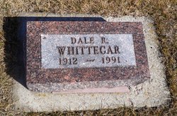
Dale Raymond Whittecar
| Birth | : | 12 Apr 1912 Akron, Plymouth County, Iowa, USA |
| Death | : | 31 Jan 1991 Tacoma, Pierce County, Washington, USA |
| Burial | : | Saint Emanuels Union Cemetery, Jefferson, York County, USA |
| Coordinate | : | 39.8172330, -76.8394000 |
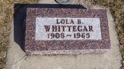
| Description | : | Mr. Whittecar was the son of Harlan & Margaret (Dunn) Whittecar. He came to SD at an early age. He grew up and attended schools in Kimball, SD. He married Lola B. Wilson, April 19, 1933. He was well-known White Lake resident for many years. He was involved in farming, construction and trucking. |
frequently asked questions (FAQ):
-
Where is Dale Raymond Whittecar's memorial?
Dale Raymond Whittecar's memorial is located at: Saint Emanuels Union Cemetery, Jefferson, York County, USA.
-
When did Dale Raymond Whittecar death?
Dale Raymond Whittecar death on 31 Jan 1991 in Tacoma, Pierce County, Washington, USA
-
Where are the coordinates of the Dale Raymond Whittecar's memorial?
Latitude: 39.8172330
Longitude: -76.8394000
Family Members:
Flowers:
Nearby Cemetories:
1. Saint Emanuels Union Cemetery
Jefferson, York County, USA
Coordinate: 39.8172330, -76.8394000
2. Bethlehem United Brethren Graveyard
Jefferson, York County, USA
Coordinate: 39.8164344, -76.8398928
3. Jefferson Cemetery
Jefferson, York County, USA
Coordinate: 39.8092200, -76.8373380
4. Chestnut Grove Brethren Cemetery
Jefferson, York County, USA
Coordinate: 39.8026000, -76.8339000
5. Greenmount United Methodist Church Cemetery
Glen Rock, York County, USA
Coordinate: 39.8084030, -76.8069839
6. Porters Cemetery
York County, USA
Coordinate: 39.8189011, -76.8961029
7. Folkenroth Burial Grounds
North Codorus Township, York County, USA
Coordinate: 39.8643860, -76.8413400
8. Church of the Brethren Cemetery
York County, USA
Coordinate: 39.8648000, -76.8194000
9. Saint Jacobs Stone Church Cemetery
Glenville, York County, USA
Coordinate: 39.7702789, -76.8158264
10. Saints Peter and Paul Chapel Cemetery
Larue, York County, USA
Coordinate: 39.8143501, -76.7660370
11. Garber Mennonite Cemetery
Menges Mills, York County, USA
Coordinate: 39.8573000, -76.8958000
12. Dubs Cemetery
Marburg, York County, USA
Coordinate: 39.7868996, -76.9060974
13. Manheim Union Burial Ground
Hanover, York County, USA
Coordinate: 39.7774658, -76.8979111
14. Wildasin Meeting House Cemetery
Hanover, York County, USA
Coordinate: 39.7884000, -76.9216000
15. Kehr Burial Grounds
York County, USA
Coordinate: 39.8312000, -76.9314000
16. Saint Johns United Methodist Cemetery
Glenville, York County, USA
Coordinate: 39.7446000, -76.8537000
17. Mount Carmel Lutheran Church Cemetery
Hanover, York County, USA
Coordinate: 39.8411430, -76.9321110
18. York Road Cemetery
Hanover, York County, USA
Coordinate: 39.8161011, -76.9413986
19. Chestnut Hill Cemetery
Glen Rock, York County, USA
Coordinate: 39.7896996, -76.7406006
20. Moulstown Cemetery
Moulstown, York County, USA
Coordinate: 39.8526000, -76.9342000
21. Reformed Cemetery
Glen Rock, York County, USA
Coordinate: 39.7881012, -76.7403030
22. Glen Rock Union Cemetery
Glen Rock, York County, USA
Coordinate: 39.8003006, -76.7288971
23. Bair Codorus Mennonite Cemetery
Bair, York County, USA
Coordinate: 39.9041000, -76.8183000
24. Marburg Memorial Gardens
Hanover, York County, USA
Coordinate: 39.7813000, -76.9500000


