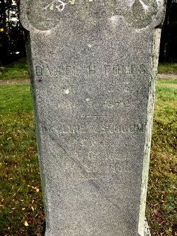
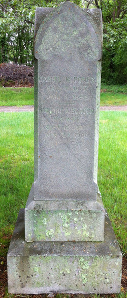
Daniel Henry Fones
| Birth | : | 7 Mar 1835 |
| Death | : | 9 Jan 1882 Davisville, Washington County, Rhode Island, USA |
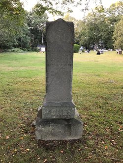
| Burial | : | Glenwood Cemetery, East Greenwich, Kent County, USA |
| Coordinate | : | 41.6550900, -71.4645200 |
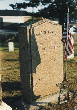
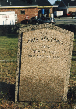
| Description | : | Parents: Joseph Fones & Julia Ann In 1861 Daniel and Emeline Fones purchsed a 37-acre farm from the Slocum family located at 420 School Street in North Kingstown. Daniel's son Henry later purchased a smaller farm across the street and he and his father worked together to manage both farms until January 1882 when Daniel passed. Henry took over the care of both farms until April 1900 when his mother, Emeline, passed. Daniel & Emeline's property on 420 School street was then sold to John & Clara Nichols. |
frequently asked questions (FAQ):
-
Where is Daniel Henry Fones's memorial?
Daniel Henry Fones's memorial is located at: Glenwood Cemetery, East Greenwich, Kent County, USA.
-
When did Daniel Henry Fones death?
Daniel Henry Fones death on 9 Jan 1882 in Davisville, Washington County, Rhode Island, USA
-
Where are the coordinates of the Daniel Henry Fones's memorial?
Latitude: 41.6550900
Longitude: -71.4645200
Family Members:
Parent
Spouse
Siblings
Children
Flowers:
Nearby Cemetories:
1. Glenwood Cemetery
East Greenwich, Kent County, USA
Coordinate: 41.6550900, -71.4645200
2. Daniel Howland Lot
East Greenwich, Kent County, USA
Coordinate: 41.6564331, -71.4653168
3. Captain Samuel Fry Lot
East Greenwich, Kent County, USA
Coordinate: 41.6567039, -71.4653168
4. Payne-Spencer Lot
East Greenwich, Kent County, USA
Coordinate: 41.6566772, -71.4657288
5. Saint Patrick Cemetery
East Greenwich, Kent County, USA
Coordinate: 41.6522179, -71.4576416
6. East Greenwich Cemetery
East Greenwich, Kent County, USA
Coordinate: 41.6553345, -71.4551392
7. Nichols Lot
East Greenwich, Kent County, USA
Coordinate: 41.6505810, -71.4751300
8. Clement Weaver Lot
East Greenwich, Kent County, USA
Coordinate: 41.6620800, -71.4743700
9. Gertrude Parker Stone
East Greenwich, Kent County, USA
Coordinate: 41.6593490, -71.4521600
10. Quaker Lot
East Greenwich, Kent County, USA
Coordinate: 41.6602500, -71.4524600
11. Henry Spencer Lot
East Greenwich, Kent County, USA
Coordinate: 41.6471980, -71.4743470
12. Saint Lukes Episcopal Churchyard
East Greenwich, Kent County, USA
Coordinate: 41.6614456, -71.4518433
13. Governor Greene Cemetery
Warwick, Kent County, USA
Coordinate: 41.6661000, -71.4594300
14. Captain Joseph Spencer Lot
Warwick, Kent County, USA
Coordinate: 41.6456108, -71.4551392
15. Doctor Peter Turner Lot (Defunct)
East Greenwich, Kent County, USA
Coordinate: 41.6628700, -71.4525360
16. Peirce-Spencer Lot
East Greenwich, Kent County, USA
Coordinate: 41.6422500, -71.4683610
17. Spencer Lot
East Greenwich, Kent County, USA
Coordinate: 41.6460533, -71.4808731
18. Baptist Burial Ground
East Greenwich, Kent County, USA
Coordinate: 41.6631241, -71.4467926
19. East Greenwich Swedish Cemetery
East Greenwich, Kent County, USA
Coordinate: 41.6628900, -71.4826600
20. Lutheran Church Cemetery
East Greenwich, Kent County, USA
Coordinate: 41.6628680, -71.4828150
21. Oliver Wickes Lot
East Greenwich, Kent County, USA
Coordinate: 41.6629524, -71.4834213
22. Anthony Hall Lot
East Greenwich, Kent County, USA
Coordinate: 41.6622500, -71.4839280
23. Major General Thomas Holden Lot
Warwick, Kent County, USA
Coordinate: 41.6636300, -71.4850800
24. Major Pardon Potter Lot
Warwick, Kent County, USA
Coordinate: 41.6728610, -71.4705830

