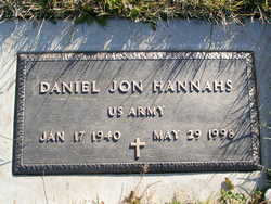
Daniel Jon “Dan” Hannahs
| Birth | : | 17 Jan 1940 Coeur d'Alene, Kootenai County, Idaho, USA |
| Death | : | 29 May 1998 Ritzville, Adams County, Washington, USA |
| Burial | : | Okanogan City Cemetery, Okanogan, Okanogan County, USA |
| Coordinate | : | 48.3546982, -119.6061020 |
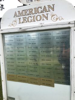
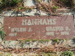
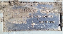
| Description | : | Wenatchee World - June 01, 1998 DANIEL JON HANNAHS Ritzville Daniel Jon Hannahs, 58, Ritzville, a former longtime resident of Grand Coulee, died Friday evening, May 19, 1998, in a Ritzville hospital, following a five-month battle with cancer. He was born Jan. 17, 1940, at Coeur d'Alene, Idaho, to Walter R. and Helen J. (Fries) Hannahs. He moved with his family to Waterville, where he grew up and graduated from Waterville High School. He served in the U.S. Army from 1960 until 1962. He married Mary Glessner on Oct. 17, 1963, in Waterville. The couple lived in Grand Coulee for many years before moving... Read More |
frequently asked questions (FAQ):
-
Where is Daniel Jon “Dan” Hannahs's memorial?
Daniel Jon “Dan” Hannahs's memorial is located at: Okanogan City Cemetery, Okanogan, Okanogan County, USA.
-
When did Daniel Jon “Dan” Hannahs death?
Daniel Jon “Dan” Hannahs death on 29 May 1998 in Ritzville, Adams County, Washington, USA
-
Where are the coordinates of the Daniel Jon “Dan” Hannahs's memorial?
Latitude: 48.3546982
Longitude: -119.6061020
Family Members:
Parent
Spouse
Flowers:
Nearby Cemetories:
1. Okanogan City Cemetery
Okanogan, Okanogan County, USA
Coordinate: 48.3546982, -119.6061020
2. Spring Coulee Family Cemetery
Okanogan County, USA
Coordinate: 48.3895950, -119.6289460
3. Okanogan Valley Memorial Gardens
Omak, Okanogan County, USA
Coordinate: 48.3911018, -119.5691986
4. Omak Memorial Cemetery
Okanogan, Okanogan County, USA
Coordinate: 48.3874000, -119.5565800
5. Cameron Lake Pioneer Memorial Cemetery
Malott, Okanogan County, USA
Coordinate: 48.2708330, -119.5700000
6. Malott Community Cemetery
Malott, Okanogan County, USA
Coordinate: 48.2925000, -119.7047300
7. Sand Flats Cemetery
Omak, Okanogan County, USA
Coordinate: 48.4157600, -119.4836600
8. Stoddard Gravesite
Okanogan, Okanogan County, USA
Coordinate: 48.4531140, -119.5411680
9. Saint Marys Mission Catholic Cemetery
Omak, Okanogan County, USA
Coordinate: 48.3752800, -119.4452800
10. Chiliwist Cemetery
Okanogan County, USA
Coordinate: 48.2630997, -119.7363968
11. Brooks Cemetery
Omak, Okanogan County, USA
Coordinate: 48.3786110, -119.3941670
12. Swipkin Family Cemetery
Riverside, Okanogan County, USA
Coordinate: 48.4664270, -119.4618660
13. Riverside Cemetery
Riverside, Okanogan County, USA
Coordinate: 48.4944400, -119.5022200
14. Ruby Cemetery
Okanogan County, USA
Coordinate: 48.5085983, -119.7221985
15. Booher Grave
Riverside, Okanogan County, USA
Coordinate: 48.3409070, -119.3244000
16. Fort Okanogan Memorial Cemetery
Okanogan, Okanogan County, USA
Coordinate: 48.1594009, -119.6632996
17. Conconully Cemetery
Conconully, Okanogan County, USA
Coordinate: 48.5441600, -119.7400100
18. Elizabeth Osborn Mikel Gravesite
Brewster, Okanogan County, USA
Coordinate: 48.1498900, -119.7514700
19. Paradise Hill Cemetery
Brewster, Okanogan County, USA
Coordinate: 48.1848980, -119.8411900
20. South Pine Creek Cemetery
Riverside, Okanogan County, USA
Coordinate: 48.5925900, -119.5663400
21. Tunk Valley Cemetery
Riverside, Okanogan County, USA
Coordinate: 48.5222015, -119.3242035
22. Kartar Cemetery
Okanogan County, USA
Coordinate: 48.2197100, -119.2694500
23. Locust Grove Cemetery
Brewster, Okanogan County, USA
Coordinate: 48.1114006, -119.7746964
24. Pine Creek Cemetery
Tonasket, Okanogan County, USA
Coordinate: 48.6330560, -119.6502780


