
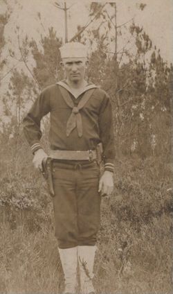
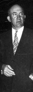
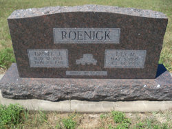
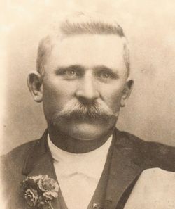
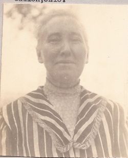
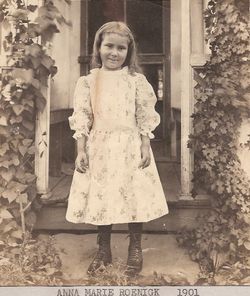
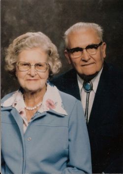
Daniel Julius Roenigk
| Birth | : | 12 Nov 1893 Morganville, Clay County, Kansas, USA |
| Death | : | 23 Nov 1981 Morganville, Clay County, Kansas, USA |
| Burial | : | Spring Canyon Cemetery, Lincoln, Lincoln County, USA |
| Coordinate | : | 47.9302788, -118.9469452 |
| Description | : | Owned business in Morganville, Clay County, Kansas, store front window still had his name written on it in 2005. He preserved the family history after Frederick Adolph Roenigk's death. He married on 23 Apr 1924 Lilly M. Mellies daughter of Frederick H. Mellies and Rosa Ruegg |
frequently asked questions (FAQ):
-
Where is Daniel Julius Roenigk's memorial?
Daniel Julius Roenigk's memorial is located at: Spring Canyon Cemetery, Lincoln, Lincoln County, USA.
-
When did Daniel Julius Roenigk death?
Daniel Julius Roenigk death on 23 Nov 1981 in Morganville, Clay County, Kansas, USA
-
Where are the coordinates of the Daniel Julius Roenigk's memorial?
Latitude: 47.9302788
Longitude: -118.9469452
Family Members:
Parent
Spouse

Siblings
Flowers:


Nearby Cemetories:
1. Spring Canyon Cemetery
Lincoln, Lincoln County, USA
Coordinate: 47.9302788, -118.9469452
2. Mary Keller Cemetery
Keller, Ferry County, USA
Coordinate: 47.9550700, -118.8780200
3. Lafollette Cemetery
Lincoln County, USA
Coordinate: 47.8293991, -118.9158020
4. Seaton Grove Cemetery
Okanogan County, USA
Coordinate: 48.0327800, -118.9644500
5. Annie Kauffman Cemetery
Keller, Ferry County, USA
Coordinate: 47.9072800, -118.7464100
6. Thompson-Shrock Cemetery
Hanson, Grant County, USA
Coordinate: 47.8014740, -119.0401160
7. Busch Cemetery
Hanson, Grant County, USA
Coordinate: 47.7863880, -118.9900000
8. Saint Johns Cemetery
Grant County, USA
Coordinate: 47.7863998, -119.0391998
9. Felicite Cemetery
Ferry County, USA
Coordinate: 47.9582100, -118.6917400
10. Simpson Family Cemetery
Okanogan County, USA
Coordinate: 48.1119400, -118.8861200
11. Daniel Ignace Cemetery
Keller, Ferry County, USA
Coordinate: 47.9886200, -118.6805700
12. Covington Cemetery (Defunct)
Keller, Ferry County, USA
Coordinate: 47.9402800, -118.6609300
13. Little Nespelem Cemetery
Okanogan County, USA
Coordinate: 48.1249400, -118.9766100
14. Delrio Cemetery
Douglas County, USA
Coordinate: 48.0049700, -119.2333700
15. Little Bob Cemetery
Nespelem, Okanogan County, USA
Coordinate: 48.1352700, -118.9861100
16. Lucy Ignace Cemetery
Keller, Ferry County, USA
Coordinate: 48.0297400, -118.6713400
17. Govan Cemetery (Defunct)
Lincoln County, USA
Coordinate: 47.7325000, -118.8300000
18. Sanpoil Cemetery
Keller, Ferry County, USA
Coordinate: 48.0331600, -118.6608800
19. Mary Hughes Cemetery
Keller, Ferry County, USA
Coordinate: 48.0405300, -118.6648100
20. Wilbur Cemetery
Wilbur, Lincoln County, USA
Coordinate: 47.7786102, -118.7002792
21. Welsh Cemetery
Grant County, USA
Coordinate: 47.7139015, -119.0447006
22. Nespelem City Cemetery
Nespelem, Okanogan County, USA
Coordinate: 48.1540460, -118.9959000
23. Norine Smith Cemetery
Nespelem, Okanogan County, USA
Coordinate: 48.1540770, -118.9971280
24. Almira Cemetery
Almira, Lincoln County, USA
Coordinate: 47.7038994, -118.9561005