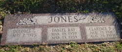
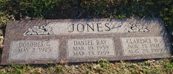
Daniel Ray Jones
| Birth | : | 19 Mar 1959 Fullerton, Nance County, Nebraska, USA |
| Death | : | 19 Mar 1959 Fullerton, Nance County, Nebraska, USA |
| Burial | : | Robe Cemetery, Robe, District Council of Robe, Australia |
| Coordinate | : | -37.1676290, 139.7506190 |
| Description | : | The Columbus Daily Telegram, March 30, 1959 JONES--Infant Dies - Daniel Ray, infant son of Mr. and Mrs. Clarence D. Jones of Silver Creek, died at birth March 19 at Memorial hospital in Fullerton. Burial was in Roselawn Memorial cemetery at Columbus on March 20 with the Rev. Hugo ____ of ___ Calvary Lutheran church, Fullerton, officiating. Fleming Funeral home of Silver Creek had charge of the arrangements. Mr. and Mrs. Jones are former residents of the Columbus vicinity. per don |
frequently asked questions (FAQ):
-
Where is Daniel Ray Jones's memorial?
Daniel Ray Jones's memorial is located at: Robe Cemetery, Robe, District Council of Robe, Australia.
-
When did Daniel Ray Jones death?
Daniel Ray Jones death on 19 Mar 1959 in Fullerton, Nance County, Nebraska, USA
-
Where are the coordinates of the Daniel Ray Jones's memorial?
Latitude: -37.1676290
Longitude: 139.7506190
Family Members:
Parent
Siblings
Flowers:
Nearby Cemetories:
1. Robe Cemetery
Robe, District Council of Robe, Australia
Coordinate: -37.1676290, 139.7506190
2. Beachport Cemetery
Beachport, Wattle Range Council, Australia
Coordinate: -37.4725340, 140.0475120
3. Lucindale Cemetery
Lucindale, Naracoorte Lucindale Council, Australia
Coordinate: -36.9696190, 140.3797090
4. Millicent Cemetery
Millicent, Wattle Range Council, Australia
Coordinate: -37.6184335, 140.3770980
5. Moyhall Homestead
Naracoorte Lucindale Council, Australia
Coordinate: -37.0585750, 140.6699470
6. Naracoorte Cemetery
Naracoorte, Naracoorte Lucindale Council, Australia
Coordinate: -36.9460270, 140.7302250
7. Burnside Cemetery
Naracoorte, Naracoorte Lucindale Council, Australia
Coordinate: -36.7925600, 140.6600300
8. Kalangadoo Cemetery
Kalangadoo, Wattle Range Council, Australia
Coordinate: -37.5694190, 140.7045780
9. Penola Old Cemetery
Penola, Wattle Range Council, Australia
Coordinate: -37.3670740, 140.8412400
10. Penola Cemetery
Penola, Wattle Range Council, Australia
Coordinate: -37.4009210, 140.8362800
11. Hynam Cemetery
Naracoorte Lucindale Council, Australia
Coordinate: -36.9393410, 140.8490120
12. Kybybolite Cemetery
Kybybolite, Naracoorte Lucindale Council, Australia
Coordinate: -36.8815610, 140.9291740
13. Carinya Gardens
Mount Gambier, Mount Gambier City, Australia
Coordinate: -37.8370330, 140.7494970
14. Pioneer Park
Mount Gambier, Mount Gambier City, Australia
Coordinate: -37.8348290, 140.7840010
15. Mieschel Park
Mount Gambier, Mount Gambier City, Australia
Coordinate: -37.8374980, 140.7855890
16. Lake Terrace Cemetery
Mount Gambier, Mount Gambier City, Australia
Coordinate: -37.8425950, 140.7854720
17. Frances Cemetery
Frances, Naracoorte Lucindale Council, Australia
Coordinate: -36.7032530, 140.9614290
18. Apsley Cemetery
Apsley, West Wimmera Shire, Australia
Coordinate: -36.9589380, 141.0837570
19. Port MacDonnell Lighthouse Cemetery
Port MacDonnell, District Council of Grant, Australia
Coordinate: -38.0558330, 140.6630560
20. Heathfield Cemetery
Lake Mundi, Glenelg Shire, Australia
Coordinate: -37.5713233, 141.1436213
21. Keith Cemetery
Keith, Tatiara District Council, Australia
Coordinate: -36.0878080, 140.3686180
22. Dergholm Cemetery
Dergholm, West Wimmera Shire, Australia
Coordinate: -37.3717520, 141.2253000
23. Minimay Cemetery
Minimay, West Wimmera Shire, Australia
Coordinate: -36.7228070, 141.1613810
24. Edenhope Cemetery
Edenhope, West Wimmera Shire, Australia
Coordinate: -37.0421400, 141.3039580


