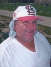
Danny Bill Stott
| Birth | : | 9 Feb 1950 Keokuk, Lee County, Iowa, USA |
| Death | : | 5 Jun 2016 Revere, Clark County, Missouri, USA |
| Burial | : | Prairie View Cemetery, Azen, Scotland County, USA |
| Coordinate | : | 40.5616700, -92.0578600 |
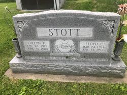
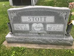
| Description | : | Danny Bill Stott, 66, of Revere, MO died Sunday at his home in Revere. He was born February 9, 1950 in Keokuk Iowa the son of Lloyd and Evelyn Flaudia Orton Stott. Danny graduated from Clark County R-1 High School and then graduated from Linn Tech Community College. He was employed with the Garnet Factory in Memphis and Shellor Globe in Keokuk. He was a man of faith and found peace within himself and the Lord. Danny enjoyed collecting Depression glass, watching birds and rabbits in his backyard. ... Read More |
frequently asked questions (FAQ):
-
Where is Danny Bill Stott's memorial?
Danny Bill Stott's memorial is located at: Prairie View Cemetery, Azen, Scotland County, USA.
-
When did Danny Bill Stott death?
Danny Bill Stott death on 5 Jun 2016 in Revere, Clark County, Missouri, USA
-
Where are the coordinates of the Danny Bill Stott's memorial?
Latitude: 40.5616700
Longitude: -92.0578600
Family Members:
Parent
Siblings
Flowers:
Nearby Cemetories:
1. Prairie View Cemetery
Azen, Scotland County, USA
Coordinate: 40.5616700, -92.0578600
2. Providence Church Cemetery
Azen, Scotland County, USA
Coordinate: 40.5614815, -92.0579605
3. Billups Cemetery
Union Township, Scotland County, USA
Coordinate: 40.5544200, -92.0794100
4. Penn Cemetery
Scotland County, USA
Coordinate: 40.5416985, -92.0532990
5. Needham Cemetery
Scotland County, USA
Coordinate: 40.5410995, -92.0761032
6. Power Family Cemetery
Scotland County, USA
Coordinate: 40.5320663, -92.0322952
7. McHenry Cemetery
Scotland County, USA
Coordinate: 40.5238991, -92.0691986
8. Mount Olive Cemetery
Scotland County, USA
Coordinate: 40.5946999, -92.0922012
9. Mount Moriah Cemetery
Azen, Scotland County, USA
Coordinate: 40.5422800, -92.0083700
10. Upton Cemetery
Cantril, Van Buren County, USA
Coordinate: 40.6074030, -92.0338380
11. Price Cemetery
Cantril, Van Buren County, USA
Coordinate: 40.6028500, -92.1132000
12. Lawn Ridge Cemetery
Scotland County, USA
Coordinate: 40.5102100, -92.0955900
13. Koellner Cemetery
Cantril, Van Buren County, USA
Coordinate: 40.6205700, -92.0694900
14. Brookhart Cemetery
Scotland County, USA
Coordinate: 40.5196991, -91.9997025
15. Davis Cemetery
Scotland County, USA
Coordinate: 40.5736008, -91.9783020
16. Prospect Grove Cemetery
Scotland County, USA
Coordinate: 40.5346985, -91.9841995
17. Gorgas Cemetery
Scotland County, USA
Coordinate: 40.5256004, -91.9891968
18. Mantonye Cemetery
Van Buren County, USA
Coordinate: 40.6264000, -92.0248000
19. Rathburn Cemetery
Scotland County, USA
Coordinate: 40.5046997, -92.0056000
20. Meadowview Cemetery
Scotland County, USA
Coordinate: 40.5669100, -92.1496100
21. Bethel Cemetery
Scotland County, USA
Coordinate: 40.5147100, -92.1281700
22. Allphin Cemetery
Scotland County, USA
Coordinate: 40.5786018, -91.9664001
23. Curtiss Cemetery
Scotland County, USA
Coordinate: 40.5741997, -92.1505966
24. Bibb Cemetery
Scotland County, USA
Coordinate: 40.5677986, -91.9621964


