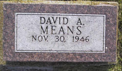
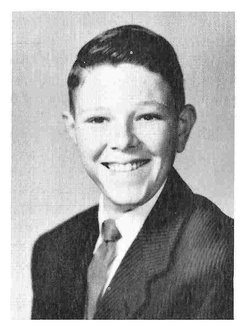
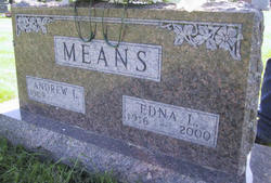
David Andrew Means
| Birth | : | 30 Nov 1946 Iowa City, Johnson County, Iowa, USA |
| Death | : | 8 Jul 2011 Oskaloosa, Mahaska County, Iowa, USA |
| Burial | : | East Greenwich Cemetery, East Greenwich, Kent County, USA |
| Coordinate | : | 41.6553345, -71.4551392 |
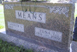
| Description | : | David A. Means, 64 of Oskaloosa, formerly of Lorimor died Friday, July 8, 2011 at the Mahaska Health Partnership in Oskaloosa, Iowa. David Andrew Means was born November 30, 1946 in Iowa City, Iowa to Edna Lea (Kalar) Means and Andrew Ivan Means. He graduated from East Union High School in 1964. He lived most of his life in the Lorimor area, later living in Pleasantville, Knoxville, and moving in 2006 to Oskaloosa. He had worked as a taxi cab driver in the Des Moines area and for Koch Office Machines. He enjoyed fishing, watching movies and driving his pickup.... Read More |
frequently asked questions (FAQ):
-
Where is David Andrew Means's memorial?
David Andrew Means's memorial is located at: East Greenwich Cemetery, East Greenwich, Kent County, USA.
-
When did David Andrew Means death?
David Andrew Means death on 8 Jul 2011 in Oskaloosa, Mahaska County, Iowa, USA
-
Where are the coordinates of the David Andrew Means's memorial?
Latitude: 41.6553345
Longitude: -71.4551392
Family Members:
Parent
Siblings
Flowers:
Nearby Cemetories:
1. East Greenwich Cemetery
East Greenwich, Kent County, USA
Coordinate: 41.6553345, -71.4551392
2. Saint Patrick Cemetery
East Greenwich, Kent County, USA
Coordinate: 41.6522179, -71.4576416
3. Gertrude Parker Stone
East Greenwich, Kent County, USA
Coordinate: 41.6593490, -71.4521600
4. Quaker Lot
East Greenwich, Kent County, USA
Coordinate: 41.6602500, -71.4524600
5. Saint Lukes Episcopal Churchyard
East Greenwich, Kent County, USA
Coordinate: 41.6614456, -71.4518433
6. Glenwood Cemetery
East Greenwich, Kent County, USA
Coordinate: 41.6550900, -71.4645200
7. Daniel Howland Lot
East Greenwich, Kent County, USA
Coordinate: 41.6564331, -71.4653168
8. Captain Samuel Fry Lot
East Greenwich, Kent County, USA
Coordinate: 41.6567039, -71.4653168
9. Doctor Peter Turner Lot (Defunct)
East Greenwich, Kent County, USA
Coordinate: 41.6628700, -71.4525360
10. Payne-Spencer Lot
East Greenwich, Kent County, USA
Coordinate: 41.6566772, -71.4657288
11. Captain Joseph Spencer Lot
Warwick, Kent County, USA
Coordinate: 41.6456108, -71.4551392
12. Baptist Burial Ground
East Greenwich, Kent County, USA
Coordinate: 41.6631241, -71.4467926
13. Governor Greene Cemetery
Warwick, Kent County, USA
Coordinate: 41.6661000, -71.4594300
14. Nichols Lot
East Greenwich, Kent County, USA
Coordinate: 41.6505810, -71.4751300
15. Clement Weaver Lot
East Greenwich, Kent County, USA
Coordinate: 41.6620800, -71.4743700
16. Peirce-Spencer Lot
East Greenwich, Kent County, USA
Coordinate: 41.6422500, -71.4683610
17. Henry Spencer Lot
East Greenwich, Kent County, USA
Coordinate: 41.6471980, -71.4743470
18. Essex-Congdon-Shippee Lot
Warwick, Kent County, USA
Coordinate: 41.6375008, -71.4547501
19. Charles Hunt Lot
North Kingstown, Washington County, USA
Coordinate: 41.6360820, -71.4591830
20. Major Pardon Potter Lot
Warwick, Kent County, USA
Coordinate: 41.6728610, -71.4705830
21. Spencer Lot
East Greenwich, Kent County, USA
Coordinate: 41.6460533, -71.4808731
22. Doctor James Greene Lot
Warwick, Kent County, USA
Coordinate: 41.6606900, -71.4272600
23. East Greenwich Swedish Cemetery
East Greenwich, Kent County, USA
Coordinate: 41.6628900, -71.4826600
24. Lutheran Church Cemetery
East Greenwich, Kent County, USA
Coordinate: 41.6628680, -71.4828150

