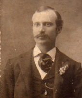
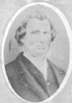
David Crockett Mathews
| Birth | : | 25 Jun 1833 Erie, Monroe County, Michigan, USA |
| Death | : | 26 Jan 1919 Danville, Des Moines County, Iowa, USA |
| Burial | : | Dorchester Cemetery, Dorchester, Dorchester County, USA |
| Coordinate | : | 33.1549060, -80.3877510 |
| Description | : | The Burlington Hawkeye Gazette, Burlington, Des Moines County, Iowa Monday, 1/29/1919, page 3 Danville, Iowa Jan 28 David Mathews, son of Herman and Ann Lester Mathews, was born in Erie, Mich., June 25, 1833 and died January 26, 1919, aged 85 years, 7 months and 1 day. He came to Iowa with his parents when 4 years of age and settled first in Lee County, later moving to Des Moines County, settling northwest of Danville, where he lived till he was married to Emily Booth, on March 19,1863. He settled on the old Booth farm, one and one-half miles north... Read More |
frequently asked questions (FAQ):
-
Where is David Crockett Mathews's memorial?
David Crockett Mathews's memorial is located at: Dorchester Cemetery, Dorchester, Dorchester County, USA.
-
When did David Crockett Mathews death?
David Crockett Mathews death on 26 Jan 1919 in Danville, Des Moines County, Iowa, USA
-
Where are the coordinates of the David Crockett Mathews's memorial?
Latitude: 33.1549060
Longitude: -80.3877510
Family Members:
Parent
Spouse
Siblings
Children
Flowers:
Nearby Cemetories:
1. Dorchester Cemetery
Dorchester, Dorchester County, USA
Coordinate: 33.1549060, -80.3877510
2. Greater Faith Temple Apostolic
Dorchester, Dorchester County, USA
Coordinate: 33.1559630, -80.3885310
3. Dorchester Cemetery
Dorchester, Dorchester County, USA
Coordinate: 33.1447000, -80.3973000
4. Surprise Baptist Church Cemetery
Dorchester, Dorchester County, USA
Coordinate: 33.1417070, -80.3831520
5. Limestone Baptist Church Cemetery
Dorchester, Dorchester County, USA
Coordinate: 33.1472015, -80.3649979
6. Old Harley Cemetery
Harleyville, Dorchester County, USA
Coordinate: 33.1473812, -80.3648153
7. Small Pines Family Cemetery
Harleyville, Dorchester County, USA
Coordinate: 33.1734320, -80.3481410
8. Saint Daniel United Methodist Church
Harleyville, Dorchester County, USA
Coordinate: 33.2030380, -80.3940050
9. Bethel United Methodist Church Cemetery
Harleyville, Dorchester County, USA
Coordinate: 33.1993710, -80.3573340
10. Calvary Baptist Church Cemetery
Pregnall, Dorchester County, USA
Coordinate: 33.1549988, -80.4685974
11. Saint John Missionary Baptist Church Cemetery
Ridgeville, Dorchester County, USA
Coordinate: 33.0902980, -80.3591970
12. Rhode Memory Garden
Dorchester, Dorchester County, USA
Coordinate: 33.0875890, -80.4066810
13. Saint John United Methodist Church Cemetery
Dorchester, Dorchester County, USA
Coordinate: 33.1094620, -80.4508870
14. Zion United Methodist Church Cemetery
Dorchester, Dorchester County, USA
Coordinate: 33.0866400, -80.4078390
15. Harleyville Cemetery
Harleyville, Dorchester County, USA
Coordinate: 33.2005997, -80.4518967
16. Mims Lake Cemetery
Pringletown, Berkeley County, USA
Coordinate: 33.1697006, -80.3011017
17. Mizell Cemetery
Sandridge, Berkeley County, USA
Coordinate: 33.1657530, -80.2993360
18. First United Methodist Church Cemetery
Harleyville, Dorchester County, USA
Coordinate: 33.2138780, -80.4457560
19. Canaday Cemetery
Harleyville, Dorchester County, USA
Coordinate: 33.1950870, -80.4694040
20. Bonnerest Garden of the Resurrection Cemetery
Ridgeville, Dorchester County, USA
Coordinate: 33.0944100, -80.3249700
21. Riggs Family Cemetery
Ridgeville, Dorchester County, USA
Coordinate: 33.1178120, -80.3027850
22. Cummings Chapel Cemetery
Ridgeville, Dorchester County, USA
Coordinate: 33.0736008, -80.3597031
23. Harrell Family Farm Cemetery
Ridgeville, Dorchester County, USA
Coordinate: 33.0684300, -80.3638070
24. Moorer Vogt Cemetery
Harleyville, Dorchester County, USA
Coordinate: 33.2450850, -80.3985460


