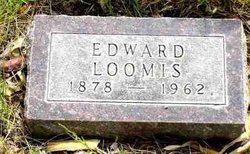
| Birth | : | 30 Jun 1905 Custer, Custer County, South Dakota, USA |
| Death | : | 1 Nov 1994 Bayard, Morrill County, Nebraska, USA |
| Burial | : | East Lawn Cemetery, Minatare, Scotts Bluff County, USA |
| Coordinate | : | 41.8591995, -103.5177994 |
| Plot | : | Section B, Block 10, Plot 2 Deed# 159 |
| Description | : | Father - Edward Loomis Mother - Emma Della VanPelt |
frequently asked questions (FAQ):
-
Where is David Edward Loomis's memorial?
David Edward Loomis's memorial is located at: East Lawn Cemetery, Minatare, Scotts Bluff County, USA.
-
When did David Edward Loomis death?
David Edward Loomis death on 1 Nov 1994 in Bayard, Morrill County, Nebraska, USA
-
Where are the coordinates of the David Edward Loomis's memorial?
Latitude: 41.8591995
Longitude: -103.5177994
Family Members:
Parent
Spouse
Siblings
Flowers:
Nearby Cemetories:
1. East Lawn Cemetery
Minatare, Scotts Bluff County, USA
Coordinate: 41.8591995, -103.5177994
2. Fairview Cemetery
Scottsbluff, Scotts Bluff County, USA
Coordinate: 41.8857994, -103.6536026
3. Saint Francis Episcopal Church Columbarium
Scottsbluff, Scotts Bluff County, USA
Coordinate: 41.8665000, -103.6617500
4. Creighton Valley Cemetery
Melbeta, Scotts Bluff County, USA
Coordinate: 41.7482300, -103.5580400
5. West Lawn Cemetery
Gering, Scotts Bluff County, USA
Coordinate: 41.8167000, -103.6849976
6. High Butte Cemetery
McGrew, Scotts Bluff County, USA
Coordinate: 41.7289009, -103.4353027
7. Sunset Memorial Park
Scottsbluff, Scotts Bluff County, USA
Coordinate: 41.8997002, -103.7166977
8. Bayard Cemetery
Bayard, Morrill County, USA
Coordinate: 41.7666910, -103.3236600
9. Pierre Didier Papin Gravesite
Gering, Scotts Bluff County, USA
Coordinate: 41.7353783, -103.6983490
10. Chimney Rock Cemetery
Morrill County, USA
Coordinate: 41.6991997, -103.3399963
11. Mitchell Valley Cemetery
Mitchell, Scotts Bluff County, USA
Coordinate: 41.8877983, -103.8311005
12. Pioneer Graves
Scotts Bluff County, USA
Coordinate: 41.8057785, -103.8303909
13. Morrill County Rural Burial Site
Bayard, Morrill County, USA
Coordinate: 41.7312100, -103.2353100
14. Mitchell Cemetery
Mitchell, Scotts Bluff County, USA
Coordinate: 41.9585991, -103.8214035
15. Angora Cemetery
Angora, Morrill County, USA
Coordinate: 41.8577995, -103.1306000
16. Snake Creek Cemetery
Box Butte County, USA
Coordinate: 42.0889015, -103.2742004
17. Caldwell Pioneer Graves
Scotts Bluff County, USA
Coordinate: 41.8911812, -103.9287087
18. Forest Lawn Cemetery
Morrill, Scotts Bluff County, USA
Coordinate: 41.9919014, -103.9128036
19. Chaulk Creek Cemetery
Harrisburg, Banner County, USA
Coordinate: 41.5496560, -103.3781240
20. Oregon Trail Memorial Park Cemetery
Bridgeport, Morrill County, USA
Coordinate: 41.6699982, -103.1449966
21. Caldwell Cemetery
Scotts Bluff County, USA
Coordinate: 41.8997002, -103.9768982
22. Harrisburg Cemetery
Banner County, USA
Coordinate: 41.5427010, -103.7158430
23. Kirk Cemetery
Harrisburg, Banner County, USA
Coordinate: 41.5103480, -103.4653220
24. Redington Cemetery
Redington, Morrill County, USA
Coordinate: 41.5697760, -103.2425540


