Deacon John Wood
| Birth | : | 13 Feb 1683 Bradford, Essex County, Massachusetts, USA |
| Death | : | 13 Feb 1753 Littleton, Middlesex County, Massachusetts, USA |
| Burial | : | Cockerham Graveyard, Mountain Park, Surry County, USA |
| Coordinate | : | 36.3518100, -80.8540160 |
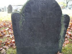
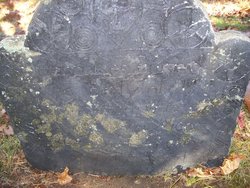
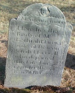
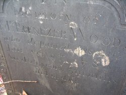
| Inscription | : | Here Lies Buried The Body of Deac John Wood who died Feb ye 13 A.D. 1753 in ye 70 year of His Age. |
| Description | : | Son of John and Isabel (Hazen) Wood. (His father is still burial unknown). Husband of Sarah Kimball. ________ Bradford Vital Records, births, pg 169 Wood, John, s. John and Isabell, Feb. 13, 1683. |
frequently asked questions (FAQ):
-
Where is Deacon John Wood's memorial?
Deacon John Wood's memorial is located at: Cockerham Graveyard, Mountain Park, Surry County, USA.
-
When did Deacon John Wood death?
Deacon John Wood death on 13 Feb 1753 in Littleton, Middlesex County, Massachusetts, USA
-
Where are the coordinates of the Deacon John Wood's memorial?
Latitude: 36.3518100
Longitude: -80.8540160
Family Members:
Parent
Spouse
Siblings
Children
Flowers:
Nearby Cemetories:
1. Cockerham Graveyard
Mountain Park, Surry County, USA
Coordinate: 36.3518100, -80.8540160
2. Swift Family Cemetery
Mountain Park, Surry County, USA
Coordinate: 36.3474731, -80.8469162
3. Golden Family Cemetery
State Road, Surry County, USA
Coordinate: 36.3439700, -80.8567300
4. Kennedy Cemetery
Mountain Park, Surry County, USA
Coordinate: 36.3668740, -80.8746310
5. Mount Pleasant Baptist Church Cemetery
State Road, Surry County, USA
Coordinate: 36.3289030, -80.8670950
6. Mountain Park Cemetery
Mountain Park, Surry County, USA
Coordinate: 36.3770828, -80.8549194
7. Smith-Jennings Family Cemetery
Elkin Township, Surry County, USA
Coordinate: 36.3736616, -80.8377105
8. Central Full Gospel Church Cemetery
State Road, Surry County, USA
Coordinate: 36.3346252, -80.8777466
9. Laster Wall Cemetery
Elkin, Surry County, USA
Coordinate: 36.3557222, -80.8224722
10. Moody Family Cemetery
State Road, Surry County, USA
Coordinate: 36.3382510, -80.8846200
11. Mann Family Cemetery
Elkin, Surry County, USA
Coordinate: 36.3656990, -80.8189490
12. State Road Primitive Baptist Church Cemetery
State Road, Surry County, USA
Coordinate: 36.3520279, -80.8977814
13. Zephyr Cemetery
Elkin, Surry County, USA
Coordinate: 36.3669170, -80.8140280
14. Charity Hill Baptist Church Cemetery
Mountain Park, Surry County, USA
Coordinate: 36.3858070, -80.8671951
15. Crestwood Memorial Gardens
State Road, Surry County, USA
Coordinate: 36.3153076, -80.8590851
16. Guyer Family Cemetery
Poplar Springs, Surry County, USA
Coordinate: 36.3112820, -80.8358360
17. Poplar Springs Baptist Cemetery
State Road, Surry County, USA
Coordinate: 36.3107780, -80.8358500
18. Mining Ridge Baptist Church Cemetery
Wilkes County, USA
Coordinate: 36.3306888, -80.9025738
19. Rigsby-Ray Cemetery
Elkin, Surry County, USA
Coordinate: 36.3067000, -80.8414200
20. Bessies Chapel Baptist Church Cemetery
Mulberry, Surry County, USA
Coordinate: 36.3329460, -80.8001340
21. Mulberry Primitive Baptist Church Cemetery
Mulberry, Surry County, USA
Coordinate: 36.3258210, -80.8045120
22. Harris Family Cemetery
Thurmond, Surry County, USA
Coordinate: 36.3858870, -80.8968290
23. Samuel Isaacks Cemetery
Thurmond, Surry County, USA
Coordinate: 36.3978610, -80.8729170
24. Lineberry Family Cemetery
Dobson, Surry County, USA
Coordinate: 36.3961300, -80.8276300


