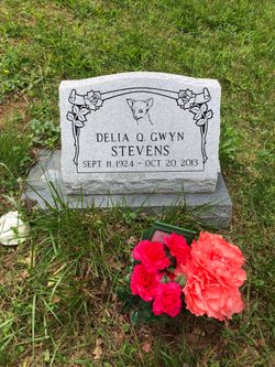
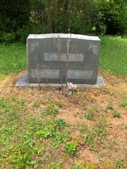
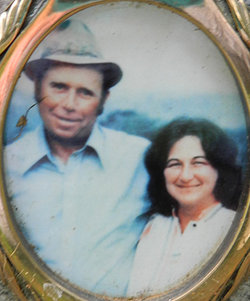
Delia Quesenberry Stevens
| Birth | : | 11 Sep 1924 Carroll County, Virginia, USA |
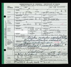
| Death | : | 20 Oct 2013 Patrick County, Virginia, USA |
| Burial | : | Crooked Oak Moravian Church Cemetery, Cana, Carroll County, USA |
| Coordinate | : | 36.6385210, -80.6507840 |
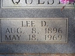
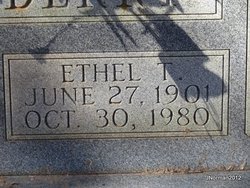
| Description | : | Mrs. Delia Quesenberry Stevens, 89, of Ararat, VA passed away Sunday, October 20, 2013 at her home. She was born on September 11, 1924 to the late Lee Davis and Ethel Virginia Taylor Quesenberry. Mrs. Stevens was homemaker and retired from Proctor Silex. She is survived by a daughter and son-in-law, Carlene and Herbert Ogle of Ararat, VA; a son and daughter-in-law, Rev. Roy and Faye Quesenberry of Cana, VA; three grandchildren, Larry Ogle, Brenda Rigney and husband, Robert, Karen Farmer and husband, Kevin; three great grandchildren, Cory Farmer, Austin Rigney and Madison Rigney; four sisters and brothers-in-law, Sarah and... Read More |
frequently asked questions (FAQ):
-
Where is Delia Quesenberry Stevens's memorial?
Delia Quesenberry Stevens's memorial is located at: Crooked Oak Moravian Church Cemetery, Cana, Carroll County, USA.
-
When did Delia Quesenberry Stevens death?
Delia Quesenberry Stevens death on 20 Oct 2013 in Patrick County, Virginia, USA
-
Where are the coordinates of the Delia Quesenberry Stevens's memorial?
Latitude: 36.6385210
Longitude: -80.6507840
Family Members:
Parent
Spouse
Siblings
Flowers:
Nearby Cemetories:
1. Crooked Oak Moravian Church Cemetery
Cana, Carroll County, USA
Coordinate: 36.6385210, -80.6507840
2. Thomas Cemetery
Fancy Gap, Carroll County, USA
Coordinate: 36.6312940, -80.6592180
3. Ayers Cemetery
Fancy Gap, Carroll County, USA
Coordinate: 36.6502800, -80.6563873
4. Bear Trail Baptist Church Cemetery
Cana, Carroll County, USA
Coordinate: 36.6263910, -80.6655010
5. Oak Grove Baptist Church Cemetery
Cana, Carroll County, USA
Coordinate: 36.6432470, -80.6280060
6. Wash Edwards Cemetery
Fancy Gap, Carroll County, USA
Coordinate: 36.6505890, -80.6777920
7. Leftwich Family Cemetery
Cana, Carroll County, USA
Coordinate: 36.6211110, -80.6758350
8. Rigney Family Cemetery
Cana, Carroll County, USA
Coordinate: 36.6233650, -80.6806990
9. Haynes Cemetery
Fancy Gap, Carroll County, USA
Coordinate: 36.6673180, -80.6505920
10. Harrold Cemetery
Carroll County, USA
Coordinate: 36.6199300, -80.6219970
11. Tate Cemetery
Fancy Gap, Carroll County, USA
Coordinate: 36.6522590, -80.6835610
12. Elk Spur Cemetery
Fancy Gap, Carroll County, USA
Coordinate: 36.6583610, -80.6808950
13. Allen Cemetery
Cana, Carroll County, USA
Coordinate: 36.6155280, -80.6192210
14. Daniel Dickens Cemetery
Fancy Gap, Carroll County, USA
Coordinate: 36.6695530, -80.6236060
15. Gwynn Cemetery
Ararat, Patrick County, USA
Coordinate: 36.6298835, -80.6046284
16. Vass Cemetery
Fancy Gap, Carroll County, USA
Coordinate: 36.6759370, -80.6418360
17. Mount Bethel Moravian Graveyard
Cana, Carroll County, USA
Coordinate: 36.6053120, -80.6272700
18. Willow Hill Moravian Church Cemetery
Ararat, Patrick County, USA
Coordinate: 36.6451890, -80.6038330
19. Edwards Cemetery
Cana, Carroll County, USA
Coordinate: 36.6154480, -80.6904890
20. Bond Cemetery
Fancy Gap, Carroll County, USA
Coordinate: 36.6791580, -80.6475450
21. Rocky Ford Christian Church Cemetery
Cana, Carroll County, USA
Coordinate: 36.6080580, -80.6857110
22. Morris Cemetery
Fancy Gap, Carroll County, USA
Coordinate: 36.6460991, -80.7018967
23. Nate Bond Cemetery
Fancy Gap, Carroll County, USA
Coordinate: 36.6812920, -80.6476310
24. Dr Jesse Dickens Cemetery
Carroll County, USA
Coordinate: 36.6792991, -80.6334025

