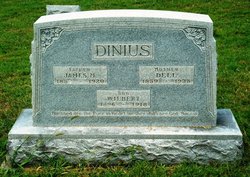
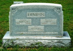
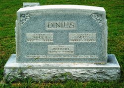
Della VanDorften Dinius
| Birth | : | 16 May 1859 Whitley County, Indiana, USA |
| Death | : | 28 Nov 1935 Roanoke, Huntington County, Indiana, USA |
| Burial | : | Westhope Cemetery, Westhope, Bottineau County, USA |
| Coordinate | : | 48.9094009, -100.9950027 |
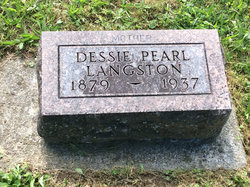
| Description | : | Wife of James M. Dinius DINIUS, DELLA VANDORFTEN Friday, November 29, 1935 Mrs. Della Dinius, aged 76, died at her home here Thursday morning after an illness of five months. Mrs. Dinius was born May 16, 1859 in Jefferson Twp., Whitley Co., to Mr. & Mrs. Jacob Vandorfter. Surviving are five daughters, two sons, grandchildren & great grandchildren. The children are Mrs. Dessie Langston, Roanoke, Mrs. Clara Coffelt, Marion, IN. Mrs. Goldie Burdoine, Ft. Wayne,... Read More |
frequently asked questions (FAQ):
-
Where is Della VanDorften Dinius's memorial?
Della VanDorften Dinius's memorial is located at: Westhope Cemetery, Westhope, Bottineau County, USA.
-
When did Della VanDorften Dinius death?
Della VanDorften Dinius death on 28 Nov 1935 in Roanoke, Huntington County, Indiana, USA
-
Where are the coordinates of the Della VanDorften Dinius's memorial?
Latitude: 48.9094009
Longitude: -100.9950027
Family Members:
Spouse
Children
Flowers:
Nearby Cemetories:
1. Westhope Cemetery
Westhope, Bottineau County, USA
Coordinate: 48.9094009, -100.9950027
2. Acheson Homestead Cemetery
Westhope, Bottineau County, USA
Coordinate: 48.9622620, -100.9804240
3. Landa Cemetery
Landa, Bottineau County, USA
Coordinate: 48.9077988, -100.9067001
4. Zion Cemetery
Landa, Bottineau County, USA
Coordinate: 48.9375000, -100.8942032
5. Weeks Cemetery
Westhope, Bottineau County, USA
Coordinate: 48.8365800, -101.1251700
6. Lesje Cemetery
Roth, Bottineau County, USA
Coordinate: 48.9664688, -100.8221359
7. Roth Grave Site
Roth, Bottineau County, USA
Coordinate: 48.9008369, -100.7966385
8. Mouse River Lutheran Cemetery
Landa, Bottineau County, USA
Coordinate: 48.8067741, -100.8635788
9. Hamel Catholic Cemetery
Dunning, Bottineau County, USA
Coordinate: 48.7707930, -101.0599920
10. Coultervale Cemetery
Coulter, Southwestern Census Division, Canada
Coordinate: 49.0580710, -101.0255330
11. Nedaros Cemetery
Landa, Bottineau County, USA
Coordinate: 48.7916985, -100.8407974
12. Lyleton Cemetery
Lyleton, Southwestern Census Division, Canada
Coordinate: 49.0300320, -101.1489680
13. Betania Cemetery
Brander Township, Bottineau County, USA
Coordinate: 48.7480060, -101.0259820
14. Antler Pioneer Cemetery
Antler, Bottineau County, USA
Coordinate: 48.9994090, -101.2626620
15. Graceland Cemetery
Maxbass, Bottineau County, USA
Coordinate: 48.7344017, -101.1363983
16. Bethel Lutheran Brethren Cemetery
Antler, Bottineau County, USA
Coordinate: 48.8720245, -101.3008423
17. Antler Cemetery
Antler, Bottineau County, USA
Coordinate: 48.9808006, -101.2878036
18. Dovre Lutheran Cemetery
Newburg, Bottineau County, USA
Coordinate: 48.7117690, -100.9069410
19. Saint Marys Cemetery
Antler, Bottineau County, USA
Coordinate: 48.9805753, -101.2897461
20. Copley Anglican Cemetery
Pierson, Southwestern Census Division, Canada
Coordinate: 49.0302150, -101.2511800
21. Mountain View Cemetery
Souris, Bottineau County, USA
Coordinate: 48.9014015, -100.6750031
22. Holden Cemetery
Eckman, Bottineau County, USA
Coordinate: 48.6906776, -101.0336533
23. Waskada Cemetery
Waskada, Southwestern Census Division, Canada
Coordinate: 49.0947200, -100.7806100
24. Russell Cemetery
Russell, Bottineau County, USA
Coordinate: 48.6759990, -100.8961550

