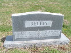
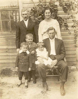
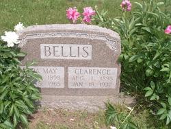
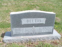
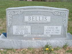
Delmar Dell Bellis
| Birth | : | 31 May 1918 Ray County, Missouri, USA |
| Death | : | 9 Mar 2005 Excelsior Springs, Clay County, Missouri, USA |
| Burial | : | Greenwich Presbyterian Church Cemetery, Greenwich, Cumberland County, USA |
| Coordinate | : | 39.4126200, -75.3459800 |
| Plot | : | Sect. 6 |
| Inscription | : | Together forever. |
| Description | : | ~~Delmar Dell Bellis completed his earthly journey on March 9, 2005. Graveside services will be 11:00 a.m., Sat., March 12, 2005, at South Point Cemetery, near Orrick, MO, with Pastor Larry Block officiating. The family will greet friends 5:00 - 7:00 Friday at Polley Funeral Home in Excelsior Springs, Missouri. Memorial tributes may be directed to South Point Cemetery Association, Maintenance Fund, P. O. Box 177, Orrick, MO 64077, or, your favorite charity. He will be remembered as a devoted family man. He retired from Missouri State Grain Inspection in 1981 and previously had worked for General... Read More |
frequently asked questions (FAQ):
-
Where is Delmar Dell Bellis's memorial?
Delmar Dell Bellis's memorial is located at: Greenwich Presbyterian Church Cemetery, Greenwich, Cumberland County, USA.
-
When did Delmar Dell Bellis death?
Delmar Dell Bellis death on 9 Mar 2005 in Excelsior Springs, Clay County, Missouri, USA
-
Where are the coordinates of the Delmar Dell Bellis's memorial?
Latitude: 39.4126200
Longitude: -75.3459800
Family Members:
Parent
Spouse
Siblings
Nearby Cemetories:
1. Greenwich Presbyterian Church Cemetery
Greenwich, Cumberland County, USA
Coordinate: 39.4126200, -75.3459800
2. Ambury Hill Cemetery
Cumberland County, USA
Coordinate: 39.4175491, -75.3496552
3. Greenwich Friends Meeting House Cemetery
Greenwich, Cumberland County, USA
Coordinate: 39.4066467, -75.3447189
4. Greenwich Friends Cemetery #02
Greenwich, Cumberland County, USA
Coordinate: 39.3997955, -75.3439865
5. Mount Pleasant Cemetery
Springtown, Cumberland County, USA
Coordinate: 39.4182663, -75.3290863
6. Othello Church Graveyard
Othello, Cumberland County, USA
Coordinate: 39.4182660, -75.3290860
7. Greenwich Baptist Church Cemetery
Greenwich, Cumberland County, USA
Coordinate: 39.3936310, -75.3417587
8. Old Cohansey Graveyard
Sheppards Mill, Cumberland County, USA
Coordinate: 39.4089432, -75.3111649
9. Cohansey Baptist Church Cemetery
Roadstown, Cumberland County, USA
Coordinate: 39.4388630, -75.3143070
10. Holly Corner Cemetery
Fairton, Cumberland County, USA
Coordinate: 39.3717303, -75.3308135
11. Shiloh Seventh Day Baptist Church Cemetery
Shiloh, Cumberland County, USA
Coordinate: 39.4591293, -75.2956696
12. Fernwood Memorial Park
Bridgeton, Cumberland County, USA
Coordinate: 39.4514008, -75.2844009
13. Cumberland County Memorial Cemetery
Bridgeton, Cumberland County, USA
Coordinate: 39.4125600, -75.2638800
14. Cedar Hill Memorial Park
Bridgeton, Cumberland County, USA
Coordinate: 39.4244003, -75.2647018
15. Cumberland County Veterans Cemetery
Bridgeton, Cumberland County, USA
Coordinate: 39.4105186, -75.2588959
16. Cuff Cemetery
Canton, Salem County, USA
Coordinate: 39.4649391, -75.4077988
17. Overlook Cemetery
Bridgeton, Cumberland County, USA
Coordinate: 39.4239006, -75.2536011
18. Marlboro Seventh Day Baptist Church Cemetery
Marlboro, Cumberland County, USA
Coordinate: 39.4899200, -75.3259500
19. Old Broad Street Presbyterian Church Cemetery
Bridgeton, Cumberland County, USA
Coordinate: 39.4295235, -75.2457123
20. Canton Baptist Church Cemetery
Canton, Salem County, USA
Coordinate: 39.4799385, -75.4120789
21. Cohanzick Zoo
Bridgeton, Cumberland County, USA
Coordinate: 39.4395510, -75.2388370
22. First Baptist Church Cemetery
Bridgeton, Cumberland County, USA
Coordinate: 39.4325638, -75.2298355
23. Old Presbyterian Cemetery
Fairton, Cumberland County, USA
Coordinate: 39.3758011, -75.2363968
24. First United Methodist Churchyard
Bridgeton, Cumberland County, USA
Coordinate: 39.4282417, -75.2277298

