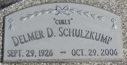
Delmer Dallas “Curly” Schulzkump
| Birth | : | 29 Sep 1926 Cuming County, Nebraska, USA |
| Death | : | 29 Oct 2006 Pender, Thurston County, Nebraska, USA |
| Burial | : | Hillside Cemetery, Kalamo, Eaton County, USA |
| Coordinate | : | 42.5462500, -85.0138100 |
| Description | : | Son of John and Maria Mauer Schulzkump. He attended School District 46 and served in the US Army from April 6, 1953 until March 17, 1955. On September 28, 1958 he married Mary Wooldrik at Grace Lutheran Church. Curly worked as trucker driving straight truck and semi from 1954 to 1972. He then worked for the West Point Coop until retiring in 1991 and ran the corn sheller for Larry Landholm. Delmer was a member of Grace Lutheran Church. He enjoyed mechanics. Survivors include his wife Mary of Nickerson, son Delwin of Nickerson, daughter in law Janelle Schulzkump of West Point, brother... Read More |
frequently asked questions (FAQ):
-
Where is Delmer Dallas “Curly” Schulzkump's memorial?
Delmer Dallas “Curly” Schulzkump's memorial is located at: Hillside Cemetery, Kalamo, Eaton County, USA.
-
When did Delmer Dallas “Curly” Schulzkump death?
Delmer Dallas “Curly” Schulzkump death on 29 Oct 2006 in Pender, Thurston County, Nebraska, USA
-
Where are the coordinates of the Delmer Dallas “Curly” Schulzkump's memorial?
Latitude: 42.5462500
Longitude: -85.0138100
Family Members:
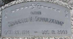
Parent
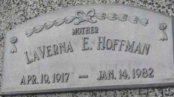
Spouse
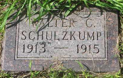
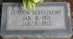
Siblings
Flowers:
Nearby Cemetories:
1. Hillside Cemetery
Kalamo, Eaton County, USA
Coordinate: 42.5462500, -85.0138100
2. Mason Cemetery
Kalamo Township, Eaton County, USA
Coordinate: 42.5669440, -85.0508330
3. Cogsdill Cemetery
Kalamo, Eaton County, USA
Coordinate: 42.5817470, -84.9747850
4. Spaulding Cemetery
Bellevue Township, Eaton County, USA
Coordinate: 42.5056000, -84.9747009
5. Follett Cemetery
Bellevue, Eaton County, USA
Coordinate: 42.4916992, -85.0224991
6. West Carmel Cemetery
Charlotte, Eaton County, USA
Coordinate: 42.5540300, -84.9359900
7. Dillon Family Farm Cemetery
Maple Grove Township, Barry County, USA
Coordinate: 42.5726400, -85.0924800
8. Quaker Cemetery
Maple Grove Township, Barry County, USA
Coordinate: 42.5311012, -85.1102982
9. Lakeview Cemetery
Nashville, Barry County, USA
Coordinate: 42.5986099, -85.0845566
10. Wilcox Cemetery
Nashville, Barry County, USA
Coordinate: 42.5388870, -85.1216660
11. Rest Haven Cemetery
Charlotte, Eaton County, USA
Coordinate: 42.6217420, -84.9563380
12. Woodlawn Cemetery
Vermontville, Eaton County, USA
Coordinate: 42.6363983, -85.0547028
13. Ames Cemetery
Vermontville, Eaton County, USA
Coordinate: 42.6411018, -84.9741974
14. Bellevue Cemetery
Bellevue, Eaton County, USA
Coordinate: 42.4469986, -85.0230408
15. German Evangelical Cemetery
Maple Grove Township, Barry County, USA
Coordinate: 42.5813900, -85.1431400
16. Ellis Cemetery
Assyria, Barry County, USA
Coordinate: 42.4933014, -85.1361008
17. Millerburg Cemetery
Carmel Township, Eaton County, USA
Coordinate: 42.5783348, -84.8752213
18. Hosmer Cemetery
Nashville, Barry County, USA
Coordinate: 42.6380997, -85.1038971
19. Bosworth Cemetery
Olivet, Eaton County, USA
Coordinate: 42.4692001, -84.8944016
20. Patterson Cemetery
Vermontville, Eaton County, USA
Coordinate: 42.6652985, -85.0327988
21. Bell Cemetery
Assyria Township, Barry County, USA
Coordinate: 42.4427986, -85.0963974
22. Gresham Cemetery
Chester Township, Eaton County, USA
Coordinate: 42.6278000, -84.8938980
23. Assyria Cemetery
Assyria, Barry County, USA
Coordinate: 42.4617119, -85.1307068
24. Olivet City Cemetery
Olivet, Eaton County, USA
Coordinate: 42.4431267, -84.9260101

