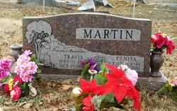
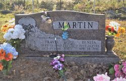
Denita Smith Martin
| Birth | : | 21 Jul 1943 Trumann, Poinsett County, Arkansas, USA |
| Death | : | 14 Apr 2011 Mountain View, Stone County, Arkansas, USA |
| Burial | : | Farris Cemetery, Onia, Stone County, USA |
| Coordinate | : | 35.9303017, -92.3555984 |
| Description | : | Denita Martin, 67, of Mtn. View entered into rest on April 14, 2011 in Mtn. View, AR. Denita was born July 21, 1943 in Trumann, Arkansas to Mack H. and Omer Edna (Willcockson) Smith. She was a member of the Vine Avenue Baptist Church and the VFW Ladies Auxiliary #7466. She owned and operated the Bargain Barn on the square in Mtn. View. Denita was a loving wife, mother, grandmother, great-grandmother and sister. She is survived by her daughter, Donna McClanahan and husband Bruce of Mtn. View; her brother, Jerry Smith of Trumann, AR; six grandchildren, Helen and Chris Green, Stephany and Casey... Read More |
frequently asked questions (FAQ):
-
Where is Denita Smith Martin's memorial?
Denita Smith Martin's memorial is located at: Farris Cemetery, Onia, Stone County, USA.
-
When did Denita Smith Martin death?
Denita Smith Martin death on 14 Apr 2011 in Mountain View, Stone County, Arkansas, USA
-
Where are the coordinates of the Denita Smith Martin's memorial?
Latitude: 35.9303017
Longitude: -92.3555984
Family Members:
Spouse
Flowers:
Nearby Cemetories:
1. Farris Cemetery
Onia, Stone County, USA
Coordinate: 35.9303017, -92.3555984
2. Pordue Cemetery
Onia, Stone County, USA
Coordinate: 35.9254570, -92.3305130
3. Freeman Cemetery
Stone County, USA
Coordinate: 35.9508018, -92.3897018
4. Alco Cemetery
Alco, Stone County, USA
Coordinate: 35.8913994, -92.3783035
5. Smithee Cemetery
Stone County, USA
Coordinate: 35.9199982, -92.3028030
6. Wallis Cemetery
Alco, Stone County, USA
Coordinate: 35.9505900, -92.4052120
7. Stevens Cemetery
Onia, Stone County, USA
Coordinate: 35.9594002, -92.3043976
8. Timbo Cemetery
Timbo, Stone County, USA
Coordinate: 35.8717200, -92.3189200
9. Brown Family Cemetery
Onia, Stone County, USA
Coordinate: 35.8782710, -92.3024940
10. McDaniel Cemetery
Thola, Searcy County, USA
Coordinate: 35.9000015, -92.4321976
11. Treat Cemetery
Searcy County, USA
Coordinate: 35.9686012, -92.4272003
12. Landis Cemetery
Landis, Searcy County, USA
Coordinate: 35.9385986, -92.4408035
13. Passmore Cemetery
Thola, Searcy County, USA
Coordinate: 35.8885994, -92.4257965
14. Nancy Lindsey Cemetery
Fiftysix, Stone County, USA
Coordinate: 35.9882164, -92.2935715
15. Big Springs Cemetery
Newnata, Stone County, USA
Coordinate: 35.9001200, -92.2683800
16. Ramsey Cemetery
Stone County, USA
Coordinate: 35.8583794, -92.3183746
17. Ramsley Cemetery
Stone County, USA
Coordinate: 35.8581009, -92.3182983
18. Norman-Rorie Cemetery
Big Flat, Baxter County, USA
Coordinate: 36.0099590, -92.3577370
19. Rorie Homeplace Cemetery
Fiftysix, Stone County, USA
Coordinate: 35.9946220, -92.2890190
20. Blue Mountain Cemetery
Timbo, Stone County, USA
Coordinate: 35.8657074, -92.2817993
21. Cooper Hill Cemetery
Newnata, Stone County, USA
Coordinate: 35.8912400, -92.2578400
22. Stevens Cemetery
Fiftysix, Stone County, USA
Coordinate: 35.9836006, -92.2677994
23. Spoonflat Cemetery
Fiftysix, Stone County, USA
Coordinate: 35.9838000, -92.2677000
24. Big Flat Cemetery
Big Flat, Baxter County, USA
Coordinate: 36.0092010, -92.4067001


