
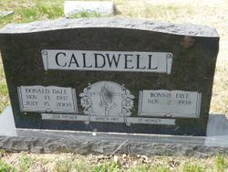
Donald Dale “Cobby” Caldwell
| Birth | : | 13 Nov 1937 Elvins, St. Francois County, Missouri, USA |
| Death | : | 15 Jul 2008 Jefferson City, Cole County, Missouri, USA |
| Burial | : | Woodmere Cemetery, Standish, Arenac County, USA |
| Coordinate | : | 43.9928017, -83.9531021 |
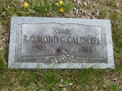
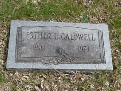
| Description | : | Dale 'Cobby' Caldwell November 13, 1937 - July 15, 2008 LINN, Mo. — Dale "Cobby" Caldwell, age 70 of Linn, Missouri, passed away on Tuesday, July 15, 2008, at St. Mary's Health Center in Jefferson City. He was born November 13, 1937, in Elvins, Missouri to the late Raymond G. and Esther E. (Rinke) Caldwell. He graduated from Esther High School in 1955. He graduated from Flat River Junior College in 1957 and graduated from the Indiana College of Mortuary Science in Indianapolis, Ind., in 1959. Dale was the co-owner of the Caldwell Funeral Home in Flat River, Missouri for many years prior... Read More |
frequently asked questions (FAQ):
-
Where is Donald Dale “Cobby” Caldwell's memorial?
Donald Dale “Cobby” Caldwell's memorial is located at: Woodmere Cemetery, Standish, Arenac County, USA.
-
When did Donald Dale “Cobby” Caldwell death?
Donald Dale “Cobby” Caldwell death on 15 Jul 2008 in Jefferson City, Cole County, Missouri, USA
-
Where are the coordinates of the Donald Dale “Cobby” Caldwell's memorial?
Latitude: 43.9928017
Longitude: -83.9531021
Family Members:
Parent
Siblings
Flowers:


Nearby Cemetories:
1. Woodmere Cemetery
Standish, Arenac County, USA
Coordinate: 43.9928017, -83.9531021
2. Resurrection of the Lord Catholic Cemetery
Standish, Arenac County, USA
Coordinate: 43.9910400, -83.9536400
3. Polish Catholic National Cemetery
Deep River Township, Arenac County, USA
Coordinate: 44.0133000, -83.9776000
4. Pine River Cemetery
Pine River, Arenac County, USA
Coordinate: 43.9810982, -83.8927994
5. Arenac Township Cemetery
Arenac Township, Arenac County, USA
Coordinate: 44.0083300, -83.8581700
6. Indian Cemetery
Standish, Arenac County, USA
Coordinate: 43.9277694, -83.9166619
7. Saganing Indian Methodist Mission Cemetery
Standish, Arenac County, USA
Coordinate: 43.9267000, -83.9114000
8. Sterling Cemetery
Sterling, Arenac County, USA
Coordinate: 44.0407982, -84.0297012
9. Saint Johns Byzantine Cemetery
Sterling, Arenac County, USA
Coordinate: 44.0430110, -84.0281370
10. Coon Family Cemetery
Saganing, Arenac County, USA
Coordinate: 43.9257400, -83.9058710
11. Plains Cemetery (Defunct)
Omer, Arenac County, USA
Coordinate: 44.0696983, -83.9574966
12. Evergreen Cemetery
Omer, Arenac County, USA
Coordinate: 44.0560989, -83.8764038
13. Saint Edwards Catholic Cemetery
Omer, Arenac County, USA
Coordinate: 44.0567200, -83.8752500
14. Clayton Cemetery
Melita, Arenac County, USA
Coordinate: 44.1161003, -83.9467010
15. Old Indian Burial Ground
Pinconning Township, Bay County, USA
Coordinate: 43.8572220, -83.9311110
16. Saint Michaels Cemetery
Pinconning, Bay County, USA
Coordinate: 43.8546982, -83.9467010
17. Pinconning Township Cemetery
Pinconning, Bay County, USA
Coordinate: 43.8535880, -83.9513640
18. Saint Agnes Catholic Cemetery
Pinconning, Bay County, USA
Coordinate: 43.8530900, -83.9602180
19. Saint John's Lutheran Memorial Cemetery
Pinconning, Bay County, USA
Coordinate: 43.8516998, -83.9494019
20. Gibson Township Cemetery
Bentley, Bay County, USA
Coordinate: 43.9543991, -84.1427994
21. New Pinconning Township Cemetery
Pinconning Township, Bay County, USA
Coordinate: 43.8505780, -83.9499920
22. Saint Marys Mount Calvary Cemetery
Pinconning, Bay County, USA
Coordinate: 43.8727989, -84.1033020
23. Forest Hill Cemetery
Mount Forest Township, Bay County, USA
Coordinate: 43.8594017, -84.0800018
24. Mount Forest Township Cemetery
Pinconning, Bay County, USA
Coordinate: 43.8727989, -84.1046982