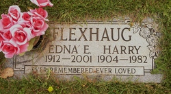
Donald Larry Flexhaug
| Birth | : | 28 Oct 1947 Raymond, Lethbridge Census Division, Alberta, Canada |
| Death | : | 4 Jan 2018 Taber, Lethbridge Census Division, Alberta, Canada |
| Burial | : | Temple Hill Cemetery, Raymond, Lethbridge Census Division, Canada |
| Coordinate | : | 49.4916300, -112.6605200 |
| Plot | : | Row 12 Block 39 Plot 2 |
| Description | : | Donald Larry Flexhaug, beloved husband of Louise Flexhaug, passed away peacefully in Taber on Thursday, January 4, 2018 at the age of 70 years, surrounded by the ones he laughed with, lived for and loved. A private burial service will be held at the Raymond Cemetery prior to the funeral service. Relatives and friends are invited to meet with the family at the church prior to the funeral service on Saturday, January 13, 2018 between 10:00 A.M. and 10:40 A.M. The Funeral Service will be held at The Church of Jesus Christ of Latter-day Saints, 54th Street... Read More |
frequently asked questions (FAQ):
-
Where is Donald Larry Flexhaug's memorial?
Donald Larry Flexhaug's memorial is located at: Temple Hill Cemetery, Raymond, Lethbridge Census Division, Canada.
-
When did Donald Larry Flexhaug death?
Donald Larry Flexhaug death on 4 Jan 2018 in Taber, Lethbridge Census Division, Alberta, Canada
-
Where are the coordinates of the Donald Larry Flexhaug's memorial?
Latitude: 49.4916300
Longitude: -112.6605200
Family Members:
Parent
Nearby Cemetories:
1. Temple Hill Cemetery
Raymond, Lethbridge Census Division, Canada
Coordinate: 49.4916300, -112.6605200
2. Stirling Cemetery
Stirling, Lethbridge Census Division, Canada
Coordinate: 49.5093400, -112.5380000
3. Stirling Mennonite Church Cemetery
Stirling, Lethbridge Census Division, Canada
Coordinate: 49.4607570, -112.5387970
4. East Raymond Hutterite Colony Cemetery
Raymond, Lethbridge Census Division, Canada
Coordinate: 49.4185305, -112.5791329
5. Wolf Creek Hutterite Colony Cemetery
Stirling, Lethbridge Census Division, Canada
Coordinate: 49.4119142, -112.5163705
6. Wilson Siding Hutterite Cemetery
Wilson, Lethbridge Census Division, Canada
Coordinate: 49.6203914, -112.5781130
7. Hutterville Hutterite Cemetery
Magrath, Claresholm Census Division, Canada
Coordinate: 49.3503165, -112.7701038
8. Magrath Cemetery
Magrath, Claresholm Census Division, Canada
Coordinate: 49.3985700, -112.8648700
9. New York Hutterite Cemetery
Judson, Lethbridge Census Division, Canada
Coordinate: 49.5931870, -112.3956383
10. New Dayton Community Cemetery
New Dayton, Lethbridge Census Division, Canada
Coordinate: 49.4254300, -112.3601800
11. Rockport Colony Cemetery
Magrath, Claresholm Census Division, Canada
Coordinate: 49.3027780, -112.8136110
12. Mountain View Cemetery
Lethbridge, Lethbridge Census Division, Canada
Coordinate: 49.6800385, -112.8297729
13. Indian Battle Park
Lethbridge, Lethbridge Census Division, Canada
Coordinate: 49.6928200, -112.8582900
14. Coaldale Community Cemetery
Coaldale, Lethbridge Census Division, Canada
Coordinate: 49.7355600, -112.6242300
15. Coaldale Mennonite Cemetery
Coaldale, Lethbridge Census Division, Canada
Coordinate: 49.7355600, -112.6242300
16. Saint Patrick's Cemetery
Lethbridge, Lethbridge Census Division, Canada
Coordinate: 49.7084618, -112.8428726
17. Lakeside Hutterite Colony Cemetery
Cranford, Lethbridge Census Division, Canada
Coordinate: 49.6685448, -112.3586315
18. Archmount Cemetery
Lethbridge, Lethbridge Census Division, Canada
Coordinate: 49.7057900, -112.9017500
19. Royal View Memorial Cemetery
Lethbridge, Lethbridge Census Division, Canada
Coordinate: 49.7518540, -112.8242250
20. Rock Lake Colony Cemetery
Coaldale, Lethbridge Census Division, Canada
Coordinate: 49.6219440, -112.2750000
21. Spring Valley Hutterite Colony Cemetery
Spring Coulee, Claresholm Census Division, Canada
Coordinate: 49.3517043, -113.0551519
22. Spring Coulee Cemetery
Spring Coulee, Claresholm Census Division, Canada
Coordinate: 49.3412100, -113.0541400
23. Hillridge Hutterite Colony Cemetery
Cranford, Lethbridge Census Division, Canada
Coordinate: 49.7196094, -112.3393464
24. Diamond City Cemetery
Diamond City, Lethbridge Census Division, Canada
Coordinate: 49.7979150, -112.8326800


