Donald Reynold Masteller
| Birth | : | 27 Dec 1927 Draper, Jones County, South Dakota, USA |
| Death | : | 17 Apr 2011 Fort Meade, Meade County, South Dakota, USA |
| Burial | : | Draper Cemetery, Draper, Jones County, USA |
| Coordinate | : | 43.9322014, -100.5475006 |
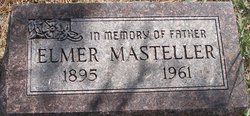
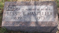
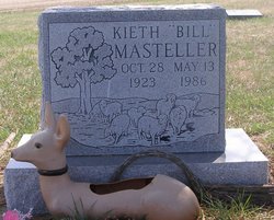
| Description | : | Donald R. Masteller, 83, of Sturgis passed away Sunday, April 17, 2011, at Fort Meade LTC. Don was born on December 27, 1927, to Elmer G. and Bessie L. (Prentice) at their home north of Draper, SD. He attended school in Draper, riding horseback to school every day with his three brothers. He enlisted into the Navy in March of 1946 and served in the Seabees, spending most of his time on the island of Kwajalein in the Marshall Islands. He returned to his home in November 1947, and began his life on a farm just like the rest of... Read More |
frequently asked questions (FAQ):
-
Where is Donald Reynold Masteller's memorial?
Donald Reynold Masteller's memorial is located at: Draper Cemetery, Draper, Jones County, USA.
-
When did Donald Reynold Masteller death?
Donald Reynold Masteller death on 17 Apr 2011 in Fort Meade, Meade County, South Dakota, USA
-
Where are the coordinates of the Donald Reynold Masteller's memorial?
Latitude: 43.9322014
Longitude: -100.5475006
Family Members:
Parent
Siblings
Children
Flowers:
Nearby Cemetories:
1. Draper Cemetery
Draper, Jones County, USA
Coordinate: 43.9322014, -100.5475006
2. Murdo Cemetery
Murdo, Jones County, USA
Coordinate: 43.8802986, -100.7035980
3. Vera Cemetery
Draper, Jones County, USA
Coordinate: 43.8504130, -100.3753260
4. Vivian Cemetery
Vivian, Lyman County, USA
Coordinate: 43.9233017, -100.2652969
5. Immanuel Lutheran Cemetery
Van Metre, Jones County, USA
Coordinate: 44.0958800, -100.7263300
6. Mathews Family Cemetery
Stanley County, USA
Coordinate: 44.1816040, -100.5581080
7. Saint Philip Episcopal Cemetery
White River, Mellette County, USA
Coordinate: 43.6788400, -100.6305700
8. Rattlesnake Hill Cemetery
Badnation, Mellette County, USA
Coordinate: 43.6620120, -100.4439850
9. Burnette Cemetery
Mellette County, USA
Coordinate: 43.7717018, -100.8666992
10. Lower Camp Cemetery
White River, Mellette County, USA
Coordinate: 43.6311800, -100.6774000
11. Hilmoe Cemetery
Presho, Lyman County, USA
Coordinate: 43.7510986, -100.1793976
12. Rosebud Cemetery
Mellette County, USA
Coordinate: 43.6632996, -100.2917023
13. Saint Georges Cemetery
Badnation, Mellette County, USA
Coordinate: 43.6633000, -100.2917000
14. Medicine Creek Cemetery
Presho, Lyman County, USA
Coordinate: 43.9053001, -100.0952988
15. Saint Catherine Cemetery
Wood, Mellette County, USA
Coordinate: 43.6666370, -100.2805800
16. Riverview Cemetery
Capa, Jones County, USA
Coordinate: 44.0952400, -100.9668100
17. Presho Cemetery
Presho, Lyman County, USA
Coordinate: 43.9108658, -100.0631256
18. Holy Angels Cemetery
Presho, Lyman County, USA
Coordinate: 43.8911018, -100.0643997
19. Saint Marks Catholic Cemetery
Capa, Jones County, USA
Coordinate: 44.1247100, -100.9948900
20. White River Cemetery
White River, Mellette County, USA
Coordinate: 43.5749890, -100.7502510
21. Saint Peters Lutheran Cemetery
Stamford, Jackson County, USA
Coordinate: 43.9623000, -101.0843100
22. Saint Paul German Lutheran Cemetery
White River, Mellette County, USA
Coordinate: 43.7803439, -101.0513015
23. Good Road Cemetery
Corn Creek, Mellette County, USA
Coordinate: 43.7856000, -101.0609400
24. Standing Elk Cemetery
White River, Mellette County, USA
Coordinate: 43.5722900, -100.7847500


