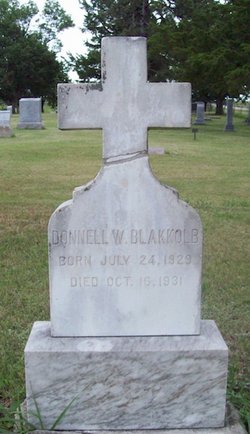
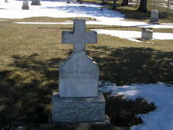
Donell William Blakkolb
| Birth | : | 24 Jul 1929 Naper, Boyd County, Nebraska, USA |
| Death | : | 16 Oct 1931 Naper, Boyd County, Nebraska, USA |
| Burial | : | Chiliwist Cemetery, Okanogan County, USA |
| Coordinate | : | 48.2630997, -119.7363968 |
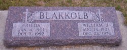
| Description | : | Donell was born on July 24, 1929 at Naper, Nebraska to William John and Freida (Statsman) Blakkolb. He died on October 16, 1931 at Naper, Nebraska at the age of 2 years. ************************************** |
frequently asked questions (FAQ):
-
Where is Donell William Blakkolb's memorial?
Donell William Blakkolb's memorial is located at: Chiliwist Cemetery, Okanogan County, USA.
-
When did Donell William Blakkolb death?
Donell William Blakkolb death on 16 Oct 1931 in Naper, Boyd County, Nebraska, USA
-
Where are the coordinates of the Donell William Blakkolb's memorial?
Latitude: 48.2630997
Longitude: -119.7363968
Family Members:
Parent
Siblings
Flowers:
Nearby Cemetories:
1. Chiliwist Cemetery
Okanogan County, USA
Coordinate: 48.2630997, -119.7363968
2. Malott Community Cemetery
Malott, Okanogan County, USA
Coordinate: 48.2925000, -119.7047300
3. Paradise Hill Cemetery
Brewster, Okanogan County, USA
Coordinate: 48.1848980, -119.8411900
4. Cameron Lake Pioneer Memorial Cemetery
Malott, Okanogan County, USA
Coordinate: 48.2708330, -119.5700000
5. Elizabeth Osborn Mikel Gravesite
Brewster, Okanogan County, USA
Coordinate: 48.1498900, -119.7514700
6. Fort Okanogan Memorial Cemetery
Okanogan, Okanogan County, USA
Coordinate: 48.1594009, -119.6632996
7. Okanogan City Cemetery
Okanogan, Okanogan County, USA
Coordinate: 48.3546982, -119.6061020
8. Spring Coulee Family Cemetery
Okanogan County, USA
Coordinate: 48.3895950, -119.6289460
9. Locust Grove Cemetery
Brewster, Okanogan County, USA
Coordinate: 48.1114006, -119.7746964
10. Okanogan Valley Memorial Gardens
Omak, Okanogan County, USA
Coordinate: 48.3911018, -119.5691986
11. Omak Memorial Cemetery
Okanogan, Okanogan County, USA
Coordinate: 48.3874000, -119.5565800
12. Beaver Creek Cemetery
Twisp, Okanogan County, USA
Coordinate: 48.3272000, -120.0564000
13. Saint Marys Mission Catholic Cemetery
Omak, Okanogan County, USA
Coordinate: 48.3752800, -119.4452800
14. Sand Flats Cemetery
Omak, Okanogan County, USA
Coordinate: 48.4157600, -119.4836600
15. Stoddard Gravesite
Okanogan, Okanogan County, USA
Coordinate: 48.4531140, -119.5411680
16. Methow Cemetery
Methow, Okanogan County, USA
Coordinate: 48.1102982, -120.0124969
17. Pateros Cemetery
Pateros, Okanogan County, USA
Coordinate: 48.0516600, -119.9097300
18. Ruby Cemetery
Okanogan County, USA
Coordinate: 48.5085983, -119.7221985
19. Miller Family Cemetery
Okanogan County, USA
Coordinate: 48.0530300, -119.9288000
20. Dick Family Cemetery
Okanogan County, USA
Coordinate: 48.0502700, -119.9241700
21. Brooks Cemetery
Omak, Okanogan County, USA
Coordinate: 48.3786110, -119.3941670
22. Packwood Memorial Cemetery
Dyer, Douglas County, USA
Coordinate: 48.0118305, -119.8178880
23. Bridgeport Cemetery
Bridgeport, Douglas County, USA
Coordinate: 48.0050000, -119.6738800
24. Swipkin Family Cemetery
Riverside, Okanogan County, USA
Coordinate: 48.4664270, -119.4618660


