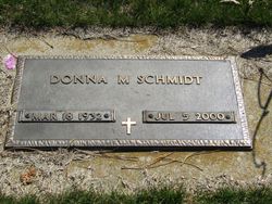
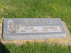
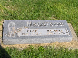
Donna Marie Hagstrom Barrie
| Birth | : | 18 Mar 1932 Turton, Spink County, South Dakota, USA |
| Death | : | 5 Jul 2000 Aberdeen, Brown County, South Dakota, USA |
| Burial | : | Ebenezer United Methodist Episcopal Church Cemeter, Neersville, Loudoun County, USA |
| Coordinate | : | 39.2957878, -77.7196045 |
| Plot | : | Div I Blk 005 Lot -- Grave 107 |
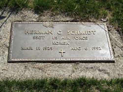
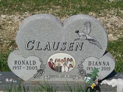
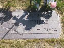
| Description | : | REDFIELD, S.D. — Donna Schmidt-Barrie, 68, died July 5. Cause of death was unavailable. She was born in Turton, S.D., and married Herman Schmidt in 1951. They farmed near Marion in Oregon and owned Marion Feed and Seed until 1971. They then moved to Redfield. Her first husband died in 1992. Survivors include her husband, Norbert Barrie, whom she married in 1997; son, Marlin Schmidt of Tulare, S.D.; daughters, Monica Friese of Redfield and Malinda Nowell of Tulare; sisters, Alice Battest of Beulah, N.D., Dianne Clausen of Redfield, and Mavis Irwin of Hazen, N.D.; six stepchildren; 10 grandchildren; and five great-grandchildren. Mass was... Read More |
frequently asked questions (FAQ):
-
Where is Donna Marie Hagstrom Barrie's memorial?
Donna Marie Hagstrom Barrie's memorial is located at: Ebenezer United Methodist Episcopal Church Cemeter, Neersville, Loudoun County, USA.
-
When did Donna Marie Hagstrom Barrie death?
Donna Marie Hagstrom Barrie death on 5 Jul 2000 in Aberdeen, Brown County, South Dakota, USA
-
Where are the coordinates of the Donna Marie Hagstrom Barrie's memorial?
Latitude: 39.2957878
Longitude: -77.7196045
Family Members:
Parent
Spouse
Siblings
Children
Flowers:
Nearby Cemetories:
1. Old Ebenezer Methodist Episcopal Cemetery
Neersville, Loudoun County, USA
Coordinate: 39.2900543, -77.7141190
2. Derry Cemetery
Neersville, Loudoun County, USA
Coordinate: 39.2920500, -77.7317900
3. Silver Grove Cemetery
Harpers Ferry, Jefferson County, USA
Coordinate: 39.2962044, -77.7552686
4. Saint Pauls Lutheran Church Cemetery
Neersville, Loudoun County, USA
Coordinate: 39.2675018, -77.7261124
5. Harper Cemetery
Harpers Ferry, Jefferson County, USA
Coordinate: 39.3236847, -77.7345352
6. Saint Peter's Cemetery
Harpers Ferry, Jefferson County, USA
Coordinate: 39.3213806, -77.7480927
7. Mount Olivet United Methodist Church Cemetery
Lovettsville, Loudoun County, USA
Coordinate: 39.2811317, -77.6757278
8. Virts Farm Cemetery
Sandy Hook, Washington County, USA
Coordinate: 39.3299675, -77.6966705
9. Fairview Lutheran Cemetery
Bolivar, Jefferson County, USA
Coordinate: 39.3215700, -77.7567500
10. Grove Cemetery
Keyes Ferry Acres, Jefferson County, USA
Coordinate: 39.2741014, -77.7644080
11. Cedar Hill Cemetery
Harpers Ferry, Jefferson County, USA
Coordinate: 39.3283520, -77.7524420
12. Chestnut Hill United Methodist Church Cemetery
Harpers Ferry, Jefferson County, USA
Coordinate: 39.2714800, -77.7681500
13. Mount Sinai Free Will Baptist Cemetery
Britain, Loudoun County, USA
Coordinate: 39.2543490, -77.6959099
14. Allstadt Graveyard
Halltown, Jefferson County, USA
Coordinate: 39.3145270, -77.7732030
15. Moler Graveyard
Halltown, Jefferson County, USA
Coordinate: 39.3188400, -77.7739900
16. Payne's Hill Cemetery
Halltown, Jefferson County, USA
Coordinate: 39.3190730, -77.7810570
17. Knoxville Reformed Cemetery
Knoxville, Frederick County, USA
Coordinate: 39.3288994, -77.6647034
18. Norris Cemetery
Garretts Mill, Washington County, USA
Coordinate: 39.3463968, -77.6781411
19. Knoxville Mountain Cemetery
Knoxville, Frederick County, USA
Coordinate: 39.3395000, -77.6649000
20. Garrett's Mill Assemblies of God Cemetery
Garretts Mill, Washington County, USA
Coordinate: 39.3527184, -77.6881485
21. Mount Moriah Baptist Church Cemetery
Washington County, USA
Coordinate: 39.3535995, -77.6908035
22. African Methodist Episcopal Church Cemetery
Lovettsville, Loudoun County, USA
Coordinate: 39.2759705, -77.6389542
23. Old Presbyterian Cemetery
Lovettsville, Loudoun County, USA
Coordinate: 39.2734299, -77.6394119
24. Garrott Family Cemetery
Knoxville, Frederick County, USA
Coordinate: 39.3395100, -77.6539500

