
| Birth | : | 3 Mar 1935 Callaway, Custer County, Nebraska, USA |
| Death | : | 17 Oct 2020 Norfolk, Madison County, Nebraska, USA |
| Burial | : | Ridge Cemetery, Fremont, Dodge County, USA |
| Coordinate | : | 41.4425011, -96.5231018 |
| Plot | : | Block 138 Lot 8 |
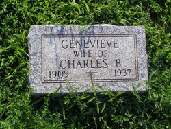
| Description | : | Donna Ranee (Maller) Mulliken, 85 March 3, 1935 ~ October 17, 2020 Donna was born March 3, 1935 in Callaway, Nebraska to Genevieve (Booth) and Charles B. Maller. She moved to Oakland, Nebraska in 1948 and attended High School there. She married Bill Mulliken in 1957 in Oakland. To this union one son was born, David Charles Mulliken. The couple moved to Denver, then briefly in Kentucky before moving to Nickerson, Nebraska on her in-law's farm where she resided until moving into Fremont. Donna Ranee (Maller) Mulliken age 85, formerly of... Read More |
frequently asked questions (FAQ):
-
Where is Donna Ranee Maller Mulliken's memorial?
Donna Ranee Maller Mulliken's memorial is located at: Ridge Cemetery, Fremont, Dodge County, USA.
-
When did Donna Ranee Maller Mulliken death?
Donna Ranee Maller Mulliken death on 17 Oct 2020 in Norfolk, Madison County, Nebraska, USA
-
Where are the coordinates of the Donna Ranee Maller Mulliken's memorial?
Latitude: 41.4425011
Longitude: -96.5231018
Family Members:
Parent
Spouse

Siblings
Children
Flowers:


Nearby Cemetories:
1. Ridge Cemetery
Fremont, Dodge County, USA
Coordinate: 41.4425011, -96.5231018
2. Calvary Cemetery
Fremont, Dodge County, USA
Coordinate: 41.4435997, -96.5271988
3. Memorial Cemetery
Fremont, Dodge County, USA
Coordinate: 41.4516210, -96.5058210
4. First Congregational Church Columbarium
Fremont, Dodge County, USA
Coordinate: 41.4439000, -96.4974300
5. Saint James Episcopal Church Columbarium
Fremont, Dodge County, USA
Coordinate: 41.4334370, -96.4944130
6. Critten Barrett Cemetery
Cedar Bluffs, Saunders County, USA
Coordinate: 41.4229110, -96.5577650
7. Maple Grove Cemetery
Cedar Bluffs, Saunders County, USA
Coordinate: 41.3880997, -96.6006012
8. Bluffs Trinity Lutheran Cemetery
Fremont, Dodge County, USA
Coordinate: 41.5098080, -96.5973720
9. Platteville Cemetery
Saunders County, USA
Coordinate: 41.3506012, -96.5410995
10. Wiegand Cemetery
Cedar Bluffs, Saunders County, USA
Coordinate: 41.3819008, -96.6205978
11. Pohocco Lutheran Church Cemetery
Leshara, Saunders County, USA
Coordinate: 41.3462715, -96.5026627
12. Hartung Cemetery
Washington County, USA
Coordinate: 41.5182991, -96.4257965
13. Johannes Cemetery
Cedar Bluffs, Saunders County, USA
Coordinate: 41.3788986, -96.6438980
14. Maple Creek Christian Cemetery
Fremont, Dodge County, USA
Coordinate: 41.5390200, -96.5973600
15. Little Flower Cemetery
Pohocco Township, Saunders County, USA
Coordinate: 41.3350860, -96.4834470
16. Union Cemetery
Cedar Bluffs, Saunders County, USA
Coordinate: 41.3513985, -96.6108017
17. Fontanelle Lutheran Cemetery
Fontanelle, Washington County, USA
Coordinate: 41.5384827, -96.4214783
18. Gods Acre Cemetery
Arlington, Washington County, USA
Coordinate: 41.5060997, -96.3677979
19. Bethel Methodist Cemetery
Dodge County, USA
Coordinate: 41.5583687, -96.6172409
20. Saint Marys Cemetery
Saunders County, USA
Coordinate: 41.3932991, -96.6943970
21. Arlington Cemetery
Arlington, Washington County, USA
Coordinate: 41.4597015, -96.3392029
22. Valley Cemetery
Valley, Douglas County, USA
Coordinate: 41.3446999, -96.3794022
23. Green Mound Cemetery
Saunders County, USA
Coordinate: 41.2855988, -96.5250015
24. Colby-Morley Cemetery
Arlington, Washington County, USA
Coordinate: 41.4664050, -96.3126470