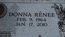
Donna Renee McAlister Hembree
| Birth | : | 9 Feb 1964 Pickens County, South Carolina, USA |
| Death | : | 17 Jan 2010 South Carolina, USA |
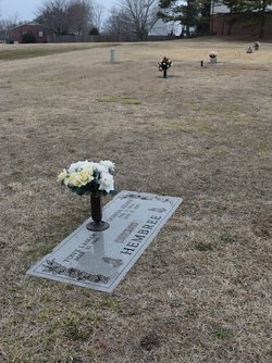
| Burial | : | Hurd Cemetery, DeWitt, Clinton County, USA |
| Coordinate | : | 42.7999992, -84.5733032 |
| Description | : | Easley, SC Donna Renee McAlister Hembree, 45, of 200 Princeton Drive and wife of Tony Lamar Hembree, died Sunday, January 17, 2010 at the home. Born in Pickens County, she was a daughter of James Howe of Simpsonville and the late Mary Black Howe, a graduate of Mauldin High School, a former deli manager at various area Bi Lo Stores, and a member of Rock Springs Baptist Church. Surviving in addition to her husband and father are one son, Joshua Wade Hembree of Easley; two daughters, Megan Elizabeth Hembree of Seneca and Alisha Morgan Howe of Easley; two brothers, Jimmy... Read More |
frequently asked questions (FAQ):
-
Where is Donna Renee McAlister Hembree's memorial?
Donna Renee McAlister Hembree's memorial is located at: Hurd Cemetery, DeWitt, Clinton County, USA.
-
When did Donna Renee McAlister Hembree death?
Donna Renee McAlister Hembree death on 17 Jan 2010 in South Carolina, USA
-
Where are the coordinates of the Donna Renee McAlister Hembree's memorial?
Latitude: 42.7999992
Longitude: -84.5733032
Family Members:
Parent
Siblings
Flowers:
Nearby Cemetories:
1. Hurd Cemetery
DeWitt, Clinton County, USA
Coordinate: 42.7999992, -84.5733032
2. Chapel Hill Memorial Gardens
DeWitt, Clinton County, USA
Coordinate: 42.7738810, -84.6113460
3. Gunnisonville Cemetery
Gunnisonville, Clinton County, USA
Coordinate: 42.8124962, -84.5219879
4. Saint Michael the Archangel Cemetery
DeWitt, Clinton County, USA
Coordinate: 42.8415490, -84.5880960
5. DeWitt City Cemetery
DeWitt, Clinton County, USA
Coordinate: 42.8476219, -84.5676498
6. Saint Joseph Catholic Cemetery
Lansing, Ingham County, USA
Coordinate: 42.7505989, -84.5883026
7. Saint David's Memorial Garden
Delta Township, Eaton County, USA
Coordinate: 42.7514420, -84.6231690
8. Hillside Cemetery
Delta Mills, Eaton County, USA
Coordinate: 42.7647600, -84.6421600
9. First Presbyterian Church Memorial Garden
Lansing, Ingham County, USA
Coordinate: 42.7349700, -84.5592150
10. Saint Pauls Episcopal Church Memorial Garden
Lansing, Ingham County, USA
Coordinate: 42.7348300, -84.5551480
11. Wilsey Cemetery
DeWitt, Clinton County, USA
Coordinate: 42.8633003, -84.5128021
12. South Riley Township Cemetery
South Riley, Clinton County, USA
Coordinate: 42.8633003, -84.6414032
13. Unitarian Universalist Church Memorial Gardens
East Lansing, Ingham County, USA
Coordinate: 42.7427540, -84.4825510
14. All Saints Episcopal Church Memorial Garden
East Lansing, Ingham County, USA
Coordinate: 42.7423020, -84.4825220
15. Peoples Church Memorial Garden
East Lansing, Ingham County, USA
Coordinate: 42.7360050, -84.4861000
16. Pleasant Hill Cemetery
Bath, Clinton County, USA
Coordinate: 42.8074989, -84.4492035
17. Alward Cemetery
Olive Township, Clinton County, USA
Coordinate: 42.8925018, -84.5717010
18. Wacousta Cemetery
Wacousta, Clinton County, USA
Coordinate: 42.8206980, -84.6963820
19. Delta Center Cemetery
Grand Ledge, Eaton County, USA
Coordinate: 42.7270000, -84.6560000
20. Deepdale Memorial Park
Delta Township, Eaton County, USA
Coordinate: 42.7080994, -84.6069031
21. Mount Hope Cemetery
Lansing, Ingham County, USA
Coordinate: 42.7075005, -84.5258026
22. Evergreen Cemetery
Lansing, Ingham County, USA
Coordinate: 42.7089005, -84.5093994
23. Our Savior Lutheran Memorial Garden
Lansing, Ingham County, USA
Coordinate: 42.7257980, -84.6829620
24. Oklahoma Peavine Equine Burial Site
East Lansing, Ingham County, USA
Coordinate: 42.7266300, -84.4560420


