Donnie Ray Jack
| Birth | : | 28 Sep 1961 Chanute, Neosho County, Kansas, USA |
| Death | : | 11 Jul 2007 Wichita, Sedgwick County, Kansas, USA |
| Burial | : | Stockton General Cemetery, Stockton, Newcastle City, Australia |
| Coordinate | : | -32.8811190, 151.7941190 |
| Plot | : | Sec200 Blk08 Lot144 Sp04 |
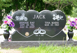
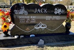
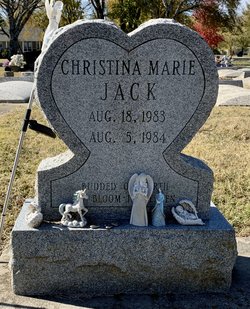
| Description | : | ************************** Chanute Tribune ~ Chanute, KS ~ July 14, 2007 Donnie Ray Jack, 45, Chanute, KS, died Wednesday, July 11, 2007, at Wesley Medical Center in Wichita, Kansas. Donnie was born Sept. 28, 1961 in Chanute, Kansas, the son of Eugene and Shirley (Lee) Jack. Donnie married Tina Wikel on Feb. 13, 1982. He had worked at Custom Campers until he became disabled. Donnie is survived by his wife, of the home; a daughter, Stephanie Jack; two brothers, Robert Jack, Stark, KS, and Allen Jack, LeCompton, KS. He was preceded in death by both parents and an infant daughter, Christina Marie. Burial will be July 18, 2007,... Read More |
frequently asked questions (FAQ):
-
Where is Donnie Ray Jack's memorial?
Donnie Ray Jack's memorial is located at: Stockton General Cemetery, Stockton, Newcastle City, Australia.
-
When did Donnie Ray Jack death?
Donnie Ray Jack death on 11 Jul 2007 in Wichita, Sedgwick County, Kansas, USA
-
Where are the coordinates of the Donnie Ray Jack's memorial?
Latitude: -32.8811190
Longitude: 151.7941190
Family Members:
Parent
Children
Flowers:
Nearby Cemetories:
1. Stockton General Cemetery
Stockton, Newcastle City, Australia
Coordinate: -32.8811190, 151.7941190
2. Carrington General Cemetery
Carrington, Mid-Coast Council, Australia
Coordinate: -32.9160530, 151.7653510
3. Lone Graves
Newcastle, Newcastle City, Australia
Coordinate: -32.9262840, 151.7812300
4. St Andrew's Church of England Burial Ground
Mayfield, Newcastle City, Australia
Coordinate: -32.8976110, 151.7418010
5. Christ Church Cathedral Cemetery
Newcastle, Newcastle City, Australia
Coordinate: -32.9285150, 151.7798810
6. Christ Church Cathedral Columbarium & Memorial Garden
Newcastle City, Australia
Coordinate: -32.9288145, 151.7803562
7. St Mark's Memorial Garden
Islington, Newcastle City, Australia
Coordinate: -32.9160001, 151.7516897
8. Sacred Heart Columbarium
Newcastle City, Australia
Coordinate: -32.9238349, 151.7540479
9. Hamilton (Scots Kirk) Presbyterian Church
Hamilton, Newcastle City, Australia
Coordinate: -32.9237737, 151.7478595
10. St Peter's Anglican Church - Memorial Garden
Hamilton, Newcastle City, Australia
Coordinate: -32.9246418, 151.7430409
11. St. Joseph's Columbarium
Merewether, Newcastle City, Australia
Coordinate: -32.9371400, 151.7587300
12. St. Augustine's Anglican Church Cemetery
Merewether, Newcastle City, Australia
Coordinate: -32.9416680, 151.7508170
13. Tomago House Chapel Cemetery
Tomago, Port Stephens Council, Australia
Coordinate: -32.8287440, 151.7352210
14. Sandgate Cemetery
Newcastle, Newcastle City, Australia
Coordinate: -32.8702580, 151.7075130
15. Sandgate War Cemetery
Newcastle, Newcastle City, Australia
Coordinate: -32.8663600, 151.7071000
16. Honeysuckle Cemetery (Defunct)
Newcastle, Newcastle City, Australia
Coordinate: -32.8689770, 151.7061310
17. St Stephen's Anglican Church
Newcastle City, Australia
Coordinate: -32.9338161, 151.7263223
18. St John the Baptist Memorial Garden
Lambton, Newcastle City, Australia
Coordinate: -32.9143566, 151.7094595
19. Wallsend Cemetery
Wallsend, Newcastle City, Australia
Coordinate: -32.8912530, 151.6855310
20. Old Wallsend Cemetery
Wallsend, Newcastle City, Australia
Coordinate: -32.9032300, 151.6751500
21. St Philip's Catholic Church Columbarium
Kotara, Newcastle City, Australia
Coordinate: -32.9488625, 151.6995859
22. Saint Luke's Anglican Church Columbarium
Wallsend, Newcastle City, Australia
Coordinate: -32.9052920, 151.6709097
23. Hannell Cemetery
Hexham, Newcastle City, Australia
Coordinate: -32.8174670, 151.6811220
24. Maryland Grave
Maryland, Newcastle City, Australia
Coordinate: -32.8677196, 151.6575968


