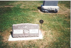
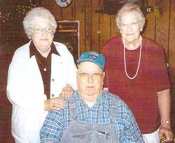
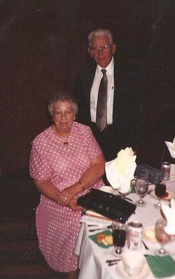
Dorathy Jean “Dorit” Hacker Nickelson
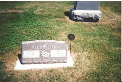
| Birth | : | 24 Feb 1924 Havelock, Pocahontas County, Iowa, USA |
| Death | : | 23 Apr 2010 Laurens, Pocahontas County, Iowa, USA |
| Burial | : | Saint Bernard Cemetery, Tariffville, Hartford County, USA |
| Coordinate | : | 41.9084282, -72.7686005 |
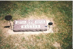
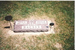
| Description | : | Dorathy Jean "Dorit" Hacker, the daughter of John and Dorathea "Dora" (Froh) Hacker, was born on February 24, 1924 in Havelock, Iowa, where she was raised and received her education, graduating from the Havelock High School. Dorathy had been Baptized and Confirmed into the Christian Faith at Trinity Lutheran Church in Mallard, Iowa. After high school, she worked as a secretary at the high school. On June 29, 1952, she was united in marriage with Elim Nickelson at Trinity Lutheran Church in Mallard, IA. The couple lived and farmed for awhile in the Havelock - Laurens area. Dorathy worked... Read More |
frequently asked questions (FAQ):
-
Where is Dorathy Jean “Dorit” Hacker Nickelson's memorial?
Dorathy Jean “Dorit” Hacker Nickelson's memorial is located at: Saint Bernard Cemetery, Tariffville, Hartford County, USA.
-
When did Dorathy Jean “Dorit” Hacker Nickelson death?
Dorathy Jean “Dorit” Hacker Nickelson death on 23 Apr 2010 in Laurens, Pocahontas County, Iowa, USA
-
Where are the coordinates of the Dorathy Jean “Dorit” Hacker Nickelson's memorial?
Latitude: 41.9084282
Longitude: -72.7686005
Family Members:
Parent
Spouse
Siblings
Flowers:
Nearby Cemetories:
1. Saint Bernard Cemetery
Tariffville, Hartford County, USA
Coordinate: 41.9084282, -72.7686005
2. Tariffville Cemetery
Tariffville, Hartford County, USA
Coordinate: 41.9079132, -72.7694473
3. Hartford Mutual Society Memorial Park
East Granby, Hartford County, USA
Coordinate: 41.9196815, -72.7742538
4. Beth Hillel Synagogue Memorial Park
East Granby, Hartford County, USA
Coordinate: 41.9218216, -72.7706451
5. Congregation Teferes Israel Memorial Park
East Granby, Hartford County, USA
Coordinate: 41.9217300, -72.7715912
6. Saint Andrew's Episcopal Church Cemetery
Bloomfield, Hartford County, USA
Coordinate: 41.8934593, -72.7584076
7. East Granby Smallpox Cemetery
East Granby, Hartford County, USA
Coordinate: 41.9245000, -72.7491000
8. Holcomb Cemetery
East Granby, Hartford County, USA
Coordinate: 41.9371223, -72.7716751
9. Simsbury United Methodist Church Memorial Garden
Simsbury, Hartford County, USA
Coordinate: 41.8760520, -72.8018120
10. Simsbury Cemetery
Simsbury, Hartford County, USA
Coordinate: 41.8749809, -72.8020782
11. Plank Hill Road Grave
Simsbury, Hartford County, USA
Coordinate: 41.8810640, -72.8134860
12. East Granby Cemetery
East Granby, Hartford County, USA
Coordinate: 41.9416008, -72.7261963
13. First Church of Christ Memorial Garden
Simsbury, Hartford County, USA
Coordinate: 41.8706790, -72.8059490
14. The First Church Memorial Garden
Granby, Hartford County, USA
Coordinate: 41.9538918, -72.7891693
15. East Granby Congregational Church Memorial Garden
East Granby, Hartford County, USA
Coordinate: 41.9434330, -72.7239120
16. Elmwood Cemetery
East Granby, Hartford County, USA
Coordinate: 41.9371986, -72.7146988
17. Granby Cemetery
Granby, Hartford County, USA
Coordinate: 41.9571991, -72.7913971
18. Old Newgate Prison Cemetery
East Granby, Hartford County, USA
Coordinate: 41.9630620, -72.7451570
19. Captain John Viets Cemetery
East Granby, Hartford County, USA
Coordinate: 41.9665909, -72.7455673
20. Saint Josephs Cemetery
Windsor, Hartford County, USA
Coordinate: 41.9136009, -72.6769028
21. Copper Hill Cemetery
East Granby, Hartford County, USA
Coordinate: 41.9766998, -72.7530975
22. West Granby Cemetery
Granby, Hartford County, USA
Coordinate: 41.9535522, -72.8400421
23. Pratt Cemetery
Granby, Hartford County, USA
Coordinate: 41.9710999, -72.8143997
24. Old Poquonock Burying Ground
Windsor, Hartford County, USA
Coordinate: 41.8895950, -72.6741714

