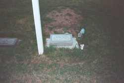
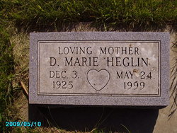
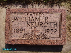
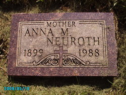
Doreen Marie Neuroth Heglin
| Birth | : | 3 Dec 1925 Union County, South Dakota, USA |
| Death | : | 24 May 1999 Sioux Falls, Minnehaha County, South Dakota, USA |
| Burial | : | Gillhovs cemetery, Hackas, Bergs kommun, Sweden |
| Coordinate | : | 62.6640800, 14.7479500 |
| Plot | : | Block 3 lot 37 grave 4 |
| Inscription | : | Loving Mother |
frequently asked questions (FAQ):
-
Where is Doreen Marie Neuroth Heglin's memorial?
Doreen Marie Neuroth Heglin's memorial is located at: Gillhovs cemetery, Hackas, Bergs kommun, Sweden.
-
When did Doreen Marie Neuroth Heglin death?
Doreen Marie Neuroth Heglin death on 24 May 1999 in Sioux Falls, Minnehaha County, South Dakota, USA
-
Where are the coordinates of the Doreen Marie Neuroth Heglin's memorial?
Latitude: 62.6640800
Longitude: 14.7479500
Family Members:
Parent
Spouse
Siblings
Children
Flowers:
Nearby Cemetories:
1. Gillhovs cemetery
Hackas, Bergs kommun, Sweden
Coordinate: 62.6640800, 14.7479500
2. Ytterhogdals Kyrkogård
Ytterhogdal, Härjedalens kommun, Sweden
Coordinate: 62.1719375, 14.9295771
3. Östra begravningsplatsen
Ostersund, Östersunds kommun, Sweden
Coordinate: 63.1741458, 14.6691471
4. Norderö kyrkogård
Nordero, Östersunds kommun, Sweden
Coordinate: 63.1491800, 14.3603200
5. Norra Begravningsplatsen
Ostersund, Östersunds kommun, Sweden
Coordinate: 63.1848319, 14.6337952
6. Krematorium Hoppets Kapell
Ostersund, Östersunds kommun, Sweden
Coordinate: 63.2522770, 14.6690600
7. Ås kyrkogård
As, Sollefteå kommun, Sweden
Coordinate: 63.2486990, 14.5627210
8. Hede Kyrkogård
Hede, Härjedalens kommun, Sweden
Coordinate: 62.4177299, 13.5162753
9. Älvros kyrkogård
Alvros, Härjedalens kommun, Sweden
Coordinate: 62.0438185, 14.6603913
10. Svegs kyrkogård
Sveg, Härjedalens kommun, Sweden
Coordinate: 62.0344661, 14.3624630
11. Häggenås kyrkogård
Häggenås, Östersunds kommun, Sweden
Coordinate: 63.3948900, 14.9117200
12. Mattmar Cemetery
Mattmar, Åre kommun, Sweden
Coordinate: 63.3046649, 13.8952725
13. Los Kyrkogård
Los, Ljusdals kommun, Sweden
Coordinate: 61.7256600, 15.1763200
14. Hammerdals Churchyard
Hammerdal, Strömsunds kommun, Sweden
Coordinate: 63.5952681, 15.3627832
15. Tännäs Church Cemetery
Tannas, Härjedalens kommun, Sweden
Coordinate: 62.4426030, 12.6796442
16. Föllinge kyrka
Föllinge, Krokoms kommun, Sweden
Coordinate: 63.6659000, 14.6175500
17. Färila Kyrkogård
Farila, Ljusdals kommun, Sweden
Coordinate: 61.8010426, 15.8482274
18. Hamra Fågelsjö Kyrkogård
Hamra, Ljusdals kommun, Sweden
Coordinate: 61.6555400, 14.9959600
19. Ljusdal Kyrkogård
Ljusdal, Ljusdals kommun, Sweden
Coordinate: 61.8283150, 16.0724050
20. Helgums Kyrkogård
Helgumsbyn, Sollefteå kommun, Sweden
Coordinate: 63.2200485, 16.8263023
21. Tuna-Attmar Cemetery
Matfors, Sundsvalls kommun, Sweden
Coordinate: 62.3499985, 17.0333328
22. Sättna Kyrkogård
Sundsvall, Sundsvalls kommun, Sweden
Coordinate: 62.4675849, 17.1500631
23. Öjung Kapell och Kyrkogård
Ovanaker, Ovanåkers kommun, Sweden
Coordinate: 61.5913170, 15.5672290
24. Laxsjö kyrkogård
Laxsjo, Krokoms kommun, Sweden
Coordinate: 63.8101290, 14.8006710

