| Birth | : | 25 Mar 1925 Osceola, Clarke County, Iowa, USA |
| Death | : | 1 Oct 2015 Van Wert, Decatur County, Iowa, USA |
| Burial | : | Old Dubbo Cemetery, Dubbo, Dubbo Regional Council, Australia |
| Coordinate | : | -32.2403680, 148.6283760 |
| Inscription | : | wife of Paul VanderEcken |
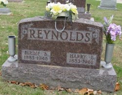
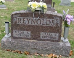
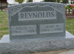
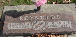
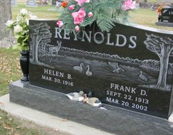
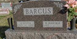
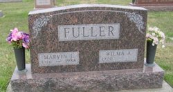
| Description | : | Doris VanderEcken, age 90, was the daughter of Harry Lee and Birdie B. (Chestnut) Reynolds. She graduated from Osceola (IA) High School in 1942. She married James Benton O'Hair on May 22, 1947, in Osceola; she married Paul VanderEcken Sr. She is survived by her children, James O'Hair and Janis Leeper, 6 grandchildren, 6 great-grandchildren, her step-children, Paul VanderEcken Jr. and Barbara Beaver, 5 step-grandchildren, 13 step-great-grandchildren, and 2 step-great-great-grandchildren. She was preceded in death by her parents, both husbands, her siblings, John Reynolds, Glen Reynolds, Raymond Reynolds, Frank Reynolds, Alberta Barcus, Icie Turk, Wilma Fuller, and Amy Turnipseed,... Read More |
frequently asked questions (FAQ):
-
Where is Doris Edna O'Hair Vander Ecken's memorial?
Doris Edna O'Hair Vander Ecken's memorial is located at: Old Dubbo Cemetery, Dubbo, Dubbo Regional Council, Australia.
-
When did Doris Edna O'Hair Vander Ecken death?
Doris Edna O'Hair Vander Ecken death on 1 Oct 2015 in Van Wert, Decatur County, Iowa, USA
-
Where are the coordinates of the Doris Edna O'Hair Vander Ecken's memorial?
Latitude: -32.2403680
Longitude: 148.6283760
Family Members:
Parent
Spouse
Siblings
Flowers:
Nearby Cemetories:
1. Old Dubbo Cemetery
Dubbo, Dubbo Regional Council, Australia
Coordinate: -32.2403680, 148.6283760
2. New Dubbo Cemetery
Dubbo, Dubbo Regional Council, Australia
Coordinate: -32.2323520, 148.6433290
3. Lone Graves
Ballimore, Dubbo Regional Council, Australia
Coordinate: -32.2456190, 148.6043360
4. Western Districts Memorial Park
Dubbo, Dubbo Regional Council, Australia
Coordinate: -32.2045930, 148.6267630
5. Dubbo Pioneer Cemetery
Dubbo, Dubbo Regional Council, Australia
Coordinate: -32.3147740, 148.6243340
6. Geurie Cemetery
Geurie, Dubbo Regional Council, Australia
Coordinate: -32.4118100, 148.8326300
7. Narromine General Cemetery
Narromine, Narromine Shire, Australia
Coordinate: -32.2481700, 148.2424500
8. Narromine War Cemetery
Narromine, Narromine Shire, Australia
Coordinate: -32.2528038, 148.2276306
9. Elong Elong Cemetery
Elong Elong, Dubbo Regional Council, Australia
Coordinate: -32.1117050, 149.0363750
10. Bodangora General Cemetery
Bodangora, Dubbo Regional Council, Australia
Coordinate: -32.4502270, 149.0323310
11. Nanima Homestead Cemetery
Wuuluman, Dubbo Regional Council, Australia
Coordinate: -32.5357130, 148.9565480
12. Wellington Blacks Camp Cemetery
Wellington, Dubbo Regional Council, Australia
Coordinate: -32.5543370, 148.9413070
13. Wellington RC Holy Family Cemetery
Wellington, Dubbo Regional Council, Australia
Coordinate: -32.5648300, 148.9328100
14. Wellington Lawn Cemetery
Wellington, Dubbo Regional Council, Australia
Coordinate: -32.5795290, 148.9500200
15. Wellington Pioneer Cemetery
Wellington, Dubbo Regional Council, Australia
Coordinate: -32.5791400, 148.9521640
16. Wellington General Cemetery
Wellington, Dubbo Regional Council, Australia
Coordinate: -32.5819120, 148.9512280
17. Curra Creek General Cemetery
Curra Creek, Dubbo Regional Council, Australia
Coordinate: -32.6617780, 148.8501550
18. Tomingley Pioneer Cemetery
Tomingley, Narromine Shire, Australia
Coordinate: -32.5676890, 148.2326270
19. Rozelayne Cemetery
Curra Creek, Dubbo Regional Council, Australia
Coordinate: -32.6852950, 148.8368230
20. Spicers Creek Cemetery
Wellington, Dubbo Regional Council, Australia
Coordinate: -32.3872640, 149.1681980
21. Yeoval General Cemetery
Yeoval, Cabonne Shire, Australia
Coordinate: -32.7360660, 148.6614970
22. Gilgandra General Cemetery
Gilgandra, Gilgandra Shire, Australia
Coordinate: -31.7130465, 148.6877720
23. Neurea Cemetery
Mumbil, Dubbo Regional Council, Australia
Coordinate: -32.7082280, 148.9471440
24. Lambing Hill Cemetery
Goolma, Mid-Western Regional Council, Australia
Coordinate: -32.3552950, 149.2623350

