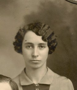
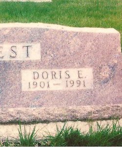
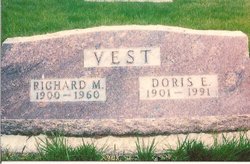
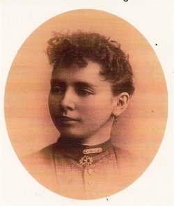
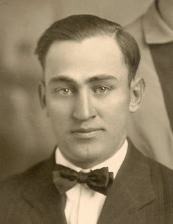
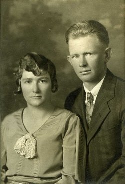
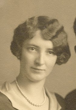
Doris Emma English Vest
| Birth | : | 5 Sep 1901 Phelps County, Nebraska, USA |
| Death | : | 24 Jan 1991 Kansas City, Jackson County, Missouri, USA |
| Burial | : | Park Hill Cemetery, Syracuse, Otoe County, USA |
| Coordinate | : | 40.6693993, -96.1875000 |
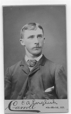
| Description | : | Daughter of Edward Abraham English and Martha Emmaline Winslow English. Married Richard Minter Vest on 17 Feb 1927 at Overton, Dawson, Nebraska, at the Methodist Episcopal Church Parsonage by Rev. Samuel McKeown. Mother of: Dorthy Maxine Vest Teel Eubank Donna Jean Vest Taylor Married to George Hood Nelsen on 19 Mar 1971 at Lexington, Dawson, Nebraska. |
frequently asked questions (FAQ):
-
Where is Doris Emma English Vest's memorial?
Doris Emma English Vest's memorial is located at: Park Hill Cemetery, Syracuse, Otoe County, USA.
-
When did Doris Emma English Vest death?
Doris Emma English Vest death on 24 Jan 1991 in Kansas City, Jackson County, Missouri, USA
-
Where are the coordinates of the Doris Emma English Vest's memorial?
Latitude: 40.6693993
Longitude: -96.1875000
Family Members:
Parent
Spouse
Siblings
Children
Flowers:
Nearby Cemetories:
1. Park Hill Cemetery
Syracuse, Otoe County, USA
Coordinate: 40.6693993, -96.1875000
2. Warner Cemetery
Syracuse, Otoe County, USA
Coordinate: 40.6822014, -96.1652985
3. Dudley Cemetery
Syracuse, Otoe County, USA
Coordinate: 40.6082993, -96.1988983
4. Corbin Family Cemetery
Otoe, Otoe County, USA
Coordinate: 40.7095820, -96.1028640
5. Unadilla Cemetery
Unadilla, Otoe County, USA
Coordinate: 40.6974983, -96.2818985
6. Whitten Family Cemetery
Otoe, Otoe County, USA
Coordinate: 40.7407460, -96.1414650
7. Delaware Lutheran Cemetery
Otoe County, USA
Coordinate: 40.6244087, -96.0870438
8. North Branch Lutheran Cemetery
Otoe County, USA
Coordinate: 40.7640510, -96.1781450
9. Dunbar Cemetery
Dunbar, Otoe County, USA
Coordinate: 40.6542015, -96.0578003
10. Hopewell Presbyterian Church Cemetery
Otoe County, USA
Coordinate: 40.6090150, -96.2930630
11. Otoe County Poor Farm Cemetery
Dunbar, Otoe County, USA
Coordinate: 40.6610430, -96.0471480
12. Union Cemetery
Otoe, Otoe County, USA
Coordinate: 40.7411003, -96.0746994
13. Pleasant Hill Cemetery
Otoe County, USA
Coordinate: 40.7694016, -96.2602997
14. Thompson Cemetery
Otoe County, USA
Coordinate: 40.7256012, -96.3311005
15. Schacht Cemetery
Otoe County, USA
Coordinate: 40.5447006, -96.1271973
16. Saint Pauls Cemetery
Otoe County, USA
Coordinate: 40.5372330, -96.1524720
17. Saint Johns Cemetery
Talmage, Otoe County, USA
Coordinate: 40.5820847, -96.0474625
18. Avoca Cemetery
Avoca, Cass County, USA
Coordinate: 40.7994003, -96.1278000
19. Pioneer Cemetery
Palmyra, Otoe County, USA
Coordinate: 40.6903000, -96.3685989
20. Hope Lutheran Cemetery
Burr, Otoe County, USA
Coordinate: 40.5525017, -96.2938995
21. Holy Trinity Catholic Church Cemetery
Otoe County, USA
Coordinate: 40.7763090, -96.0583380
22. Biggs Cemetery
Lorton, Otoe County, USA
Coordinate: 40.6025009, -96.0105972
23. Grace Lutheran Church Cemetery
Cook, Johnson County, USA
Coordinate: 40.5178000, -96.1799500
24. Cook Cemetery
Cook, Johnson County, USA
Coordinate: 40.5168991, -96.1797028

