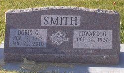
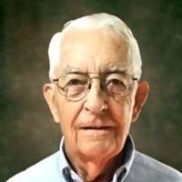
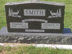
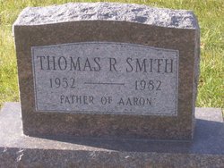
Doris G Deburn Smith
| Birth | : | 12 Nov 1927 |
| Death | : | 25 Jan 2010 |
| Burial | : | Resthaven Gardens of Memory, Wichita, Sedgwick County, USA |
| Coordinate | : | 37.6666985, -97.4772034 |
| Description | : | Doris G. Smith, 82, died Monday, January 25, 2010 at the Dennis & Donna Oldorf Hospice House of Mercy in Hiawatha following an extended illness. Private services will be held at Phillips Funeral Home Chapel in Keystone with Father Jack McClure, C.PP.S officiating. Interment will be held at the Keystone Cemetery. A Memorial Fund has been established. Doris was born November 12, 1927 at Ottumwa to Ray and Lena (Box) Deburn and graduated from Ottumwa High School in 1947. Doris loved country music and from age 8 until... Read More |
frequently asked questions (FAQ):
-
Where is Doris G Deburn Smith's memorial?
Doris G Deburn Smith's memorial is located at: Resthaven Gardens of Memory, Wichita, Sedgwick County, USA.
-
When did Doris G Deburn Smith death?
Doris G Deburn Smith death on 25 Jan 2010 in
-
Where are the coordinates of the Doris G Deburn Smith's memorial?
Latitude: 37.6666985
Longitude: -97.4772034
Family Members:
Parent
Spouse
Siblings
Children
Flowers:
Nearby Cemetories:
1. Resthaven Gardens of Memory
Wichita, Sedgwick County, USA
Coordinate: 37.6666985, -97.4772034
2. Saint Peters Cemetery
Schulte, Sedgwick County, USA
Coordinate: 37.6244700, -97.4705600
3. Resurrection Cemetery and Mausoleum
Wichita, Sedgwick County, USA
Coordinate: 37.7131250, -97.4623780
4. Covenant Presbyterian Church Columbarium
Wichita, Sedgwick County, USA
Coordinate: 37.7152678, -97.4436548
5. Jamesburg Park Cemetery
Wichita, Sedgwick County, USA
Coordinate: 37.7160988, -97.4449997
6. Good Shepherd Episcopal Memorial Garden
Wichita, Sedgwick County, USA
Coordinate: 37.7222700, -97.4362300
7. Pleasant Ridge Cemetery
Goddard, Sedgwick County, USA
Coordinate: 37.6777992, -97.5627975
8. Greenwood Cemetery
Wichita, Sedgwick County, USA
Coordinate: 37.6067009, -97.4156036
9. Adorers of The Blood of Christ Convent Cemetery
Wichita, Sedgwick County, USA
Coordinate: 37.6677700, -97.3787800
10. Cornerstone Pentecostal Holiness Church
Wichita, Sedgwick County, USA
Coordinate: 37.6578700, -97.3705700
11. Saint Marks Cemetery
Saint Marks, Sedgwick County, USA
Coordinate: 37.7363014, -97.5613022
12. Afton Cemetery
Goddard, Sedgwick County, USA
Coordinate: 37.6338997, -97.6057968
13. Ruby Cemetery
Clearwater, Sedgwick County, USA
Coordinate: 37.5621986, -97.5158005
14. Old Saint Johns Cemetery
Viola, Sedgwick County, USA
Coordinate: 37.5822868, -97.5706635
15. Maize Cemetery
Maize, Sedgwick County, USA
Coordinate: 37.7792015, -97.4897003
16. Shirley Tilford Memorial Garden
Wichita, Sedgwick County, USA
Coordinate: 37.6942700, -97.3359600
17. Saint Johns Episcopal Church Columbarium
Wichita, Sedgwick County, USA
Coordinate: 37.6918950, -97.3339670
18. Saint John's Cemetery
Viola, Sedgwick County, USA
Coordinate: 37.5644302, -97.5557480
19. Sacred Heart Catholic Cemetery
Colwich, Sedgwick County, USA
Coordinate: 37.7798004, -97.5447006
20. Saint Marys Cemetery
Garden Plain, Sedgwick County, USA
Coordinate: 37.7068300, -97.6430500
21. Temple Emanuel Cemetery
Wichita, Sedgwick County, USA
Coordinate: 37.7014000, -97.3008000
22. Highland Cemetery
Wichita, Sedgwick County, USA
Coordinate: 37.7028008, -97.3007965
23. Calvary Cemetery
Wichita, Sedgwick County, USA
Coordinate: 37.6781006, -97.2949982
24. Saint James Episcopal Church Columbarium
Wichita, Sedgwick County, USA
Coordinate: 37.6865600, -97.2930000


