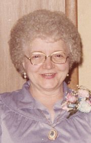
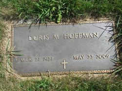
Doris Mae Wood Hoffman
| Birth | : | 27 Mar 1927 Marshalltown, Marshall County, Iowa, USA |
| Death | : | 22 May 2009 |
| Burial | : | Cygnet St James Roman Catholic Cemetery, Cygnet, Huon Valley Council, Australia |
| Coordinate | : | -43.1647000, 147.0759800 |
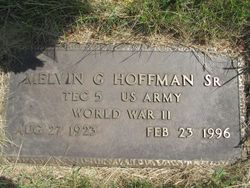
| Description | : | Doris Mae (Wood) Hoffman, 82 years old and a lifelong resident of Marshalltown, Iowa went home to the place that had been prepared for her by her loving Savior Jesus Christ on May 22, 2009. Born in Marshalltown on March 27, 1927 she was the daughter of Charles and Agnes Wood. She attended schools locally then moved to Des Moines, Iowa to attend Central Iowa Business School. It was in Des Moines that she met Melvin Guy Hoffman, Sr. her future husband. The two of them were married on November 23, 1954 at the First United Methodist... Read More |
frequently asked questions (FAQ):
-
Where is Doris Mae Wood Hoffman's memorial?
Doris Mae Wood Hoffman's memorial is located at: Cygnet St James Roman Catholic Cemetery, Cygnet, Huon Valley Council, Australia.
-
When did Doris Mae Wood Hoffman death?
Doris Mae Wood Hoffman death on 22 May 2009 in
-
Where are the coordinates of the Doris Mae Wood Hoffman's memorial?
Latitude: -43.1647000
Longitude: 147.0759800
Family Members:
Parent
Spouse
Siblings
Children
Flowers:
Nearby Cemetories:
1. Cygnet St James Roman Catholic Cemetery
Cygnet, Huon Valley Council, Australia
Coordinate: -43.1647000, 147.0759800
2. St. Mark Anglican Cemetery
Cygnet, Huon Valley Council, Australia
Coordinate: -43.1616412, 147.0755499
3. Cygnet Uniting Cemetery
Cygnet, Huon Valley Council, Australia
Coordinate: -43.1629010, 147.0698100
4. Cradoc Cemetery
Cradoc, Huon Valley Council, Australia
Coordinate: -43.1110000, 147.0360000
5. Jackson’s Point Catholic Cemetery
Franklin, Huon Valley Council, Australia
Coordinate: -43.1093880, 146.9988080
6. Castle Forbes Bay Methodist Cemetery
Castle Forbes Bay, Huon Valley Council, Australia
Coordinate: -43.1354720, 146.9745780
7. Surges Bay Public Cemetery
Surges Bay, Huon Valley Council, Australia
Coordinate: -43.2172490, 146.9922260
8. Cairns Bay Congregational and Uniting Cemetery
Cairns Bay, Huon Valley Council, Australia
Coordinate: -43.1976440, 146.9585630
9. Church of Christ Cemetery
Geeveston, Huon Valley Council, Australia
Coordinate: -43.1978100, 146.9582100
10. St. John's Anglican Church Cemetery
Franklin, Huon Valley Council, Australia
Coordinate: -43.0847300, 147.0128070
11. St. Peter’s Anglican Cemetery
Cairns Bay, Huon Valley Council, Australia
Coordinate: -43.1971300, 146.9569200
12. St. Joseph's Catholic Church & Cemetery
Geeveston, Huon Valley Council, Australia
Coordinate: -43.1647733, 146.9438447
13. Maxfields Road Pioneer Cemetery
Franklin, Huon Valley Council, Australia
Coordinate: -43.0589250, 147.0234810
14. Woodbridge Cemetery
Woodbridge, Kingborough Council, Australia
Coordinate: -43.1624500, 147.2373500
15. Geeveston Congregational Cemetery
Geeveston, Huon Valley Council, Australia
Coordinate: -43.1653990, 146.9136320
16. Church of the Holy Spirit Cemetery
Kettering, Kingborough Council, Australia
Coordinate: -43.1204350, 147.2450320
17. The Dripstone Public Catholic Cemetery
Kingborough Council, Australia
Coordinate: -43.2118505, 147.2579035
18. Middleton Cemetery
Middleton, Kingborough Council, Australia
Coordinate: -43.2244850, 147.2534720
19. Huonville Congregational Cemetery
Huonville, Huon Valley Council, Australia
Coordinate: -43.0218230, 147.0517060
20. Huon Lawn Cemetery
Huonville, Huon Valley Council, Australia
Coordinate: -43.0241530, 147.0029080
21. Sacred Heart Catholic Church Cemetery
Ranelagh, Huon Valley Council, Australia
Coordinate: -43.0135940, 147.0402090
22. St. James' Anglican Cemetery
Ranelagh, Huon Valley Council, Australia
Coordinate: -43.0135185, 147.0386736
23. Dover Community Church Cemetery
Dover, Huon Valley Council, Australia
Coordinate: -43.3136670, 147.0151270
24. Glen Huon Methodist Cemetery
Glen Huon, Huon Valley Council, Australia
Coordinate: -43.0275730, 146.9643980


