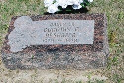
Dorothy G Wolford Deshazer
| Birth | : | Jan 1920 Garden County, Nebraska, USA |
| Death | : | 20 Mar 1938 Garden County, Nebraska, USA |
| Burial | : | Mount Olivet Cemetery, Finch, Ritchie County, USA |
| Coordinate | : | 39.3126200, -81.0825800 |
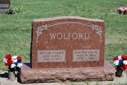
| Description | : | Dorothy G Wolford, daughter to Walter Cecil & Bessie Tamer (Goodro) Wolford. Married Lester William DeShazer on June 2, 1937 in Julesburg, Colo. One son; Gary L DeShazer born 19 Mar 1938. On the 1940 census he is living with her parents; Walter & Bessie in Blue Creek, Garden Co., Nebraska (George L Vesfeyer). Dorothy sibling to; Ila M (Ted) Lewis- ( ) Robb, Walter Junior Wolford, Robert William Wolford, Morris H Wolford and Phillip Eugene Wolford. |
frequently asked questions (FAQ):
-
Where is Dorothy G Wolford Deshazer's memorial?
Dorothy G Wolford Deshazer's memorial is located at: Mount Olivet Cemetery, Finch, Ritchie County, USA.
-
When did Dorothy G Wolford Deshazer death?
Dorothy G Wolford Deshazer death on 20 Mar 1938 in Garden County, Nebraska, USA
-
Where are the coordinates of the Dorothy G Wolford Deshazer's memorial?
Latitude: 39.3126200
Longitude: -81.0825800
Family Members:
Parent
Spouse
Siblings
Flowers:
Nearby Cemetories:
1. Mount Olivet Cemetery
Finch, Ritchie County, USA
Coordinate: 39.3126200, -81.0825800
2. Wince Chapel Cemetery
Pike, Ritchie County, USA
Coordinate: 39.2880900, -81.0783300
3. Church of Christ Cemetery
Pike, Ritchie County, USA
Coordinate: 39.2849700, -81.0809800
4. Highland Cemetery
Highland, Ritchie County, USA
Coordinate: 39.3093400, -81.0465000
5. Cronin Cemetery
Pleasants County, USA
Coordinate: 39.3154600, -81.1236100
6. Pine Grove Cemetery
Cairo, Ritchie County, USA
Coordinate: 39.2991982, -81.1241989
7. Wiley Family Cemetery
Saint Marys, Pleasants County, USA
Coordinate: 39.3307790, -81.1255230
8. Mount Carmel Cemetery
Ritchie County, USA
Coordinate: 39.3021340, -81.1327480
9. Nine Mile Cemetery
Saint Marys, Pleasants County, USA
Coordinate: 39.3456001, -81.1196976
10. Ellenboro Cemetery
Ellenboro, Ritchie County, USA
Coordinate: 39.2686005, -81.0507965
11. Ellenboro Pioneer Cemetery
Ritchie County, USA
Coordinate: 39.2664600, -81.0547800
12. Husher's Run Cemetery
Ritchie County, USA
Coordinate: 39.2847000, -81.0257100
13. Lamberton Cemetery
Ellenboro, Ritchie County, USA
Coordinate: 39.2645232, -81.0562217
14. Zoar Baptist Church Cemetery
Pleasants County, USA
Coordinate: 39.3661620, -81.1014490
15. Fairmont Cemetery
Ellenboro, Ritchie County, USA
Coordinate: 39.2580986, -81.0969009
16. Maple Lane Cemetery
Pleasants County, USA
Coordinate: 39.3581009, -81.0374985
17. Jonestown Cemetery
Pleasants County, USA
Coordinate: 39.3653100, -81.1128100
18. Hornet’s Nest Cemetery
Ritchie County, USA
Coordinate: 39.3093987, -81.1580963
19. Pine Grove Cemetery
Pine Grove, Pleasants County, USA
Coordinate: 39.3678017, -81.0441971
20. Shingleton Cemetery
Saint Marys, Pleasants County, USA
Coordinate: 39.3746200, -81.1006350
21. Wilson Family Cemetery
Pleasants County, USA
Coordinate: 39.3438680, -81.1547080
22. Hogue Cemetery
Beech Grove, Ritchie County, USA
Coordinate: 39.3244100, -81.0000700
23. Wilson Cemetery
Pleasants County, USA
Coordinate: 39.3499170, -81.1542830
24. Cloverdale Cemetery
Saint Marys, Pleasants County, USA
Coordinate: 39.3643990, -81.1421967


