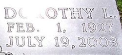
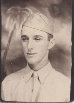
Dorothy Lucile Hodges Cleland
| Birth | : | 1 Feb 1927 Topeka, Shawnee County, Kansas, USA |
| Death | : | 19 Jul 2003 Seneca, Nemaha County, Kansas, USA |
| Burial | : | Saint Joseph Cemetery, Taunton, Bristol County, USA |
| Coordinate | : | 41.9199982, -71.0792007 |
| Description | : | SENECA --- Dorothy L. Cleland, 76, of Seneca, died Saturday, July 19, 2003, at Country View Estates Care Home in Seneca. Due to health problems, Dorothy had been a resident there for several years. She was diagnosed with pancreatic cancer with metastasis to the lungs nine weeks ago. She was born Feb. 1, 1927, the daughter of Carl and Lucy Stone Hodges, in Topeka. After graduation from Topeka High School in 1945, she attended Baker University and Washburn University as music major. She was a piano teacher. On May 6, 1956, she married Paul Cleland at the First... Read More |
frequently asked questions (FAQ):
-
Where is Dorothy Lucile Hodges Cleland's memorial?
Dorothy Lucile Hodges Cleland's memorial is located at: Saint Joseph Cemetery, Taunton, Bristol County, USA.
-
When did Dorothy Lucile Hodges Cleland death?
Dorothy Lucile Hodges Cleland death on 19 Jul 2003 in Seneca, Nemaha County, Kansas, USA
-
Where are the coordinates of the Dorothy Lucile Hodges Cleland's memorial?
Latitude: 41.9199982
Longitude: -71.0792007
Family Members:
Flowers:
Nearby Cemetories:
1. Saint Joseph Cemetery
Taunton, Bristol County, USA
Coordinate: 41.9199982, -71.0792007
2. Mayflower Hill Cemetery
Taunton, Bristol County, USA
Coordinate: 41.9199982, -71.0875015
3. Saint Mary Cemetery
Taunton, Bristol County, USA
Coordinate: 41.9219900, -71.0878900
4. Plain Cemetery
Taunton, Bristol County, USA
Coordinate: 41.9124985, -71.0916977
5. Father Wilson Cemetery
Taunton, Bristol County, USA
Coordinate: 41.9087600, -71.0921900
6. Ox Bow Farm Cemetery
Taunton, Bristol County, USA
Coordinate: 41.9027020, -71.0714260
7. Dean Cemetery
Raynham, Bristol County, USA
Coordinate: 41.9053970, -71.0616490
8. Shaw Cemetery
Raynham, Bristol County, USA
Coordinate: 41.9081400, -71.0550000
9. Neck O Land Cemetery
Taunton, Bristol County, USA
Coordinate: 41.8978500, -71.0850000
10. Pleasant Street Cemetery
Raynham, Bristol County, USA
Coordinate: 41.9277992, -71.0477982
11. Seth Staples Gravesite
Taunton, Bristol County, USA
Coordinate: 41.8954700, -71.0730000
12. Brittun Cemetery
Raynham, Bristol County, USA
Coordinate: 41.9446800, -71.0698100
13. Wetherell Cemetery
Taunton, Bristol County, USA
Coordinate: 41.9449200, -71.0886700
14. Britton Cemetery
Raynham, Bristol County, USA
Coordinate: 41.9440800, -71.0579800
15. Mount Pleasant Cemetery
Taunton, Bristol County, USA
Coordinate: 41.8941500, -71.1009100
16. King Cemetery
Raynham, Bristol County, USA
Coordinate: 41.9019020, -71.0439020
17. Bassett Street Cemetery
Taunton, Bristol County, USA
Coordinate: 41.9395100, -71.1156200
18. Bezer Lincoln Cemetery
Taunton, Bristol County, USA
Coordinate: 41.9429800, -71.1153300
19. Saint Thomas Episcopal Burying Ground
Taunton, Bristol County, USA
Coordinate: 41.9105900, -71.1270100
20. Asa Lincoln Family Gravesite
Taunton, Bristol County, USA
Coordinate: 41.9043950, -71.1240160
21. East Weir Cemetery
Taunton, Bristol County, USA
Coordinate: 41.8827270, -71.0851280
22. Harvey Family Burying Ground
Taunton, Bristol County, USA
Coordinate: 41.9408500, -71.1231300
23. Cooper Burying Ground
Taunton, Bristol County, USA
Coordinate: 41.8792900, -71.0882500
24. Crane Avenue South Thayer Family Burial Ground
Taunton, Bristol County, USA
Coordinate: 41.9288300, -71.1336900


