
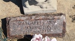
Dorothy Rebecca Sweet Harrington
| Birth | : | 5 Aug 1915 |
| Death | : | 4 Feb 1988 |
| Burial | : | Kilcoy Cemetery, Kilcoy, Somerset Region, Australia |
| Coordinate | : | -26.9455258, 152.5522361 |
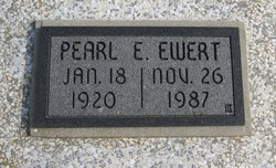
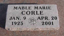
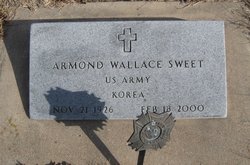
| Description | : | Dorothy Rebecca Harrington, 72, former Grenola resident, retired custodian, died Thursday, Feb. 4, 1988. Rosary 7:30 p.m. Sunday, Watt Funeral Home, Moline; service 10 a.m. Monday, St. Mary's Catholic Church, Moline. Survivors: son, James T. of Howard; daughters, Mary Miller, Carolyn Chrisman, both of Winfield, Beth Moore of Grenola; brothers, Harold Sweet of St. James, Mo., Raymond Sweet of Topeka, Armond Sweet of Grenola; sisters, Mable Corle of Moline, Evelyn Futhey of Grenola, Shirley Gillespie of Elk City; 12 grandchildren; six great-grandchildren. Wichita Eagle, The (KS) | 6 February 1988 |
frequently asked questions (FAQ):
-
Where is Dorothy Rebecca Sweet Harrington's memorial?
Dorothy Rebecca Sweet Harrington's memorial is located at: Kilcoy Cemetery, Kilcoy, Somerset Region, Australia.
-
When did Dorothy Rebecca Sweet Harrington death?
Dorothy Rebecca Sweet Harrington death on 4 Feb 1988 in
-
Where are the coordinates of the Dorothy Rebecca Sweet Harrington's memorial?
Latitude: -26.9455258
Longitude: 152.5522361
Family Members:
Parent
Spouse
Siblings

Children
Flowers:


Nearby Cemetories:
1. Kilcoy Cemetery
Kilcoy, Somerset Region, Australia
Coordinate: -26.9455258, 152.5522361
2. Cressbrook Homestead Cemetery
Rochedale South, Logan City, Australia
Coordinate: -27.0603650, 152.4084090
3. Cressbrook Homestead Cemetery
Cressbrook, Somerset Region, Australia
Coordinate: -27.0578000, 152.4047000
4. Harlin General Cemetery
Harlin, Somerset Region, Australia
Coordinate: -26.9684600, 152.3536000
5. Toogoolawah Cemetery
Toogoolawah, Somerset Region, Australia
Coordinate: -27.0572990, 152.3794210
6. Caboonbah Church Cemetery
Caboonbah, Somerset Region, Australia
Coordinate: -27.1334046, 152.4675252
7. Woodford Cemetery
Woodford, Moreton Bay Region, Australia
Coordinate: -26.9458580, 152.7866720
8. Mount Mee Cemetery
Mount Mee, Moreton Bay Region, Australia
Coordinate: -27.0586281, 152.7549438
9. Moore-Linville Cemetery
Moore, Somerset Region, Australia
Coordinate: -26.8773340, 152.2965680
10. Fairview Cemetery
Bryden, Somerset Region, Australia
Coordinate: -27.2057004, 152.5536795
11. Bryden Catholic Cemetery
Bryden, Somerset Region, Australia
Coordinate: -27.2426026, 152.5698927
12. Peachester Cemetery
Crohamhurst, Sunshine Coast Council, Australia
Coordinate: -26.8199922, 152.8714523
13. Esk Cemetery
Esk, Somerset Region, Australia
Coordinate: -27.2394293, 152.4163463
14. Grigor Children
Glass House Mountains, Sunshine Coast Council, Australia
Coordinate: -26.9166600, 152.9228750
15. Dayboro Cemetery
Dayboro, Moreton Bay Region, Australia
Coordinate: -27.1912910, 152.8129120
16. Witta Cemetery
Witta, Sunshine Coast Council, Australia
Coordinate: -26.7061560, 152.8270080
17. Upper Caboolture Uniting Church Cemetery
Upper Caboolture, Moreton Bay Region, Australia
Coordinate: -27.1071200, 152.8945300
18. Beerburrum Cemetery
Beerburrum, Sunshine Coast Council, Australia
Coordinate: -26.9490050, 152.9547500
19. Caboolture Cemetery
Caboolture, Moreton Bay Region, Australia
Coordinate: -27.0856520, 152.9397800
20. Australia Zoo
Beerwah, Sunshine Coast Council, Australia
Coordinate: -26.8361140, 152.9615310
21. Blackbutt-Benarkin Cemetery
Blackbutt, South Burnett Region, Australia
Coordinate: -26.8877200, 152.1261340
22. St Mary's Church
Montville, Sunshine Coast Council, Australia
Coordinate: -26.6879465, 152.8926176
23. Beerwah Cemetery
Beerwah, Sunshine Coast Council, Australia
Coordinate: -26.8521020, 152.9875450
24. Flaxton Cemetery
Flaxton, Sunshine Coast Council, Australia
Coordinate: -26.6617420, 152.8731570