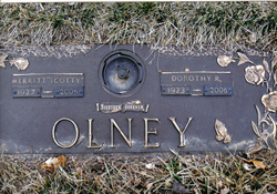
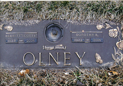
Dorothy Roberta “Dottie” McCormick Olney
| Birth | : | 13 Mar 1923 Trumbull, Clay County, Nebraska, USA |
| Death | : | 16 Apr 2006 Council Bluffs, Pottawattamie County, Iowa, USA |
| Burial | : | Gungahlin Cemetery, Mitchell, Canberra, Australia |
| Coordinate | : | -35.2145856, 149.1371241 |
| Plot | : | Parklawn section, lot 57, space 5 |
| Description | : | Dorothy Roberta McCormick Olney, 83, of Council Bluffs, passed away April 16, 2006. She was born in Trumbull, Nebraska to Warren and Fern (Pavey) McCormick. She had formerly resided in Salina, Kansas where she was a secretary in state government. She had also resided in Winston-Salem, North Carolina where she was a member of the Cedar Forest Baptist Church. She was preceded in death by her parents, son, Terry Wayne Vallier, stepson, Merritt "Corky" Olney and stepdaughter, Verna Salisbury. She is survived by her husband of 39 years, Merritt O."Scotty" Olney, daughters, Judy and husband Jerry Williams of... Read More |
frequently asked questions (FAQ):
-
Where is Dorothy Roberta “Dottie” McCormick Olney's memorial?
Dorothy Roberta “Dottie” McCormick Olney's memorial is located at: Gungahlin Cemetery, Mitchell, Canberra, Australia.
-
When did Dorothy Roberta “Dottie” McCormick Olney death?
Dorothy Roberta “Dottie” McCormick Olney death on 16 Apr 2006 in Council Bluffs, Pottawattamie County, Iowa, USA
-
Where are the coordinates of the Dorothy Roberta “Dottie” McCormick Olney's memorial?
Latitude: -35.2145856
Longitude: 149.1371241
Family Members:
Spouse
Children
Flowers:
Nearby Cemetories:
1. Gungahlin Cemetery
Mitchell, Canberra, Australia
Coordinate: -35.2145856, 149.1371241
2. Norwood Park Crematorium
Mitchell, Canberra, Australia
Coordinate: -35.2200070, 149.1332390
3. Evatt Cemetery (Defunct)
Evatt, Canberra, Australia
Coordinate: -35.2140390, 149.0607480
4. Australian War Memorial
Campbell, Canberra, Australia
Coordinate: -35.2805000, 149.1491000
5. St John the Baptist Cemetery
Reid, Canberra, Australia
Coordinate: -35.2876800, 149.1412900
6. Hall Cemetery
Hall, Australian Capital Territory, Australia
Coordinate: -35.1724560, 149.0575480
7. National Police Memorial
Parkes, Canberra, Australia
Coordinate: -35.2992092, 149.1441029
8. Old Weetangera Methodist Cemetery
Hawker, Canberra, Australia
Coordinate: -35.2483534, 149.0381581
9. Duntroon Military College Grounds
Duntroon, Canberra, Australia
Coordinate: -35.2997220, 149.1650000
10. Saint Christopher's Cathedral
Forrest, Canberra, Australia
Coordinate: -35.3189500, 149.1316790
11. Woden Cemetery
Phillip, Canberra, Australia
Coordinate: -35.3426437, 149.0932770
12. Oaks Burial Ground
Australian Capital Territory, Australia
Coordinate: -35.3401810, 149.2267220
13. Queanbeyan Riverside Cemetery
Queanbeyan, Queanbeyan–Palerang Regional Council, Australia
Coordinate: -35.3440470, 149.2353160
14. Queanbeyan Lawn Cemetery & Memorial Gardens
Queanbeyan, Queanbeyan–Palerang Regional Council, Australia
Coordinate: -35.3692199, 149.2021252
15. Turalla Cemetery
Bungendore, Queanbeyan–Palerang Regional Council, Australia
Coordinate: -35.2419090, 149.4080250
16. Bungendore Cemetery
Bungendore, Queanbeyan–Palerang Regional Council, Australia
Coordinate: -35.2590741, 149.4526073
17. Tharwa Cemetery
Tharwa, Australian Capital Territory, Australia
Coordinate: -35.4964739, 149.0610437
18. Saint Thomas' Cemetery
Carwoola, Queanbeyan–Palerang Regional Council, Australia
Coordinate: -35.4389480, 149.3827710
19. De Salis Cemetery
Tharwa, Australian Capital Territory, Australia
Coordinate: -35.5197548, 149.0747517
20. De Salis Cuppacumbalong Homestead Cuppacumbalong
Australian Capital Territory, Australia
Coordinate: -35.5197700, 149.0748200
21. St Peter & Paul Roman Catholic Cemetery
Hoskinstown, Queanbeyan–Palerang Regional Council, Australia
Coordinate: -35.4229520, 149.4534450
22. Tarago General Cemetery
Tarago, Goulburn Mulwaree Council, Australia
Coordinate: -35.0786380, 149.6413420
23. St. John's Church Cemetery
Lake Bathurst, Goulburn Mulwaree Council, Australia
Coordinate: -35.0120700, 149.6477890
24. Captain's Flat Cemetery
Captains Flat, Queanbeyan–Palerang Regional Council, Australia
Coordinate: -35.6124200, 149.4589850


