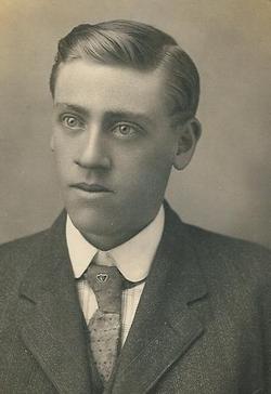
Dorsey Harold Grafflin
| Birth | : | 23 Jan 1898 Gunnison County, Colorado, USA |
| Death | : | 10 Sep 1921 Durango, La Plata County, Colorado, USA |
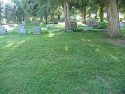
| Burial | : | Te Henui Cemetery, New Plymouth, New Plymouth District, New Zealand |
| Coordinate | : | -39.0558000, 174.0910000 |
| Plot | : | Section 27, East 1/2 of Plot 9 |
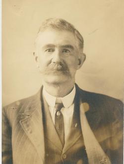
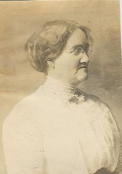
| Description | : | Dorsey Harold GRAFFLIN was the youngest child of William Mason GRAFFLIN and Carrie LORE GRAFFLIN. Born 23 January 1898 he died a short 23 years later. Married to Sadie Nelson on 10 September 1921. Just hours after his marriage Dorsey took ill and died one week later at his parents home in Durango, Colorado of acute pneumonia. He was laid to rest at the Greenmount Cemetery in Durango. Dorsey was proceeded in death by his sister Florence Ester who died of Bright's disease at the age of 16. He was survived by his parents,... Read More |
frequently asked questions (FAQ):
-
Where is Dorsey Harold Grafflin's memorial?
Dorsey Harold Grafflin's memorial is located at: Te Henui Cemetery, New Plymouth, New Plymouth District, New Zealand.
-
When did Dorsey Harold Grafflin death?
Dorsey Harold Grafflin death on 10 Sep 1921 in Durango, La Plata County, Colorado, USA
-
Where are the coordinates of the Dorsey Harold Grafflin's memorial?
Latitude: -39.0558000
Longitude: 174.0910000
Family Members:
Parent
Siblings
Flowers:
Nearby Cemetories:
1. Te Henui Cemetery
New Plymouth, New Plymouth District, New Zealand
Coordinate: -39.0558000, 174.0910000
2. Henui Primitive Methodist Burial Ground
Fitzroy, New Plymouth District, New Zealand
Coordinate: -39.0502937, 174.0987132
3. Awanui Cemetery
New Plymouth, New Plymouth District, New Zealand
Coordinate: -39.0670040, 174.0972140
4. St Mary's Anglican Churchyard
New Plymouth, New Plymouth District, New Zealand
Coordinate: -39.0601390, 174.0734240
5. Marsland Hill
New Plymouth, New Plymouth District, New Zealand
Coordinate: -39.0607490, 174.0733470
6. Port Taranaki
New Plymouth, New Plymouth District, New Zealand
Coordinate: -39.0615099, 174.0420725
7. Otaka Park
New Plymouth District, New Zealand
Coordinate: -39.0614948, 174.0363927
8. Hurdon Cemetery
New Plymouth, New Plymouth District, New Zealand
Coordinate: -39.0870420, 174.0529740
9. St. Luke's Cemetery Biblical Garden and Labyrinth
Bell Block, New Plymouth District, New Zealand
Coordinate: -39.0348800, 174.1475250
10. St Luke's Methodist Church Cemetery
Bell Block, New Plymouth District, New Zealand
Coordinate: -39.0331650, 174.1537750
11. St Lukes Churchyard
New Plymouth, New Plymouth District, New Zealand
Coordinate: -39.0332876, 174.1539411
12. Taumata Historic Reserve
Bell Block, New Plymouth District, New Zealand
Coordinate: -39.0478297, 174.1720073
13. Taranaki Crematorium
New Plymouth, New Plymouth District, New Zealand
Coordinate: -39.1216900, 174.1149500
14. Waireka Cemetery
Omata, New Plymouth District, New Zealand
Coordinate: -39.0929300, 174.0087200
15. Mangapouri Cemetery
Egmont Village, New Plymouth District, New Zealand
Coordinate: -39.1347278, 174.1282396
16. Lepperton Cemetery
Lepperton, New Plymouth District, New Zealand
Coordinate: -39.0575500, 174.2086000
17. Huirangi Cemetery
Huirangi, New Plymouth District, New Zealand
Coordinate: -39.0500060, 174.2513380
18. O'Carroll Family Cemetery
New Plymouth District, New Zealand
Coordinate: -39.0465210, 174.2651080
19. Inglewood Cemetery
Inglewood, New Plymouth District, New Zealand
Coordinate: -39.1554140, 174.2145930
20. Waitara Cemetery
Waitara, New Plymouth District, New Zealand
Coordinate: -38.9953000, 174.2537000
21. Waipapa Māori Cemetery
Motunui, New Plymouth District, New Zealand
Coordinate: -38.9872800, 174.2702100
22. Tikorangi Cemetery
Tikorangi, New Plymouth District, New Zealand
Coordinate: -39.0291440, 174.2967880
23. Tataraimaka Cemetery
Oakura, New Plymouth District, New Zealand
Coordinate: -39.1503230, 173.9138870
24. Okato Cemetery
Okato, New Plymouth District, New Zealand
Coordinate: -39.1904200, 173.8821100


