
| Birth | : | 4 Sep 1899 Circleville, Jackson County, Kansas, USA |
| Death | : | 4 May 1967 Valley Falls, Jefferson County, Kansas, USA |
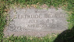
| Burial | : | East Fork Cemetery, Barryton, Mecosta County, USA |
| Coordinate | : | 43.7703018, -85.1069031 |
| Plot | : | Rose Hill Block 5 Lot 38 |
| Description | : | Topeka Daily Capital, Friday 5 May 1967 VALLEY FALLS - Earl Clifford Bronson, 67, owner of Earl's Tavern here, died Thursday morning in his home here. He had an apparent heart attack. Born September 4, 1899 in Circleville, he was the son of the late Hiram and Mary Ellen Hinton Bronson. He was reared in Jackson County. Mr. Bronson lived in Topeka 28 years where he was employed as a truck driver by the Meadow Gold Dairy. In 1945, he was married to Maxine Allen in Lawrence. They had operated the Sugar Bowl in Topeka four years prior to... Read More |
frequently asked questions (FAQ):
-
Where is Earl Clifford Bronson's memorial?
Earl Clifford Bronson's memorial is located at: East Fork Cemetery, Barryton, Mecosta County, USA.
-
When did Earl Clifford Bronson death?
Earl Clifford Bronson death on 4 May 1967 in Valley Falls, Jefferson County, Kansas, USA
-
Where are the coordinates of the Earl Clifford Bronson's memorial?
Latitude: 43.7703018
Longitude: -85.1069031
Family Members:
Parent
Siblings

Flowers:


Nearby Cemetories:
1. East Fork Cemetery
Barryton, Mecosta County, USA
Coordinate: 43.7703018, -85.1069031
2. Flake Cemetery
Barryton, Mecosta County, USA
Coordinate: 43.7372017, -85.1280975
3. Brown Cemetery
Barryton, Mecosta County, USA
Coordinate: 43.7663994, -85.1682968
4. Sherman City Cemetery
Weidman, Isabella County, USA
Coordinate: 43.7186012, -85.0725021
5. IOOF Cemetery
Brinton, Isabella County, USA
Coordinate: 43.7704735, -85.0247345
6. Strong Cemetery
Sheridan Township, Mecosta County, USA
Coordinate: 43.7108002, -85.1117020
7. North Brinton Cemetery
Brinton, Isabella County, USA
Coordinate: 43.7907982, -85.0068970
8. Eaton Cemetery
Barryton, Mecosta County, USA
Coordinate: 43.7564011, -85.2202988
9. Conley Cemetery
Brinton, Isabella County, USA
Coordinate: 43.7557983, -84.9935989
10. Forest Hill Cemetery
Weidman, Isabella County, USA
Coordinate: 43.6825000, -85.0572220
11. Sparks Cemetery
Chippewa Township, Mecosta County, USA
Coordinate: 43.7724991, -85.2442017
12. Garfield Township Cemetery
Lake, Clare County, USA
Coordinate: 43.8611110, -85.0144440
13. Dye Cemetery
Mecosta, Mecosta County, USA
Coordinate: 43.6646004, -85.1864929
14. Church Cemetery
Chippewa Township, Mecosta County, USA
Coordinate: 43.8058300, -85.2662240
15. Orient Township Cemetery
Orient Township, Osceola County, USA
Coordinate: 43.8925018, -85.1663971
16. Chippewa Lake Cemetery
Chippewa Township, Mecosta County, USA
Coordinate: 43.7494011, -85.2900009
17. Stryker Cemetery
Evart Township, Osceola County, USA
Coordinate: 43.8391991, -85.2667007
18. Fairview Cemetery
Weidman, Isabella County, USA
Coordinate: 43.6843987, -84.9578018
19. Bennett Cemetery
Weidman, Isabella County, USA
Coordinate: 43.6464200, -84.9725200
20. Gilmore Township Cemetery
Gilmore Township, Isabella County, USA
Coordinate: 43.7691994, -84.8869019
21. Forest Hill Cemetery
Evart, Osceola County, USA
Coordinate: 43.9019012, -85.2397003
22. County Farm Cemetery
Sears, Osceola County, USA
Coordinate: 43.9277780, -85.1677780
23. Nottawa Indian Cemetery
Beal City, Isabella County, USA
Coordinate: 43.7132988, -84.8930969
24. Morgan Cemetery
Wheatland Township, Mecosta County, USA
Coordinate: 43.6150017, -85.1932983