
| Birth | : | 10 Apr 1928 Union County, Iowa, USA |
| Death | : | 11 Jul 2019 Osceola, Clarke County, Iowa, USA |
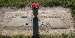
| Burial | : | Murray Cemetery, Murray, Clarke County, USA |
| Coordinate | : | 41.0278015, -93.9456024 |
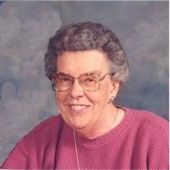
| Description | : | Earl Marion Latham, son of John Walter Latham and Cleone Ruth (Long) Latham, was born on April 10, 1928, on the family farm near Arispe, Iowa. Earl passed from this life July 11, 2019, at the Clarke County Hospital Extended Care Wing, Osceola, IA, at 91 years of age. Earl lived most of his life in the Murray area. He graduated from Arispe High School in 1946. He married Bonnie Joyce Beaman on January 23, 1951, in Atchison, KS. Two children blessed this union, son, Doug and daughter, Beryl. Earl was a very caring, loving, and helpful man,... Read More |
frequently asked questions (FAQ):
-
Where is Earl Marion Latham's memorial?
Earl Marion Latham's memorial is located at: Murray Cemetery, Murray, Clarke County, USA.
-
When did Earl Marion Latham death?
Earl Marion Latham death on 11 Jul 2019 in Osceola, Clarke County, Iowa, USA
-
Where are the coordinates of the Earl Marion Latham's memorial?
Latitude: 41.0278015
Longitude: -93.9456024
Family Members:
Parent

Spouse

Siblings

Flowers:


Nearby Cemetories:
1. Murray Cemetery
Murray, Clarke County, USA
Coordinate: 41.0278015, -93.9456024
2. Bell Family Cemetery
Murray, Clarke County, USA
Coordinate: 41.0625267, -93.9240036
3. Sanders Cemetery
Doyle Township, Clarke County, USA
Coordinate: 40.9730000, -93.9016000
4. Claypool Cemetery
Thayer, Union County, USA
Coordinate: 41.0126114, -94.0303497
5. Thayer Catholic Cemetery
Thayer, Union County, USA
Coordinate: 41.0374985, -94.0357971
6. Olinger Cemetery
Union County, USA
Coordinate: 40.9690208, -94.0274887
7. Hopeville Cemetery
Hopeville, Clarke County, USA
Coordinate: 40.9450000, -93.9870000
8. West Union Cemetery
Thayer, Union County, USA
Coordinate: 41.0191994, -94.0721970
9. Bethel Cemetery
Thayer, Union County, USA
Coordinate: 41.0600014, -94.0693970
10. Lacelle Cemetery
Clarke County, USA
Coordinate: 40.9446500, -93.8690300
11. Union Cemetery
Murray, Clarke County, USA
Coordinate: 41.1265000, -93.9115000
12. Beulah Cemetery
Thayer, Union County, USA
Coordinate: 41.0589981, -94.0759964
13. Pierson Cemetery
Osceola, Clarke County, USA
Coordinate: 40.9954491, -93.8131104
14. Monette Cemetery
Lorimor, Union County, USA
Coordinate: 41.0800743, -94.0715866
15. Cox Cemetery
Osceola, Clarke County, USA
Coordinate: 41.0722008, -93.8142014
16. Otterbein Cemetery
Thayer, Union County, USA
Coordinate: 40.9990005, -94.0879974
17. Gregg Cemetery
Doyle Township, Clarke County, USA
Coordinate: 40.9138000, -93.9520000
18. Lorimor Cemetery
Lorimor, Union County, USA
Coordinate: 41.1128006, -94.0516968
19. Browns Mountain Cemetery
Thayer, Union County, USA
Coordinate: 41.0499992, -94.0999985
20. Mount Pisgah Cemetery
Thayer, Union County, USA
Coordinate: 41.0511017, -94.1007996
21. Maple Hill Cemetery
Osceola, Clarke County, USA
Coordinate: 41.0278015, -93.7794037
22. Homewood Cemetery
Thayer, Union County, USA
Coordinate: 40.9220009, -94.0419998
23. Warrick Cemetery
Decatur County, USA
Coordinate: 40.8960000, -93.9234000
24. Leas Cemetery
Union County, USA
Coordinate: 40.9080009, -94.0220032