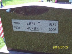
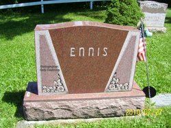
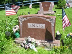
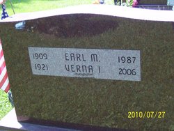
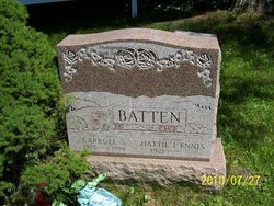
Earl Maxwell Ennis
| Birth | : | 22 May 1909 Cabot, Washington County, Vermont, USA |
| Death | : | 14 Jun 1987 Windsor, Windsor County, Vermont, USA |
| Burial | : | Evergreen Cemetery North, Parkersburg, Wood County, USA |
| Coordinate | : | 39.2949982, -81.5156021 |
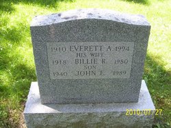
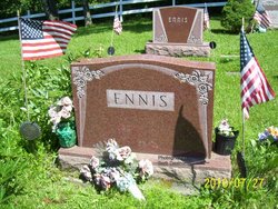
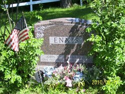
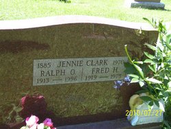
| Description | : | Earl Maxwell Ennis was son of Ora Orrie Ennis and Jennie Sarah (Clark) Ennis in Cabot, Washington County, Vermont. He married Verna Irene Clark on August 15, 1946 AD in St. Johnsbury, Caledonia County, Vermont. They settled in Cabot, Washington County, Vermont. He worked as a carpenter and later in bridge construction as a supervisor. Earl died of Metastatic Prostatic Cancer on Jun 14, 1987 at Mt. Ascutney Hospital & Health Center in Windsor, Windsor County, Vermont at age 78 years and 23 days old. See the Sager/Clark Family Tree at https://sager.tribalpages.com Contributor:... Read More |
frequently asked questions (FAQ):
-
Where is Earl Maxwell Ennis's memorial?
Earl Maxwell Ennis's memorial is located at: Evergreen Cemetery North, Parkersburg, Wood County, USA.
-
When did Earl Maxwell Ennis death?
Earl Maxwell Ennis death on 14 Jun 1987 in Windsor, Windsor County, Vermont, USA
-
Where are the coordinates of the Earl Maxwell Ennis's memorial?
Latitude: 39.2949982
Longitude: -81.5156021
Family Members:
Parent
Spouse
Siblings
Children
Flowers:
Nearby Cemetories:
1. Woodyard Cemetery
Parkersburg, Wood County, USA
Coordinate: 39.2873420, -81.5183030
2. Ogden Cemetery
Parkersburg, Wood County, USA
Coordinate: 39.3006000, -81.5252550
3. Rosemar Methodist Cemetery
Wood County, USA
Coordinate: 39.3050730, -81.5259200
4. Spring Grove Cemetery
Parkersburg, Wood County, USA
Coordinate: 39.2975006, -81.5325012
5. Stern Burial Place
Parkersburg, Wood County, USA
Coordinate: 39.2772726, -81.5140238
6. Mount Moriah Cemetery
Parkersburg, Wood County, USA
Coordinate: 39.2852800, -81.4924500
7. Mount Olivet Cemetery
Parkersburg, Wood County, USA
Coordinate: 39.2761002, -81.5289001
8. Core Cemetery
Parkersburg, Wood County, USA
Coordinate: 39.2746070, -81.5034700
9. Mount Carmel Cemetery
Parkersburg, Wood County, USA
Coordinate: 39.2728004, -81.5222015
10. Dils Cemetery
Parkersburg, Wood County, USA
Coordinate: 39.2682509, -81.5183363
11. Immaculate Conception Catholic Cemetery
Wood County, USA
Coordinate: 39.2680100, -81.5168600
12. Catholic Cemetery
Parkersburg, Wood County, USA
Coordinate: 39.2678450, -81.5178970
13. First Lutheran Church Columbarium
Parkersburg, Wood County, USA
Coordinate: 39.2729370, -81.5365440
14. Parkersburg Memorial Gardens
Parkersburg, Wood County, USA
Coordinate: 39.2798310, -81.5491430
15. Saint Francis Xavier Catholic Cemetery
Parkersburg, Wood County, USA
Coordinate: 39.2703018, -81.5430984
16. DeSales Heights Convent
Parkersburg, Wood County, USA
Coordinate: 39.2763700, -81.5535050
17. Good Shepherd Episcopal Church Columbarium
Wood County, USA
Coordinate: 39.2670300, -81.5464980
18. Riverview Cemetery
Parkersburg, Wood County, USA
Coordinate: 39.2735020, -81.5543890
19. Five Mile Cemetery
Parkersburg, Wood County, USA
Coordinate: 39.2927400, -81.4646500
20. Jesterville Cemetery
Parkersburg, Wood County, USA
Coordinate: 39.3145340, -81.4704210
21. Wenmoth Cemetery
Parkersburg, Wood County, USA
Coordinate: 39.2943330, -81.4624530
22. Trinity Episcopal Church Columbarium
Parkersburg, Wood County, USA
Coordinate: 39.2665240, -81.5614570
23. Holliday Cemetery
Parkersburg, Wood County, USA
Coordinate: 39.2619019, -81.5560989
24. Jacob White Gravesite
Summit, Wood County, USA
Coordinate: 39.3394330, -81.5001000

