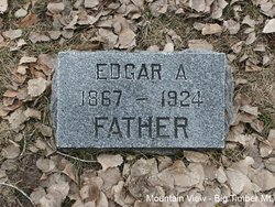
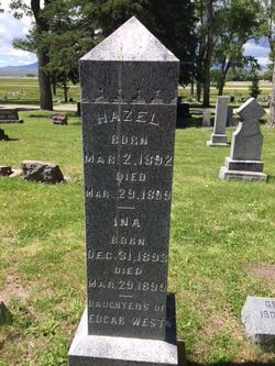
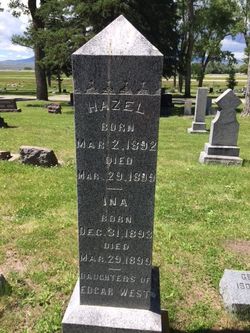
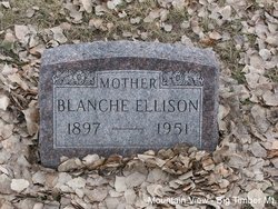
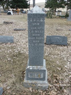
Edgar A West
| Birth | : | 17 Feb 1867 Ogden, Weber County, Utah, USA |
| Death | : | 21 Oct 1924 Livingston, Park County, Montana, USA |
| Burial | : | Stockton Memorial Cemetery, Stockton, Baldwin County, USA |
| Coordinate | : | 30.9883003, -87.8585968 |
| Plot | : | Section 6, Block 6, Lot 4, Grave 10 |
| Description | : | From Death Certificate: Father: Chauncy W. West born in Erie County, Pennsylvania Mother: Adeline A. Wright born in West Brook, Connecticut Informant: Mrs. Edgar West of Livingston, Montana He was a tool man for the Northern Pacific Railroad. Contributor: Julia Kinsey (48922386) • [email protected] Big Timber Pioneer, October 23, 1924 Edgar A. West Died Tuesday of This Week Edgar A West for nearly a quarter of a century a rancher on Dry creek, a few miles east of this city died suddenly of heart failure at his home in Livingston Tuesday morning where he... Read More |
frequently asked questions (FAQ):
-
Where is Edgar A West's memorial?
Edgar A West's memorial is located at: Stockton Memorial Cemetery, Stockton, Baldwin County, USA.
-
When did Edgar A West death?
Edgar A West death on 21 Oct 1924 in Livingston, Park County, Montana, USA
-
Where are the coordinates of the Edgar A West's memorial?
Latitude: 30.9883003
Longitude: -87.8585968
Family Members:
Spouse
Children
Nearby Cemetories:
1. Stockton Memorial Cemetery
Stockton, Baldwin County, USA
Coordinate: 30.9883003, -87.8585968
2. Richerson Cemetery
Stockton, Baldwin County, USA
Coordinate: 31.0144005, -87.8602982
3. Vaughn Cemetery
Vaughn, Baldwin County, USA
Coordinate: 31.0312010, -87.8609040
4. Watson Family Cemetery
Baldwin County, USA
Coordinate: 31.0301369, -87.8390816
5. Robinson Cemetery
Stockton, Baldwin County, USA
Coordinate: 31.0402000, -87.8555000
6. Lancaster Cemetery
Baldwin County, USA
Coordinate: 31.0426120, -87.8494800
7. Dennis Family Cemetery
Baldwin County, USA
Coordinate: 30.9274078, -87.8495614
8. Bryars Family Cemetery
Stockton, Baldwin County, USA
Coordinate: 31.0665500, -87.8397100
9. New Life Baptist Church Cemetery
Bay Minette, Baldwin County, USA
Coordinate: 30.9469200, -87.7638500
10. Dean Cemetery
Rabun, Baldwin County, USA
Coordinate: 31.0031891, -87.7488632
11. New Providence Southern Baptist Church Cemetery
Rabun, Baldwin County, USA
Coordinate: 30.9967003, -87.7449036
12. Latham Methodist Church Cemetery
Latham, Baldwin County, USA
Coordinate: 31.0983658, -87.8300323
13. Guys Chapel United Methodist Church Cemetery
Rabun, Baldwin County, USA
Coordinate: 31.0272007, -87.7247009
14. Smiths Cemetery
Axis, Mobile County, USA
Coordinate: 30.9373380, -87.9913580
15. Hall Family Graveyard
Carpenter, Baldwin County, USA
Coordinate: 30.8616505, -87.8687973
16. Bay Minette Cemetery
Bay Minette, Baldwin County, USA
Coordinate: 30.8906002, -87.7596970
17. Gentry Cemetery
Baldwin County, USA
Coordinate: 31.0475006, -87.7236023
18. Stanmyer Cemetery
Bay Minette, Baldwin County, USA
Coordinate: 30.8770008, -87.7750015
19. Bluff Cemetery
Axis, Mobile County, USA
Coordinate: 30.9373250, -88.0053650
20. Cain Cemetery
Bay Minette, Baldwin County, USA
Coordinate: 30.8885994, -87.7446976
21. Saint Louis Baptist Church Cemetery
Axis, Mobile County, USA
Coordinate: 30.9206200, -88.0013300
22. Mount Nebo Baptists Church Cemetery
Stockton, Baldwin County, USA
Coordinate: 31.1290300, -87.8346800
23. Seymour Bluff Cemetery
Chastang, Mobile County, USA
Coordinate: 31.0255770, -88.0216580
24. Dyas Cemetery
Dyas, Baldwin County, USA
Coordinate: 30.9608652, -87.6909509

