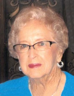
Edith L Knutson Ward - Raemer
| Birth | : | 3 Jan 1925 Centerville, Turner County, South Dakota, USA |
| Death | : | 15 Jul 2020 Sioux Falls, Minnehaha County, South Dakota, USA |
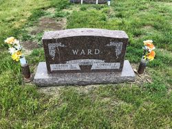
| Burial | : | Holland Cemetery, Centerville, Turner County, USA |
| Coordinate | : | 43.1114006, -97.0314026 |
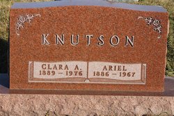
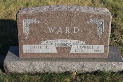
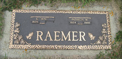
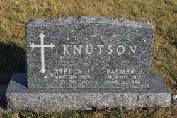
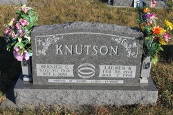
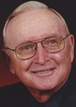
| Description | : | Edith Knutson was born January 3, 1925 in Centerville, SD to Ariel and Clara (Lunning) Knutson. She joined 4 sisters and 5 brothers. Edith graduated from Centerville High School in 1943. She married Lowell Ward on June 21, 1946 and they farmed together for forty years. They were blessed with their daughter, Linda. Lowell passed away in 1987. After traveling to Arizona to visit her sister, she met Mac Raemer and they were married on August 3, 1992. They traveled extensively during their time together. Mac passed away in March 2020. |
frequently asked questions (FAQ):
-
Where is Edith L Knutson Ward - Raemer's memorial?
Edith L Knutson Ward - Raemer's memorial is located at: Holland Cemetery, Centerville, Turner County, USA.
-
When did Edith L Knutson Ward - Raemer death?
Edith L Knutson Ward - Raemer death on 15 Jul 2020 in Sioux Falls, Minnehaha County, South Dakota, USA
-
Where are the coordinates of the Edith L Knutson Ward - Raemer's memorial?
Latitude: 43.1114006
Longitude: -97.0314026
Family Members:
Parent
Spouse
Siblings
Flowers:
Nearby Cemetories:
1. Holland Cemetery
Centerville, Turner County, USA
Coordinate: 43.1114006, -97.0314026
2. Grace Lutheran Cemetery
Turner County, USA
Coordinate: 43.1489100, -97.0034000
3. Evangelical Cemetery
Turner County, USA
Coordinate: 43.1569950, -96.9931519
4. Riverview Cemetery
Centerville, Turner County, USA
Coordinate: 43.1333008, -96.9567032
5. Saint Columbkill Cemetery
Wakonda, Clay County, USA
Coordinate: 43.0642014, -97.0828018
6. Baptist Cemetery
Viborg, Turner County, USA
Coordinate: 43.1702000, -97.0512000
7. Rose Hill Cemetery
Viborg, Turner County, USA
Coordinate: 43.1669000, -97.0813000
8. Hattervig Cemetery
Turner County, USA
Coordinate: 43.1925011, -97.0438995
9. Riverside-Barton Cemetery
Clay County, USA
Coordinate: 43.0402985, -96.9725037
10. Hansen Cemetery
Turner County, USA
Coordinate: 43.1260986, -97.1511002
11. Bethania Cemetery
Viborg, Turner County, USA
Coordinate: 43.1702995, -97.1417007
12. Saint Johns Cemetery
Clay County, USA
Coordinate: 43.0696983, -96.9056015
13. CJ Anderson Homestead
Riverside Township, Clay County, USA
Coordinate: 43.0214180, -96.9675540
14. Hillcrest Cemetery
Yankton County, USA
Coordinate: 43.0835991, -97.1680984
15. Mount Zion Cemetery
Lincoln County, USA
Coordinate: 43.1716995, -96.9105988
16. Turkey Valley Baptist Cemetery
Yankton County, USA
Coordinate: 43.1260100, -97.1800110
17. Turkey Valley Lutheran Cemetery
Yankton County, USA
Coordinate: 43.1257950, -97.1803430
18. Frieling Cemetery
Turner County, USA
Coordinate: 43.2186012, -96.9816971
19. Komstad Cemetery
Dalesburg, Clay County, USA
Coordinate: 43.0417938, -96.9058914
20. Hovde Cemetery
Clay County, USA
Coordinate: 43.0685997, -96.8835983
21. Evergreen Cemetery
Viborg, Turner County, USA
Coordinate: 43.1994019, -97.1607971
22. Salem Cemetery
Yankton County, USA
Coordinate: 43.0830180, -97.2090590
23. Pioneer Cemetery
Yankton County, USA
Coordinate: 43.0758018, -97.2118988
24. Old Lodi Cemetery
Lodi, Clay County, USA
Coordinate: 42.9757996, -96.9907990

