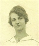
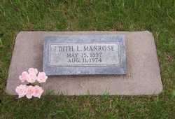
Edith Laverne Haneline Manrose
| Birth | : | 15 May 1897 Nemaha County, Nebraska, USA |
| Death | : | 11 Aug 1974 Nemaha County, Nebraska, USA |
| Burial | : | Lafayette Cemetery, Brock, Nemaha County, USA |
| Coordinate | : | 40.5127983, -95.9543991 |
| Plot | : | Lot-160 Grave-7 |
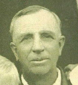
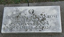
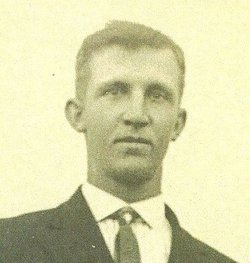
| Description | : | Edith was the daughter of Enoch Haneline and Phoebe Stephens. She was born on the farm in Nemaha County, Nebraska. She attended rural school near their farm home. She helped her parents and siblings with the farm. On November 2, 1921, in Brock, Nebraska, she married Brice Arnold Manrose. Brice was a World War I Veteran, He served in the Navy for 14 months. He started working as a carpenter and bridge building for the Missouri Pacific railroad. Edith had excellent queitites and worthy of the man of her choice. ... Read More |
frequently asked questions (FAQ):
-
Where is Edith Laverne Haneline Manrose's memorial?
Edith Laverne Haneline Manrose's memorial is located at: Lafayette Cemetery, Brock, Nemaha County, USA.
-
When did Edith Laverne Haneline Manrose death?
Edith Laverne Haneline Manrose death on 11 Aug 1974 in Nemaha County, Nebraska, USA
-
Where are the coordinates of the Edith Laverne Haneline Manrose's memorial?
Latitude: 40.5127983
Longitude: -95.9543991
Family Members:
Parent
Spouse
Siblings
Children
Flowers:
Nearby Cemetories:
1. Lafayette Cemetery
Brock, Nemaha County, USA
Coordinate: 40.5127983, -95.9543991
2. Saint Pauls Cemetery
Talmage, Otoe County, USA
Coordinate: 40.5448810, -95.9919480
3. Fairview Cemetery
Talmage, Otoe County, USA
Coordinate: 40.5525017, -96.0102997
4. Saint Joseph Catholic Cemetery
Paul, Otoe County, USA
Coordinate: 40.5806530, -95.9339190
5. Grant Evergreen Cemetery
Nemaha County, USA
Coordinate: 40.5065430, -96.0472250
6. Saint Bernards Church Cemetery
Julian, Nemaha County, USA
Coordinate: 40.5078000, -95.8592000
7. Coryell Park Mausoleum
Johnson, Nemaha County, USA
Coordinate: 40.4371150, -95.9548690
8. Glenrock Cemetery
Glenrock, Nemaha County, USA
Coordinate: 40.4644012, -95.8764038
9. Clifton Cemetery
Johnson, Nemaha County, USA
Coordinate: 40.4333000, -95.9563980
10. Bloomingdale Cemetery
Otoe County, USA
Coordinate: 40.5685997, -95.8783035
11. Zion Lutheran Church Cemetery
Johnson, Nemaha County, USA
Coordinate: 40.4287000, -96.0099000
12. Saint Johns Cemetery
Talmage, Otoe County, USA
Coordinate: 40.5820847, -96.0474625
13. Linden Cemetery
Nemaha County, USA
Coordinate: 40.4216995, -95.9032974
14. Biggs Cemetery
Lorton, Otoe County, USA
Coordinate: 40.6025009, -96.0105972
15. Johnson Cemetery
Johnson, Nemaha County, USA
Coordinate: 40.4142000, -96.0052300
16. Heuser Cemetery
Otoe County, USA
Coordinate: 40.6223259, -95.9318848
17. Saint Matthews Lutheran Cemetery
Johnson, Nemaha County, USA
Coordinate: 40.4073060, -96.0086500
18. Highland Baptist Cemetery
Auburn, Nemaha County, USA
Coordinate: 40.4578018, -95.8191986
19. Highland Methodist Cemetery
Nemaha County, USA
Coordinate: 40.4581850, -95.8097140
20. Karn Cemetery
Glenrock, Nemaha County, USA
Coordinate: 40.4789000, -95.7917000
21. Camp Creek Cemetery
Otoe County, USA
Coordinate: 40.5681000, -95.8019028
22. Livingston Cemetery
Cook, Johnson County, USA
Coordinate: 40.5080986, -96.1235962
23. Mount Hope Church Cemetery
Cook, Johnson County, USA
Coordinate: 40.4775000, -96.1233000
24. Schacht Cemetery
Otoe County, USA
Coordinate: 40.5447006, -96.1271973

