
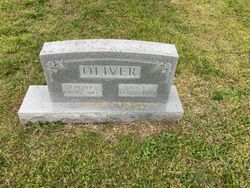
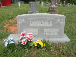
Edith Lora Sandridge Oliver Mills
| Birth | : | 22 Dec 1904 Thayer, Oregon County, Missouri, USA |
| Death | : | 2 Aug 2002 Thayer, Oregon County, Missouri, USA |
| Burial | : | San Miguel District Cemetery, San Miguel, San Luis Obispo County, USA |
| Coordinate | : | 35.7392006, -120.7013550 |
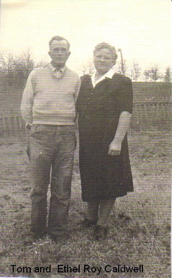
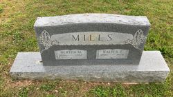
| Description | : | Daughter of George Washington Sandridge and Ida Ellen (Young) Sandridge. Married Roy K. Oliver 01/Jan/1928 at Oregon Co., MO. Married Leaman Homer Brewer 02/Aug/1936; divorced May/1946. Married William "Tom" Thomas Caldwell 04/Feb/1955. Married Walter Thomas Mills 05/Feb/1964 at Thayer, MO. Buried beside her first husband, Roy Oliver. |
frequently asked questions (FAQ):
-
Where is Edith Lora Sandridge Oliver Mills's memorial?
Edith Lora Sandridge Oliver Mills's memorial is located at: San Miguel District Cemetery, San Miguel, San Luis Obispo County, USA.
-
When did Edith Lora Sandridge Oliver Mills death?
Edith Lora Sandridge Oliver Mills death on 2 Aug 2002 in Thayer, Oregon County, Missouri, USA
-
Where are the coordinates of the Edith Lora Sandridge Oliver Mills's memorial?
Latitude: 35.7392006
Longitude: -120.7013550
Family Members:
Parent
Spouse

Siblings
Flowers:


Nearby Cemetories:
1. San Miguel District Cemetery
San Miguel, San Luis Obispo County, USA
Coordinate: 35.7392006, -120.7013550
2. Mission San Miguel Cemetery
San Miguel, San Luis Obispo County, USA
Coordinate: 35.7452610, -120.6977370
3. Estrella Adobe Cemetery
Paso Robles, San Luis Obispo County, USA
Coordinate: 35.6975080, -120.6399460
4. Pleasant Valley Cemetery
San Miguel, San Luis Obispo County, USA
Coordinate: 35.7181892, -120.6228485
5. San Marcos Mennonite Cemetery
San Luis Obispo County, USA
Coordinate: 35.6874570, -120.7995160
6. Paso Robles District Cemetery
Paso Robles, San Luis Obispo County, USA
Coordinate: 35.6424700, -120.7035000
7. Saint James Episcopal Church Inurnment Garden
Paso Robles, San Luis Obispo County, USA
Coordinate: 35.6283460, -120.6929780
8. Adelaida Cemetery
San Luis Obispo County, USA
Coordinate: 35.6563988, -120.8728027
9. Templeton Cemetery
Templeton, San Luis Obispo County, USA
Coordinate: 35.5714455, -120.7022095
10. Hames Valley Cemetery
Bradley, Monterey County, USA
Coordinate: 35.8644660, -120.8505700
11. Willow Creek Mennonite Cemetery
Wilson Corner, San Luis Obispo County, USA
Coordinate: 35.5890410, -120.8215860
12. Adelaida Cemetery
Adelaida, San Luis Obispo County, USA
Coordinate: 35.5632085, -120.8956170
13. Chapel of the Roses Cemetery
Atascadero, San Luis Obispo County, USA
Coordinate: 35.5027340, -120.6881430
14. Imusdale Cemetery
Monterey County, USA
Coordinate: 35.9247017, -120.5074997
15. Atascadero Pine Mountain Cemetery
Atascadero, San Luis Obispo County, USA
Coordinate: 35.4960835, -120.6565582
16. Creston Cemetery
Creston, San Luis Obispo County, USA
Coordinate: 35.5328640, -120.5121450
17. Parkfield Cemetery
Monterey County, USA
Coordinate: 35.8666992, -120.4137726
18. Pleyto Cemetery
Monterey County, USA
Coordinate: 35.8645248, -121.0176468
19. Porte Family Cemetery
San Simeon, San Luis Obispo County, USA
Coordinate: 35.6376400, -121.0379800
20. Shandon Cemetery
San Luis Obispo County, USA
Coordinate: 35.6693993, -120.3525009
21. Dove Cemetery
San Luis Obispo County, USA
Coordinate: 35.4482231, -120.6344299
22. Sands Cemetery
Bryson, Monterey County, USA
Coordinate: 35.7981840, -121.0882190
23. San Ardo Cemetery
San Ardo, Monterey County, USA
Coordinate: 36.0269089, -120.9120941
24. Cayucos-Morro Bay District Cemetery
Cayucos, San Luis Obispo County, USA
Coordinate: 35.4371986, -120.8850021